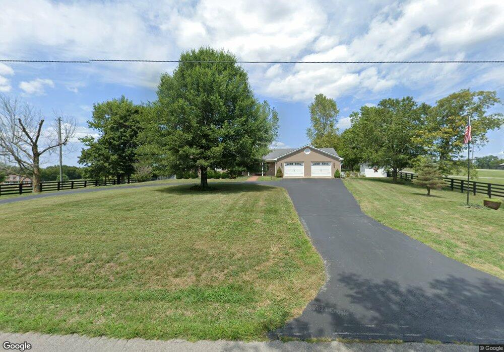
819 Sparrow Ln Harrodsburg, KY 40330
Estimated Value: $366,000 - $592,552
3
Beds
2
Baths
2,257
Sq Ft
$214/Sq Ft
Est. Value
About This Home
This home is located at 819 Sparrow Ln, Harrodsburg, KY 40330 and is currently estimated at $482,138, approximately $213 per square foot. 819 Sparrow Ln is a home located in Mercer County with nearby schools including Mercer County Elementary School, Mercer County Intermediate School, and King Middle School.
Ownership History
Date
Name
Owned For
Owner Type
Purchase Details
Closed on
May 27, 2022
Sold by
Mitchell Harvey W and Mitchell Lucinda A
Bought by
Perrin Keith A and Perrin Geneva Gail
Current Estimated Value
Home Financials for this Owner
Home Financials are based on the most recent Mortgage that was taken out on this home.
Original Mortgage
$238,625
Outstanding Balance
$221,720
Interest Rate
5.1%
Mortgage Type
Construction
Estimated Equity
$260,418
Purchase Details
Closed on
Jan 5, 2008
Sold by
Southworth Shirley W and Southworth Ruth E
Bought by
Mitchell Harvey W and Mitchell Lucinda A
Create a Home Valuation Report for This Property
The Home Valuation Report is an in-depth analysis detailing your home's value as well as a comparison with similar homes in the area
Home Values in the Area
Average Home Value in this Area
Purchase History
| Date | Buyer | Sale Price | Title Company |
|---|---|---|---|
| Perrin Keith A | $535,000 | Bottoms Law Office Psc | |
| Mitchell Harvey W | $290,000 | -- |
Source: Public Records
Mortgage History
| Date | Status | Borrower | Loan Amount |
|---|---|---|---|
| Open | Perrin Keith A | $238,625 |
Source: Public Records
Tax History Compared to Growth
Tax History
| Year | Tax Paid | Tax Assessment Tax Assessment Total Assessment is a certain percentage of the fair market value that is determined by local assessors to be the total taxable value of land and additions on the property. | Land | Improvement |
|---|---|---|---|---|
| 2024 | $5,151 | $431,086 | $9,086 | $422,000 |
| 2023 | $5,199 | $431,086 | $0 | $0 |
| 2022 | $2,744 | $272,787 | $0 | $0 |
| 2021 | $2,762 | $272,787 | $0 | $0 |
| 2020 | $2,764 | $272,787 | $9,086 | $263,701 |
| 2019 | $2,807 | $272,787 | $9,086 | $263,701 |
| 2018 | $2,763 | $272,787 | $0 | $0 |
| 2017 | $2,669 | $272,787 | $0 | $0 |
| 2016 | $2,636 | $273,486 | $0 | $0 |
| 2015 | $2,962 | $273,486 | $7,193 | $266,293 |
| 2014 | $2,962 | $273,486 | $0 | $0 |
| 2010 | -- | $243,246 | $7,193 | $236,053 |
Source: Public Records
Map
Nearby Homes
- 1259 Perryville Rd
- 214 Sparrow Ln
- 1211 Perryville Rd
- 521 Adams Ln
- 215 Mercer Ave
- 547 Legion Dr Unit 7
- 547 Legion Dr Unit 6
- 547 Legion Dr Unit 5
- 547 Legion Dr Unit 4
- 547 Legion Dr
- 501 Ashley Dr
- 496 Atlee Dr
- 479 Atlee Dr
- 497 Atlee Dr
- 117 Gracelynn Cir
- 766 Beaumont Ave
- 215 New Dixville Rd
- Lots 28-35 Beaumont Inn Dr
- 108 Brightleaf Dr
- 655 Beaumont Ave
- 823 Sparrow Ln
- 827 Sparrow Ln
- 790 Sparrow Ln
- 760 Sparrow Ln
- 730 Sparrow Ln
- 700 Sparrow Ln
- 684 Sparrow Ln
- 831 Sparrow Ln
- 525 Sparrow Ln
- 635 Dry Branch Rd
- 909 Dry Branch Rd
- 658 Sparrow Ln
- 627 Dry Branch Rd
- 668 Sparrow Ln
- 515 Sparrow Ln
- 592 Sparrow Ln
- 605 Dry Branch Rd
- 549 Sparrow Ln
- 658 Dry Branch Rd
- 500 Sparrow Ln