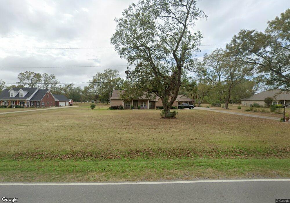
819 Stubbs Vinson Rd Monroe, LA 71203
Estimated Value: $283,059 - $334,000
3
Beds
2
Baths
2,436
Sq Ft
$126/Sq Ft
Est. Value
About This Home
This home is located at 819 Stubbs Vinson Rd, Monroe, LA 71203 and is currently estimated at $308,015, approximately $126 per square foot. 819 Stubbs Vinson Rd is a home located in Ouachita Parish with nearby schools including Swartz Lower Elementary School, Swartz Upper Elementary School, and Ouachita Junior High School.
Ownership History
Date
Name
Owned For
Owner Type
Purchase Details
Closed on
Jan 22, 2010
Sold by
Mcfarlin Allen Michael and Mcfarlin Nelda Dearman
Bought by
Daniel Sandra Hatten
Current Estimated Value
Home Financials for this Owner
Home Financials are based on the most recent Mortgage that was taken out on this home.
Original Mortgage
$68,000
Outstanding Balance
$44,373
Interest Rate
4.83%
Mortgage Type
Purchase Money Mortgage
Estimated Equity
$263,642
Purchase Details
Closed on
Jul 26, 2005
Sold by
Rand Charles Lionel
Bought by
Mcfarlin Allen M and Mcfarlin Nelda D
Create a Home Valuation Report for This Property
The Home Valuation Report is an in-depth analysis detailing your home's value as well as a comparison with similar homes in the area
Home Values in the Area
Average Home Value in this Area
Purchase History
| Date | Buyer | Sale Price | Title Company |
|---|---|---|---|
| Daniel Sandra Hatten | $241,000 | None Available | |
| Mcfarlin Allen M | $25,750 | None Available |
Source: Public Records
Mortgage History
| Date | Status | Borrower | Loan Amount |
|---|---|---|---|
| Open | Daniel Sandra Hatten | $68,000 |
Source: Public Records
Tax History Compared to Growth
Tax History
| Year | Tax Paid | Tax Assessment Tax Assessment Total Assessment is a certain percentage of the fair market value that is determined by local assessors to be the total taxable value of land and additions on the property. | Land | Improvement |
|---|---|---|---|---|
| 2024 | $3,171 | $24,795 | $3,500 | $21,295 |
| 2023 | $3,171 | $24,785 | $3,500 | $21,285 |
| 2022 | $4,085 | $24,785 | $3,500 | $21,285 |
| 2021 | $4,118 | $29,849 | $3,500 | $26,349 |
| 2020 | $4,118 | $29,849 | $3,500 | $26,349 |
| 2019 | $3,367 | $24,752 | $3,500 | $21,252 |
| 2018 | $2,243 | $23,252 | $3,500 | $19,752 |
| 2017 | $3,298 | $23,252 | $3,500 | $19,752 |
| 2016 | $3,218 | $24,752 | $3,500 | $21,252 |
| 2015 | $2,239 | $24,752 | $3,500 | $21,252 |
| 2014 | $2,239 | $23,252 | $3,500 | $19,752 |
| 2013 | $2,234 | $24,752 | $3,500 | $21,252 |
Source: Public Records
Map
Nearby Homes
- 1077 Stubbs Vinson Rd
- 94 Nelson Rd
- 120 Donovan Cir
- 119 Daywood Dr
- 306 Taylor Dr
- 204 W Nelson Rd Unit 412 Allen, 413 n 23r
- 202 Daywood Dr
- 158 Barbara Dr
- 212 Wood Dr
- 1870 Highway 594
- 719 Ed Edelen Rd
- 2210 Highway 594
- 2238 Highway 594
- 229 Eisenhower Dr
- 209 Harding Dr
- 03 Stubbs Vinson Rd
- 02 Stubbs Vinson Rd
- 00 Stubbs Vinson Rd
- 04 Stubbs Vinson Rd
- 01 Stubbs Vinson Rd
- 837 Stubbs Vinson Rd
- 837 Stubbs Vinson Rd
- 783 Stubbs Vinson Rd
- 120 Ed Edelen Rd
- 130 Kiowa Ln
- 765 Stubbs Vinson Rd
- 869 Stubbs Vinson Rd
- 136 Ed Edelen Rd
- 128 Kiowa St
- 806 Stubbs Vinson Rd
- 747 Stubbs Vinson Rd
- 780 Stubbs Vinson Rd
- 124 Kiowa St
- 156 Ed Edelen Rd
- 729 Stubbs Vinson Rd
- 131 Kiowa Ln
- 754 Stubbs Vinson Rd
- 129 Kiowa Ln
- 131 Kiowa St
- 122 Kiowa St