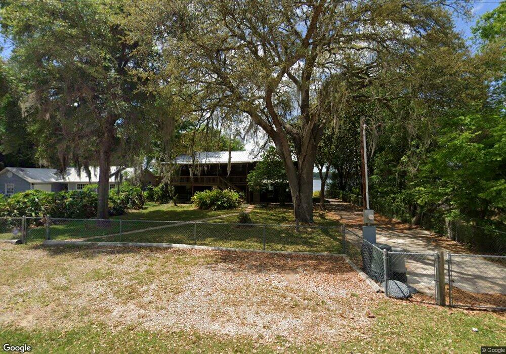
8190 Carl Brook Rd Keystone Heights, FL 32656
Estimated Value: $320,000 - $413,000
2
Beds
2
Baths
2,184
Sq Ft
$168/Sq Ft
Est. Value
About This Home
This home is located at 8190 Carl Brook Rd, Keystone Heights, FL 32656 and is currently estimated at $366,075, approximately $167 per square foot. 8190 Carl Brook Rd is a home located in Clay County with nearby schools including Keystone Heights Elementary School and Keystone Heights Junior/Senior High School.
Ownership History
Date
Name
Owned For
Owner Type
Purchase Details
Closed on
Mar 16, 2015
Sold by
Massebeau Thomas C and Massebeau Patricia A
Bought by
Massebeau Thomas C and Massebeau Patricia A
Current Estimated Value
Purchase Details
Closed on
Sep 18, 2014
Sold by
Merrett Debra R and Jowers Leona R
Bought by
Sanders Michael S and Sanders Tara A
Purchase Details
Closed on
Nov 29, 2011
Sold by
Ridaught Leon O
Bought by
Merrett Debra R and Jowers Leona R
Home Financials for this Owner
Home Financials are based on the most recent Mortgage that was taken out on this home.
Original Mortgage
$44,000
Interest Rate
4.17%
Mortgage Type
New Conventional
Purchase Details
Closed on
Nov 30, 2007
Sold by
Merrett Debra R and Jowers Leona R
Bought by
Merrett Debra R and Jowers Leona R
Purchase Details
Closed on
Jul 27, 2007
Sold by
Ridaught Minnie L
Bought by
Merrett Debra R and Jowers Leona R
Create a Home Valuation Report for This Property
The Home Valuation Report is an in-depth analysis detailing your home's value as well as a comparison with similar homes in the area
Home Values in the Area
Average Home Value in this Area
Purchase History
| Date | Buyer | Sale Price | Title Company |
|---|---|---|---|
| Massebeau Thomas C | -- | Attorney | |
| Sanders Michael S | $130,000 | Haile Title Company Llc | |
| Merrett Debra R | -- | Haile Title Company | |
| Merrett Debra R | -- | Attorney | |
| Merrett Debra R | -- | None Available |
Source: Public Records
Mortgage History
| Date | Status | Borrower | Loan Amount |
|---|---|---|---|
| Previous Owner | Merrett Debra R | $44,000 |
Source: Public Records
Tax History Compared to Growth
Tax History
| Year | Tax Paid | Tax Assessment Tax Assessment Total Assessment is a certain percentage of the fair market value that is determined by local assessors to be the total taxable value of land and additions on the property. | Land | Improvement |
|---|---|---|---|---|
| 2024 | $4,461 | $319,213 | $19,184 | $300,029 |
| 2023 | $4,461 | $312,992 | $19,184 | $293,808 |
| 2022 | $3,804 | $257,201 | $19,184 | $238,017 |
| 2021 | $3,386 | $205,399 | $19,184 | $186,215 |
| 2020 | $3,076 | $192,906 | $19,184 | $173,722 |
| 2019 | $2,780 | $165,916 | $19,184 | $146,732 |
| 2018 | $2,437 | $155,638 | $0 | $0 |
| 2017 | $2,285 | $143,290 | $0 | $0 |
| 2016 | $2,105 | $124,983 | $0 | $0 |
| 2015 | $2,079 | $118,954 | $0 | $0 |
| 2014 | -- | $125,207 | $0 | $0 |
Source: Public Records
Map
Nearby Homes
- 6315 5th Ave
- 6287 Magnolia St
- 6417 Baker Rd
- 8320 Singleton Place
- 6761 County Road 214
- 6220 Blue Marlin Dr
- 6249 Blue Marlin Dr
- 6228 Blue Marlin Dr
- 6192 County Road 219
- TBD Gustafson Rd Unit 44-46
- 112 Serenity Dr
- 8180 Melrose Rd
- 0 Gustafson Rd Unit 1 293957
- 6838 Big Sky Ln
- 8449 Lilly Lake Rd
- 0 State Road 100 Unit 1260784
- 8864 Shores Place
- 8290 Melrose Rd
- 8453 Nittany Dr
- 6519 Neale Rd
- 8194 Carl Brook Rd
- 8198 Carl Brook Rd
- 8202 Carl Brook Rd
- 8193 Carl Brook Rd
- 6334 Hutchinson Ave
- 8204 Carl Brook Rd
- 6332 Hutchinson Ave
- 8208 Carl Brook Rd
- 00 Carl Brook Rd
- 6325 Hutchinson Ave
- 0 Merrian & Magnolia
- 6330 Hutchinson Ave
- 8210 Carl Brook Rd
- 6330 5th Ave
- 0 SE 5 Ave
- 6322 4th Ave
- 8214 Carl Brook Rd
- 8174 Merrian Rd
- 6318 4th Ave
- 8175 Merrian Rd