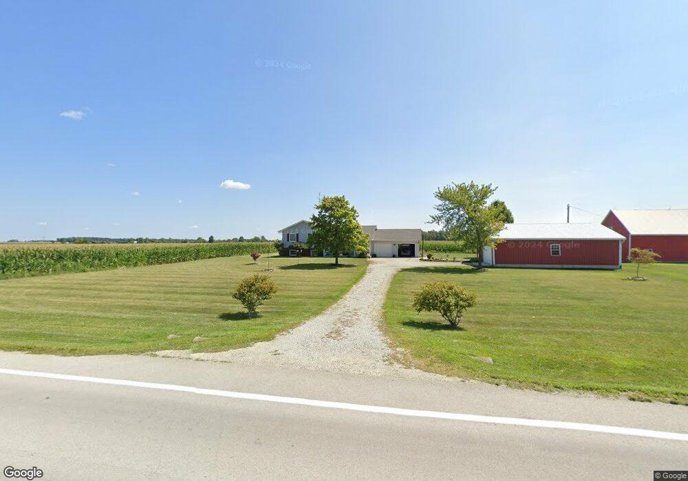
8192 State Route 118 Celina, OH 45822
Estimated Value: $278,000 - $469,000
--
Bed
2
Baths
2,040
Sq Ft
$173/Sq Ft
Est. Value
About This Home
This home is located at 8192 State Route 118, Celina, OH 45822 and is currently estimated at $353,097, approximately $173 per square foot. 8192 State Route 118 is a home located in Mercer County with nearby schools including Celina Middle School and Celina High School.
Ownership History
Date
Name
Owned For
Owner Type
Purchase Details
Closed on
Sep 22, 2010
Sold by
Hayes Stephen B and Hayes Kathleen
Bought by
Wellman Louis D and Wellman Jennifer R
Current Estimated Value
Home Financials for this Owner
Home Financials are based on the most recent Mortgage that was taken out on this home.
Original Mortgage
$106,851
Interest Rate
4.37%
Mortgage Type
FHA
Create a Home Valuation Report for This Property
The Home Valuation Report is an in-depth analysis detailing your home's value as well as a comparison with similar homes in the area
Home Values in the Area
Average Home Value in this Area
Purchase History
| Date | Buyer | Sale Price | Title Company |
|---|---|---|---|
| Wellman Louis D | $140,000 | Attorney |
Source: Public Records
Mortgage History
| Date | Status | Borrower | Loan Amount |
|---|---|---|---|
| Closed | Wellman Louis D | $106,851 |
Source: Public Records
Tax History Compared to Growth
Tax History
| Year | Tax Paid | Tax Assessment Tax Assessment Total Assessment is a certain percentage of the fair market value that is determined by local assessors to be the total taxable value of land and additions on the property. | Land | Improvement |
|---|---|---|---|---|
| 2024 | $3,344 | $82,780 | $9,280 | $73,500 |
| 2023 | $3,344 | $82,780 | $9,280 | $73,500 |
| 2022 | $2,772 | $58,380 | $8,190 | $50,190 |
| 2021 | $2,779 | $58,380 | $8,190 | $50,190 |
| 2020 | $1,187 | $58,380 | $8,190 | $50,190 |
| 2019 | $2,158 | $50,540 | $7,420 | $43,120 |
| 2018 | $2,239 | $50,540 | $7,420 | $43,120 |
| 2017 | $2,065 | $50,540 | $7,420 | $43,120 |
| 2016 | $1,890 | $43,860 | $7,810 | $36,050 |
| 2015 | $1,837 | $43,860 | $7,810 | $36,050 |
| 2014 | $1,766 | $43,860 | $7,810 | $36,050 |
| 2013 | $1,687 | $38,960 | $6,900 | $32,060 |
Source: Public Records
Map
Nearby Homes
- 6799 Debra Ave
- 4640 Sierra Dr
- 6699 Gause Rd
- 6764 Silver Lakes Dr
- 1101 Timothy Ln
- 1218 Brittany Dr
- 0 Anderson 13&14 & Roadway 12&13 Unit 1037886
- 1528 Mary Ln
- 0 Anderson Lots 10 11 & 12 Ln Unit 1037885
- 0 Springer 1-6 & Roadway 14-16 Unit 1037883
- 628 Hoying St
- 9155 Us Route 127
- 618 W Livingston St
- 627 N Sugar St
- 611 N Sugar St
- 115 Touvelle St
- 210 S Elm St
- 515 W Fayette St
- 680 N Main St
- 718 Wilkins St
- 8192 Ohio 118
- 8240 State Route 118
- 8080 State Route 118
- 8332 State Route 118
- 8339 State Route 118
- 3845 Schleucher Rd
- 4001 Frahm Pike
- 7879 State Route 118
- 3687 Schleucher Rd
- 7879 Ohio 118
- 4370 Frahm Pike
- 3853 Frahm Pike
- 8571 State Route 118
- 3835 Frahm Pike
- 4249 Frahm Pike
- 4307 Frahm Pike
- 4349 Frahm Pike
- 4349 Frahm Pike
- 4400 Frahm Pike
- 3594 Schleucher Rd