Estimated Value: $159,895 - $343,000
--
Bed
1
Bath
1,860
Sq Ft
$141/Sq Ft
Est. Value
About This Home
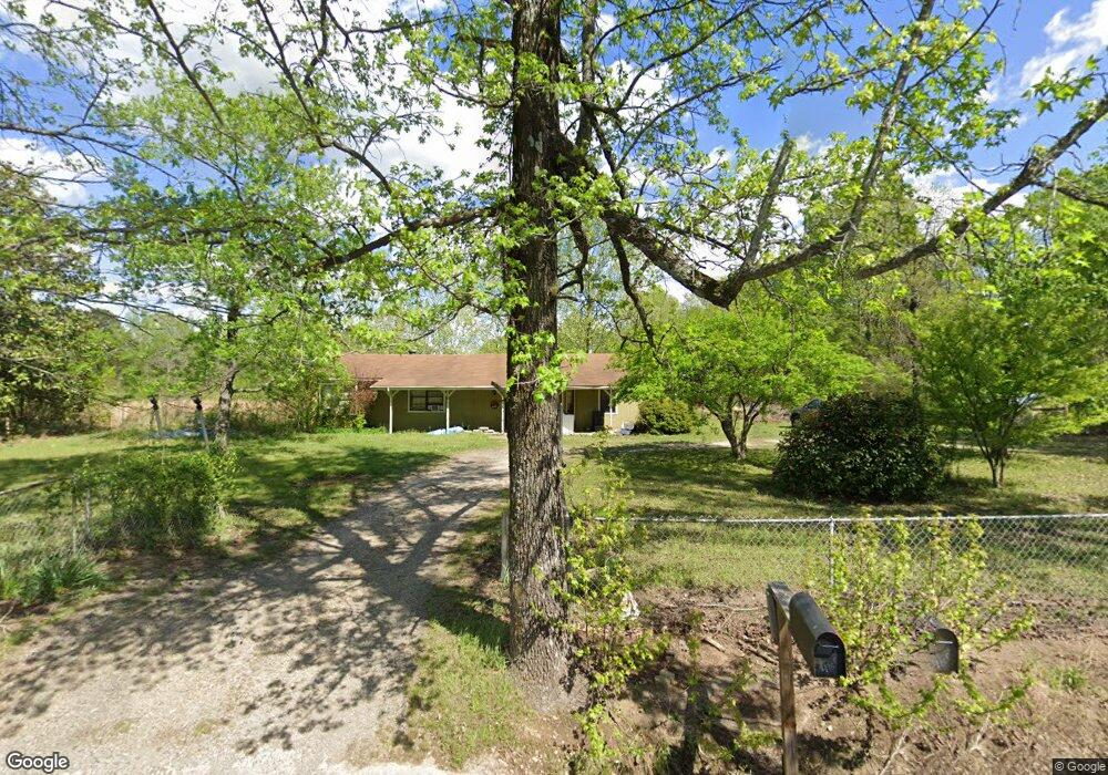
This home is located at 8195 Kerr Station Rd, Cabot, AR 72023 and is currently estimated at $261,974, approximately $140 per square foot. 8195 Kerr Station Rd is a home located in Lonoke County with nearby schools including Southside Elementary School, Cabot Junior High South, and Cabot Middle School South.
Ownership History
Date
Name
Owned For
Owner Type
Purchase Details
Closed on
Sep 20, 2006
Sold by
Perry David C and Perry Pamela
Bought by
Shuptrine Matthew and Shuptrine Katie
Current Estimated Value
Home Financials for this Owner
Home Financials are based on the most recent Mortgage that was taken out on this home.
Original Mortgage
$80,750
Outstanding Balance
$48,176
Interest Rate
6.55%
Estimated Equity
$213,798
Purchase Details
Closed on
Sep 6, 2006
Sold by
Perry David C and Perry Pamela
Bought by
Shuptrine Matthew and Shuptrine Katie
Home Financials for this Owner
Home Financials are based on the most recent Mortgage that was taken out on this home.
Original Mortgage
$80,750
Outstanding Balance
$48,176
Interest Rate
6.55%
Estimated Equity
$213,798
Purchase Details
Closed on
Feb 26, 1980
Bought by
David Perry and Wife Pamela
Create a Home Valuation Report for This Property
The Home Valuation Report is an in-depth analysis detailing your home's value as well as a comparison with similar homes in the area
Home Values in the Area
Average Home Value in this Area
Purchase History
| Date | Buyer | Sale Price | Title Company |
|---|---|---|---|
| Shuptrine Matthew | -- | Bankers Title Llc | |
| Shuptrine Matthew | -- | Bankers Title Llc | |
| David Perry | -- | -- |
Source: Public Records
Mortgage History
| Date | Status | Borrower | Loan Amount |
|---|---|---|---|
| Open | Shuptrine Matthew | $80,750 | |
| Closed | Shuptrine Matthew | $80,750 |
Source: Public Records
Tax History Compared to Growth
Tax History
| Year | Tax Paid | Tax Assessment Tax Assessment Total Assessment is a certain percentage of the fair market value that is determined by local assessors to be the total taxable value of land and additions on the property. | Land | Improvement |
|---|---|---|---|---|
| 2025 | $587 | $21,960 | $3,000 | $18,960 |
| 2024 | $587 | $21,960 | $3,000 | $18,960 |
| 2023 | $587 | $21,960 | $3,000 | $18,960 |
| 2022 | $594 | $21,960 | $3,000 | $18,960 |
| 2021 | $551 | $21,960 | $3,000 | $18,960 |
| 2020 | $509 | $18,640 | $3,000 | $15,640 |
| 2019 | $509 | $18,640 | $3,000 | $15,640 |
| 2018 | $534 | $18,640 | $3,000 | $15,640 |
| 2017 | $775 | $18,640 | $3,000 | $15,640 |
| 2016 | $517 | $18,640 | $3,000 | $15,640 |
| 2015 | $477 | $17,410 | $3,000 | $14,410 |
| 2014 | $477 | $17,410 | $3,000 | $14,410 |
Source: Public Records
Map
Nearby Homes
- 2804 Arkansas 294
- 176 John Shelton Rd
- 224 and 262 Oak Grove Dr
- 923 Cole Dr
- 20 Tower Hill Ln
- 136 Chickory Ln
- 000 Poppy Ln
- 215 Williamson Blvd
- 1375 Robin Rd
- 214 Lone Oak Dr
- 189 Flowers Rd
- 141 Highway 294
- 5821 Arkansas 294
- 2923 Graham Rd
- 232 Sunset Cir
- 1064 Oliver Ln
- 281 Gautney Ln
- 1D Forbus Rd
- Lot 40 S Kittyhawk Ln
- 1305 Glenn Rd
- 101 Bill Foster Hwy
- 101 Bill Foster Hwy Unit Hwy 321/ Bill Foster
- 8174 Kerr Station Rd
- 8135 Kerr Station Rd
- 8045 Kerr Station Rd
- 2165 Graham Rd
- 2235 Graham Rd
- 2135 Graham Rd
- 2365 Graham Rd
- 8226 Kerr Station Rd
- 2190 Graham Rd
- 2160 Graham Rd
- 2300 Graham Rd
- 2300 Graham Rd
- 7964 Kerr Station Rd
- 2010 Graham Rd
- 2040 Graham Rd
- 1895 Graham Rd
- 2015 Graham Rd Unit 2025
- 8125 Kerr Station Rd