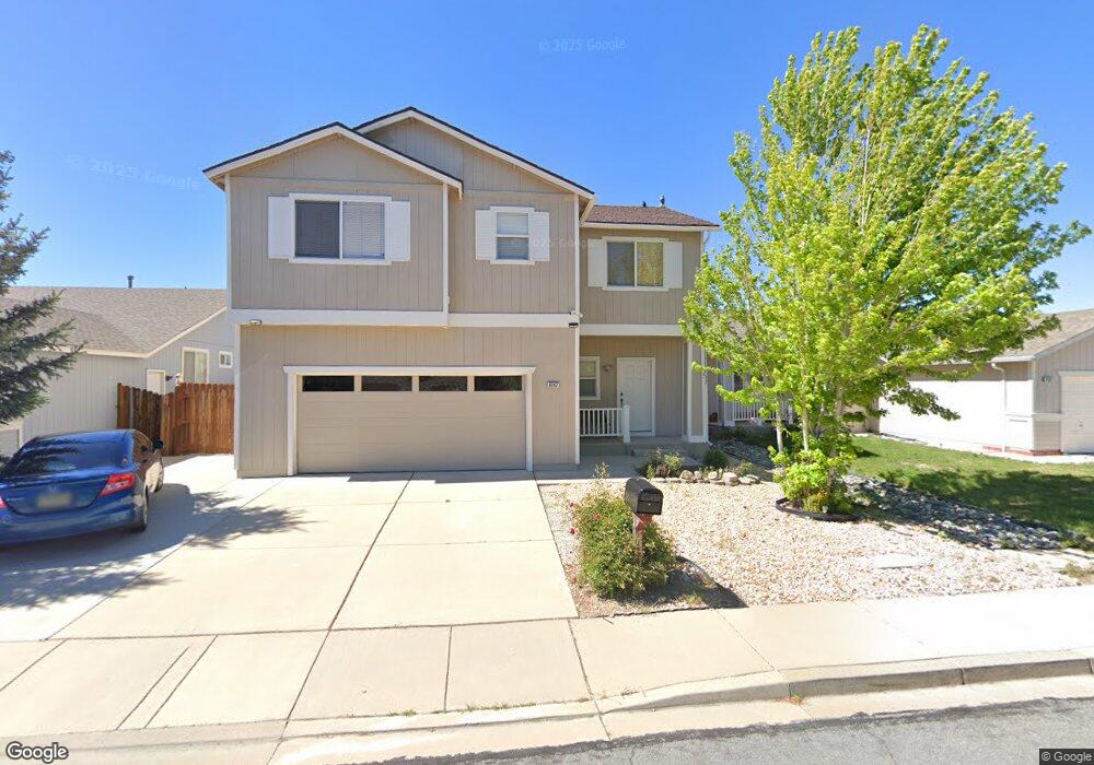
8197 Anchor Point Dr Reno, NV 89506
Stead NeighborhoodEstimated Value: $427,437 - $452,000
4
Beds
3
Baths
1,698
Sq Ft
$259/Sq Ft
Est. Value
About This Home
This home is located at 8197 Anchor Point Dr, Reno, NV 89506 and is currently estimated at $440,609, approximately $259 per square foot. 8197 Anchor Point Dr is a home located in Washoe County with nearby schools including Silver Lake Elementary School, Cold Springs Middle Schools, and North Valleys High School.
Ownership History
Date
Name
Owned For
Owner Type
Purchase Details
Closed on
May 3, 2004
Sold by
Cline Dennis D and Cline Raedeane
Bought by
Pivaral Pozuelos Haroldo and Giron Zully A
Current Estimated Value
Home Financials for this Owner
Home Financials are based on the most recent Mortgage that was taken out on this home.
Original Mortgage
$159,920
Outstanding Balance
$74,346
Interest Rate
5.38%
Mortgage Type
Unknown
Estimated Equity
$366,263
Purchase Details
Closed on
Oct 9, 1998
Sold by
Lewis Homes Of Nevada
Bought by
Cline Dennis D and Cline Raedeane
Home Financials for this Owner
Home Financials are based on the most recent Mortgage that was taken out on this home.
Original Mortgage
$132,822
Interest Rate
6.61%
Mortgage Type
FHA
Create a Home Valuation Report for This Property
The Home Valuation Report is an in-depth analysis detailing your home's value as well as a comparison with similar homes in the area
Home Values in the Area
Average Home Value in this Area
Purchase History
| Date | Buyer | Sale Price | Title Company |
|---|---|---|---|
| Pivaral Pozuelos Haroldo | $200,000 | First Centennial Title Co | |
| Cline Dennis D | $135,500 | United Title |
Source: Public Records
Mortgage History
| Date | Status | Borrower | Loan Amount |
|---|---|---|---|
| Open | Pivaral Pozuelos Haroldo | $159,920 | |
| Previous Owner | Cline Dennis D | $132,822 | |
| Closed | Pivaral Pozuelos Haroldo | $29,985 |
Source: Public Records
Tax History Compared to Growth
Tax History
| Year | Tax Paid | Tax Assessment Tax Assessment Total Assessment is a certain percentage of the fair market value that is determined by local assessors to be the total taxable value of land and additions on the property. | Land | Improvement |
|---|---|---|---|---|
| 2025 | $1,894 | $92,279 | $32,270 | $60,009 |
| 2024 | $1,894 | $89,687 | $28,980 | $60,707 |
| 2023 | $1,839 | $85,283 | $27,790 | $57,493 |
| 2022 | $1,786 | $72,241 | $24,360 | $47,881 |
| 2021 | $1,734 | $66,844 | $19,075 | $47,769 |
| 2020 | $1,682 | $66,440 | $18,480 | $47,960 |
| 2019 | $1,633 | $64,694 | $18,235 | $46,459 |
| 2018 | $1,449 | $54,716 | $12,915 | $41,801 |
| 2017 | $1,407 | $53,946 | $12,040 | $41,906 |
| 2016 | $1,371 | $53,547 | $10,675 | $42,872 |
| 2015 | $345 | $51,818 | $8,960 | $42,858 |
| 2014 | $1,329 | $46,120 | $7,175 | $38,945 |
| 2013 | -- | $35,613 | $5,250 | $30,363 |
Source: Public Records
Map
Nearby Homes
- 8055 White Falls Dr
- 8720 Malibu Dr
- 7973 Moss Creek Dr
- 7956 White Falls Dr
- 7961 Big River Dr Unit 17
- 8565 Silver Shores Dr
- 7991 Mariner Cove Dr
- 8529 Red Baron Blvd
- 7690 Deep Bay Dr
- 8419 Sopwith Blvd
- 7751 Mariner Cove Dr
- 7750 Mariner Cove Dr
- 9500 N Red Rock Rd
- 8517 Corrigan Way
- 8480 Corrigan Way
- Red Rock 19.82 Acres
- 8678 Strutter Way
- 8410 Red Baron Blvd
- 7378 Silver Dawn Dr
- 7480 Spey Dr
- 8207 Anchor Point Dr
- 8217 Anchor Point Dr
- 8177 Anchor Point Dr
- 8187 Anchor Point Dr
- 8200 Shifting Sands Dr
- 8190 Shifting Sands Dr
- 8208 Anchor Point Dr
- 8227 Anchor Point Dr
- 8220 Shifting Sands Dr
- 8167 Anchor Point Dr
- 8180 Shifting Sands Dr
- 8188 Anchor Point Dr
- 8198 Anchor Point Dr
- 8178 Anchor Point Dr
- 8230 Shifting Sands Dr
- 8170 Shifting Sands Dr
- 8218 Anchor Point Dr
- 8237 Anchor Point Dr
- 8168 Anchor Point Dr
- 8157 Anchor Point Dr