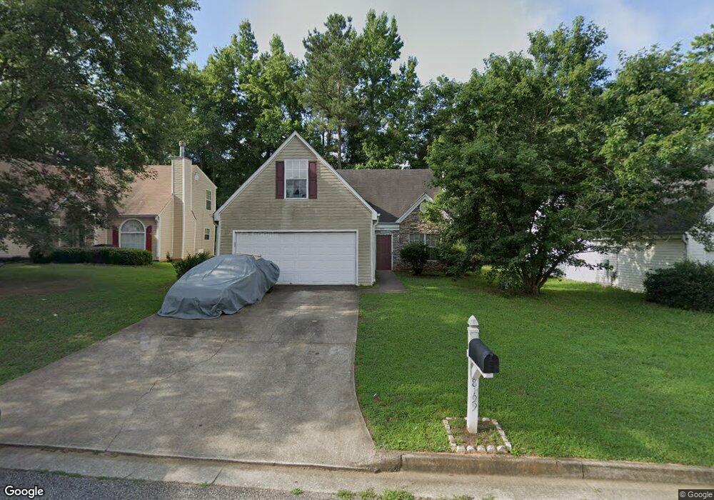
8199 Wynfield Dr Jonesboro, GA 30238
Estimated Value: $244,094 - $258,000
3
Beds
2
Baths
1,860
Sq Ft
$136/Sq Ft
Est. Value
About This Home
This home is located at 8199 Wynfield Dr, Jonesboro, GA 30238 and is currently estimated at $253,024, approximately $136 per square foot. 8199 Wynfield Dr is a home located in Clayton County with nearby schools including Lee Street Elementary School, Jonesboro Middle School, and Jonesboro High School.
Ownership History
Date
Name
Owned For
Owner Type
Purchase Details
Closed on
Jan 20, 2004
Sold by
Hud
Bought by
Turner Darlerie
Current Estimated Value
Home Financials for this Owner
Home Financials are based on the most recent Mortgage that was taken out on this home.
Original Mortgage
$100,000
Outstanding Balance
$46,474
Interest Rate
5.81%
Mortgage Type
New Conventional
Estimated Equity
$206,550
Purchase Details
Closed on
Sep 2, 2003
Sold by
Midfirst Bank
Bought by
Hud
Purchase Details
Closed on
Jul 27, 2000
Sold by
Forrest Homes
Bought by
Hill Clestine
Home Financials for this Owner
Home Financials are based on the most recent Mortgage that was taken out on this home.
Original Mortgage
$120,410
Interest Rate
8.23%
Mortgage Type
FHA
Create a Home Valuation Report for This Property
The Home Valuation Report is an in-depth analysis detailing your home's value as well as a comparison with similar homes in the area
Home Values in the Area
Average Home Value in this Area
Purchase History
| Date | Buyer | Sale Price | Title Company |
|---|---|---|---|
| Turner Darlerie | -- | -- | |
| Hud | -- | -- | |
| Midfirst Bank | $155,071 | -- | |
| Hill Clestine | $122,000 | -- |
Source: Public Records
Mortgage History
| Date | Status | Borrower | Loan Amount |
|---|---|---|---|
| Open | Turner Darlerie | $100,000 | |
| Previous Owner | Hill Clestine | $120,410 |
Source: Public Records
Tax History Compared to Growth
Tax History
| Year | Tax Paid | Tax Assessment Tax Assessment Total Assessment is a certain percentage of the fair market value that is determined by local assessors to be the total taxable value of land and additions on the property. | Land | Improvement |
|---|---|---|---|---|
| 2024 | $3,304 | $93,720 | $6,400 | $87,320 |
| 2023 | $3,398 | $94,120 | $6,400 | $87,720 |
| 2022 | $2,630 | $76,040 | $6,400 | $69,640 |
| 2021 | $1,768 | $53,800 | $6,400 | $47,400 |
| 2020 | $1,689 | $51,292 | $6,400 | $44,892 |
| 2019 | $1,654 | $49,802 | $6,000 | $43,802 |
| 2018 | $1,500 | $46,010 | $6,000 | $40,010 |
| 2017 | $1,433 | $44,273 | $6,000 | $38,273 |
| 2016 | $1,097 | $36,037 | $6,000 | $30,037 |
| 2015 | $1,078 | $0 | $0 | $0 |
| 2014 | $988 | $33,872 | $6,000 | $27,872 |
Source: Public Records
Map
Nearby Homes
- 602 Dixon Rd
- 729 Winter Ln
- 8474 Magnolia Dr
- 636 North Ave Unit 3H
- 636 North Ave Unit 5A
- 636 North Ave Unit 11A
- 8431 Magnolia Dr
- 626 Sycamore Dr
- 570 Sycamore Dr
- 8469 Shiloh Ct
- 8506 Kaden Dr
- 139 North Ave
- 761 Robert e Lee Pkwy
- 7994 Devonshire Dr
- 8236 Tudor Dr
- 135 N Main St
- 181 Dean St
- 9758 Highway 54
- 556 Maggie Ln
- 687 Utoy Ct
- 8193 Wynfield Dr
- 8205 Wynfield Dr
- 8187 Wynfield Dr
- 8211 Wynfield Dr
- 694 Hynds Springs Dr
- 688 Hynds Springs Dr
- 700 Hynds Springs Dr
- 8196 Wynfield Dr
- 682 Hynds Springs Dr
- 8202 Wynfield Dr
- 8190 Wynfield Dr
- 8217 Wynfield Dr
- 706 Hynds Springs Dr
- 706 Hynds Springs Dr Unit 72
- 8181 Wynfield Dr
- 8208 Wynfield Dr
- 8184 Wynfield Dr
- 676 Hynds Springs Dr
- 712 Hynds Springs Dr
- 8223 Wynfield Dr