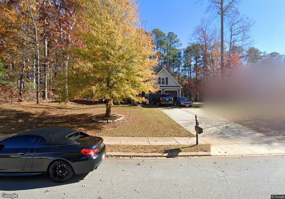
82 Adams Point Dr Garner, NC 27529
Cleveland NeighborhoodEstimated Value: $538,000 - $550,893
4
Beds
3
Baths
3,232
Sq Ft
$168/Sq Ft
Est. Value
About This Home
This home is located at 82 Adams Point Dr, Garner, NC 27529 and is currently estimated at $544,223, approximately $168 per square foot. 82 Adams Point Dr is a home located in Johnston County with nearby schools including West View Elementary School, Cleveland Middle School, and West Johnston High School.
Ownership History
Date
Name
Owned For
Owner Type
Purchase Details
Closed on
Nov 6, 2020
Sold by
Case Nicholas W and Case Melissa
Bought by
Lawrence Sherice Laynette and Lawrence Gerald Wendell
Current Estimated Value
Home Financials for this Owner
Home Financials are based on the most recent Mortgage that was taken out on this home.
Original Mortgage
$327,250
Outstanding Balance
$291,729
Interest Rate
2.9%
Mortgage Type
New Conventional
Estimated Equity
$252,494
Purchase Details
Closed on
Jul 23, 2018
Sold by
Smith Andrea J and Smith Phillip L
Bought by
Case Nicholas W and Case Melissa
Home Financials for this Owner
Home Financials are based on the most recent Mortgage that was taken out on this home.
Original Mortgage
$281,200
Interest Rate
4.6%
Mortgage Type
New Conventional
Purchase Details
Closed on
Oct 31, 2013
Sold by
Brookfield Relocation Inc
Bought by
Smith Andrea J and Smith Phillip L
Home Financials for this Owner
Home Financials are based on the most recent Mortgage that was taken out on this home.
Original Mortgage
$270,697
Interest Rate
4.23%
Mortgage Type
VA
Purchase Details
Closed on
Apr 5, 2007
Sold by
Southpoint Homes Llc
Bought by
Lascano Edison and Lascano Lillian
Home Financials for this Owner
Home Financials are based on the most recent Mortgage that was taken out on this home.
Original Mortgage
$58,000
Interest Rate
6.1%
Mortgage Type
Stand Alone Second
Create a Home Valuation Report for This Property
The Home Valuation Report is an in-depth analysis detailing your home's value as well as a comparison with similar homes in the area
Home Values in the Area
Average Home Value in this Area
Purchase History
| Date | Buyer | Sale Price | Title Company |
|---|---|---|---|
| Lawrence Sherice Laynette | $385,000 | None Available | |
| Case Nicholas W | $296,000 | None Available | |
| Smith Andrea J | $265,000 | None Available | |
| Brookfield Relocation Inc | $265,000 | None Available | |
| Lascano Edison | $290,000 | None Available |
Source: Public Records
Mortgage History
| Date | Status | Borrower | Loan Amount |
|---|---|---|---|
| Open | Lawrence Sherice Laynette | $327,250 | |
| Previous Owner | Case Nicholas W | $281,200 | |
| Previous Owner | Brookfield Relocation Inc | $270,697 | |
| Previous Owner | Lascano Edison | $58,000 | |
| Previous Owner | Lascano Edison | $232,000 |
Source: Public Records
Tax History Compared to Growth
Tax History
| Year | Tax Paid | Tax Assessment Tax Assessment Total Assessment is a certain percentage of the fair market value that is determined by local assessors to be the total taxable value of land and additions on the property. | Land | Improvement |
|---|---|---|---|---|
| 2025 | $3,352 | $527,900 | $70,000 | $457,900 |
| 2024 | $2,787 | $344,030 | $48,000 | $296,030 |
| 2023 | $2,692 | $344,030 | $48,000 | $296,030 |
| 2022 | $2,830 | $344,030 | $48,000 | $296,030 |
| 2021 | $2,830 | $344,030 | $48,000 | $296,030 |
| 2020 | $2,885 | $344,030 | $48,000 | $296,030 |
| 2019 | $2,636 | $316,650 | $48,000 | $268,650 |
| 2018 | $0 | $294,700 | $44,000 | $250,700 |
| 2017 | $2,512 | $294,700 | $44,000 | $250,700 |
| 2016 | $2,512 | $294,700 | $44,000 | $250,700 |
| 2015 | $2,512 | $294,700 | $44,000 | $250,700 |
| 2014 | $2,512 | $294,700 | $44,000 | $250,700 |
Source: Public Records
Map
Nearby Homes
- 75 Fawn Hill Ct
- 181 Fawn Hill Ct
- 413 Fieldtrial Cir
- Roanoke Plan at Brant Station
- Fontana Plan at Brant Station
- Avenel II Plan at Brant Station
- 111 Artic Cir
- 325 Airedale Trail
- 146 Shadowbark Dr
- 39 Beau Dr
- 115 Unique Place
- 394 Airedale Trail
- 386 Artic Cir
- 291 Artic Cir
- 1037 Olive Dr
- 165 Rynal Dr
- 58 Larkwood Ln
- 36 Labradoodle Ct
- 51 Makers Way
- 1152 Black Angus Dr
- 58 Adams Point Dr
- 1750 Old Drug Store Rd
- 40 Adams Point Dr
- 65 Adams Point Dr
- 99 Adams Point Dr
- 83 Adams Point Dr
- 137 Adams Point Dr
- 22 Adams Point Dr
- 27 Adams Point Dr
- 174 Adams Point Dr
- 194 Adams Point Dr
- 112 Fawn Hill Ct
- 23 Morning Mist Dr
- 1721 Old Drug Store Rd
- 1715 Old Drug Store Rd
- 1198 Fieldtrial Cir
- 1204 Fieldtrial Cir
- 364 Adams Point Dr
- 243 Adams Point Dr
- 126 Fawn Hill Ct