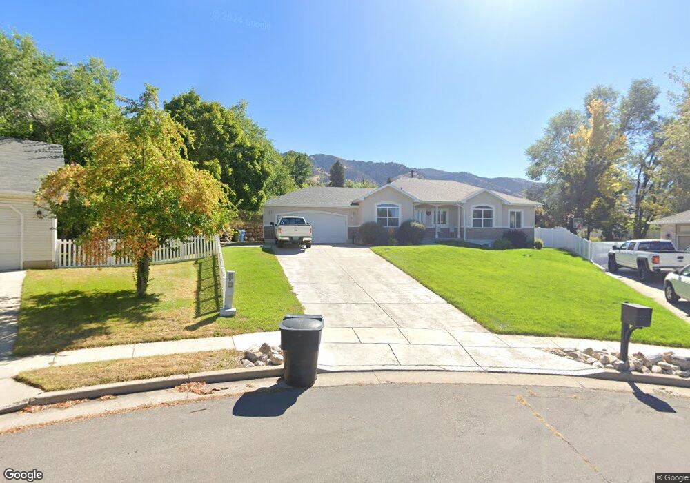
82 Canterbury Cir Logan, UT 84321
Wilson NeighborhoodEstimated Value: $548,000 - $669,000
6
Beds
3
Baths
3,312
Sq Ft
$186/Sq Ft
Est. Value
About This Home
This home is located at 82 Canterbury Cir, Logan, UT 84321 and is currently estimated at $616,173, approximately $186 per square foot. 82 Canterbury Cir is a home located in Cache County with nearby schools including Wilson School, Mount Logan Middle School, and Logan High School.
Ownership History
Date
Name
Owned For
Owner Type
Purchase Details
Closed on
Nov 17, 2017
Sold by
Edwards Boyd and Edwards Nadine
Bought by
Nixon Debbie Lynn and Nixon Richard Todd
Current Estimated Value
Home Financials for this Owner
Home Financials are based on the most recent Mortgage that was taken out on this home.
Original Mortgage
$261,600
Outstanding Balance
$218,860
Interest Rate
3.88%
Mortgage Type
New Conventional
Estimated Equity
$397,313
Purchase Details
Closed on
Nov 16, 2015
Sold by
Burton Scott L and Burton Angela
Bought by
Edwards Boyd and Edwards Nadine
Purchase Details
Closed on
Aug 22, 2005
Sold by
B & J Custom Building Inc
Bought by
Burton Scott L and Burton Angela
Home Financials for this Owner
Home Financials are based on the most recent Mortgage that was taken out on this home.
Original Mortgage
$230,000
Interest Rate
10%
Mortgage Type
Purchase Money Mortgage
Create a Home Valuation Report for This Property
The Home Valuation Report is an in-depth analysis detailing your home's value as well as a comparison with similar homes in the area
Home Values in the Area
Average Home Value in this Area
Purchase History
| Date | Buyer | Sale Price | Title Company |
|---|---|---|---|
| Nixon Debbie Lynn | -- | -- | |
| Edwards Boyd | -- | American Secure Title Logan | |
| Burton Scott L | -- | Northern Title Company |
Source: Public Records
Mortgage History
| Date | Status | Borrower | Loan Amount |
|---|---|---|---|
| Open | Nixon Debbie Lynn | $261,600 | |
| Previous Owner | Burton Scott L | $230,000 |
Source: Public Records
Tax History Compared to Growth
Tax History
| Year | Tax Paid | Tax Assessment Tax Assessment Total Assessment is a certain percentage of the fair market value that is determined by local assessors to be the total taxable value of land and additions on the property. | Land | Improvement |
|---|---|---|---|---|
| 2025 | $2,427 | $313,935 | $0 | $0 |
| 2024 | $2,510 | $314,470 | $0 | $0 |
| 2023 | $2,604 | $310,890 | $0 | $0 |
| 2022 | $2,404 | $268,020 | $0 | $0 |
| 2021 | $238 | $409,810 | $99,850 | $309,960 |
| 2020 | $2,505 | $388,397 | $99,850 | $288,547 |
| 2019 | $2,619 | $388,396 | $99,850 | $288,546 |
| 2018 | $2,590 | $350,760 | $99,850 | $250,910 |
| 2017 | $2,301 | $164,780 | $0 | $0 |
| 2016 | $2,386 | $164,780 | $0 | $0 |
| 2015 | $2,432 | $167,750 | $0 | $0 |
| 2014 | $1,903 | $145,185 | $0 | $0 |
| 2013 | -- | $145,185 | $0 | $0 |
Source: Public Records
Map
Nearby Homes
- 1034 Thrushwood Dr
- 28 River Pointe Dr
- 128 S 1170 E
- 1045 Fox Farm Rd
- 1279 Eastridge Dr
- 10 S 1300 E
- 45 River Circle Dr
- 1374 E 260 N
- 1383 Mount Logan Loop
- 684 Apple Dr
- 1387 E 260 N
- 555 E Center St
- 239 E 690 N
- 443 S 750 E
- 780 Green Field Cir
- 567 E 200 N
- 665 E 400 S
- 429 750 E Unit 25
- 540 750 E Unit 41
- 490 750 E Unit 51
- 90 Canterbury Cir
- 972 Sunset Ridge
- 74 Canterbury Cir
- 74 Canterbury Cir
- 996 Sunset Ridge
- 83 Canterbury Cir
- 83 Canterbury Cir
- 66 Canterbury Cir Unit 17
- 66 Canterbury Cir
- 960 Sunset Ridge
- 81 Lj Cir Unit 4
- 75 Canterbury Cir
- 52 S 1000 E
- 96 Lj Cir
- 985 Sunset Ridge
- 1010 E 100 S
- 1010 E 100 S Unit 1
- 997 Sunset Ridge
- 86 River Heights Blvd
- 58 Canterbury Cir