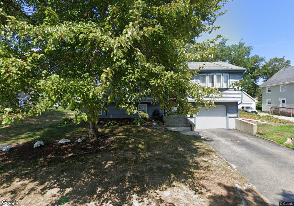
82 Euclid Ave Somerset, MA 02726
Somerset Historic Village NeighborhoodEstimated Value: $513,000 - $602,000
3
Beds
2
Baths
1,132
Sq Ft
$479/Sq Ft
Est. Value
About This Home
This home is located at 82 Euclid Ave, Somerset, MA 02726 and is currently estimated at $542,069, approximately $478 per square foot. 82 Euclid Ave is a home located in Bristol County with nearby schools including North Elementary School and Somerset Middle School.
Ownership History
Date
Name
Owned For
Owner Type
Purchase Details
Closed on
Aug 31, 2005
Sold by
Cox Carol L and Chabot Randy R
Bought by
Duwart Kimberly and Rego Ryan D
Current Estimated Value
Home Financials for this Owner
Home Financials are based on the most recent Mortgage that was taken out on this home.
Original Mortgage
$256,000
Outstanding Balance
$136,616
Interest Rate
5.81%
Mortgage Type
Purchase Money Mortgage
Estimated Equity
$405,453
Purchase Details
Closed on
Nov 12, 2002
Sold by
Sirois John J and Sirois Michelle
Bought by
Chabot Randy R and Cox Carol
Home Financials for this Owner
Home Financials are based on the most recent Mortgage that was taken out on this home.
Original Mortgage
$246,056
Interest Rate
6.04%
Mortgage Type
Purchase Money Mortgage
Purchase Details
Closed on
Mar 24, 1997
Sold by
Correira David J and Correira Ann M
Bought by
Sirois John J and Sirois Michelle
Create a Home Valuation Report for This Property
The Home Valuation Report is an in-depth analysis detailing your home's value as well as a comparison with similar homes in the area
Home Values in the Area
Average Home Value in this Area
Purchase History
| Date | Buyer | Sale Price | Title Company |
|---|---|---|---|
| Duwart Kimberly | $320,000 | -- | |
| Duwart Kimberly | $320,000 | -- | |
| Chabot Randy R | $248,000 | -- | |
| Chabot Randy R | $248,000 | -- | |
| Sirois John J | $130,000 | -- | |
| Sirois John J | $130,000 | -- |
Source: Public Records
Mortgage History
| Date | Status | Borrower | Loan Amount |
|---|---|---|---|
| Open | Duwart Kimberly | $256,000 | |
| Closed | Sirois John J | $256,000 | |
| Previous Owner | Sirois John J | $246,056 |
Source: Public Records
Tax History Compared to Growth
Tax History
| Year | Tax Paid | Tax Assessment Tax Assessment Total Assessment is a certain percentage of the fair market value that is determined by local assessors to be the total taxable value of land and additions on the property. | Land | Improvement |
|---|---|---|---|---|
| 2025 | $5,625 | $422,900 | $180,100 | $242,800 |
| 2024 | $5,245 | $410,100 | $180,100 | $230,000 |
| 2023 | $4,629 | $365,100 | $156,500 | $208,600 |
| 2022 | $4,278 | $321,900 | $135,100 | $186,800 |
| 2021 | $3,153 | $293,500 | $122,100 | $171,400 |
| 2020 | $4,350 | $285,800 | $122,100 | $163,700 |
| 2019 | $4,917 | $269,400 | $122,100 | $147,300 |
| 2018 | $2,931 | $260,500 | $118,000 | $142,500 |
| 2017 | $4,284 | $246,200 | $112,600 | $133,600 |
| 2016 | $4,311 | $246,200 | $112,600 | $133,600 |
| 2015 | $4,022 | $231,800 | $107,500 | $124,300 |
| 2014 | $5,593 | $231,600 | $104,400 | $127,200 |
Source: Public Records
Map
Nearby Homes
- 239 Maple St
- 138 Bourn Ave
- 562 Main St
- 0 Palmer St
- 2546 County St
- 4700 N Main St Unit 3E
- 190 Gibbs St
- 224 Chace St
- 165 Yankee Peddler Dr
- 112 Rounseville Ave
- 135 Grove Ave
- 601 Eastview Ave
- 5455 N Main St Unit 17A
- 5455 N Main St Unit 13A
- 5455 N Main St Unit 14B
- 95 Brookside Rd
- 64 Midland Rd
- 3896 N Main St
- 604 Lafayette St
- 64 Denham Ave