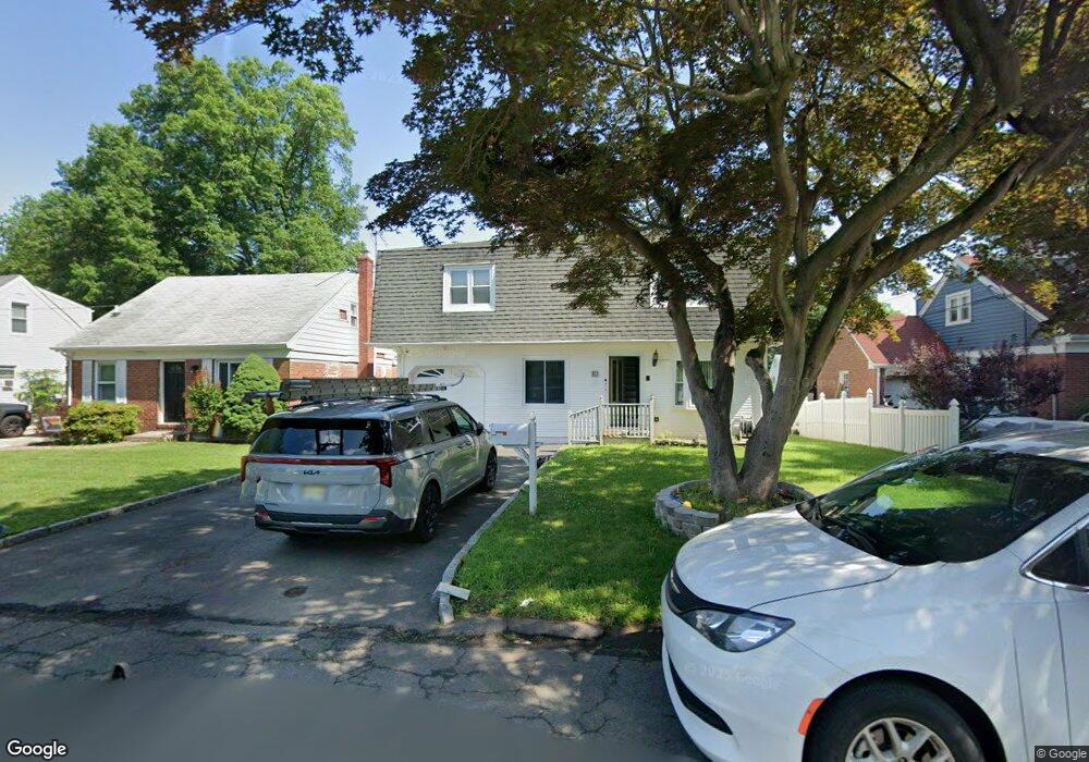
82 Forest Rd Dumont, NJ 07628
Estimated Value: $643,000 - $773,000
4
Beds
3
Baths
2,052
Sq Ft
$349/Sq Ft
Est. Value
About This Home
This home is located at 82 Forest Rd, Dumont, NJ 07628 and is currently estimated at $715,541, approximately $348 per square foot. 82 Forest Rd is a home located in Bergen County with nearby schools including Dumont High School and Institute For Educational Achievement.
Ownership History
Date
Name
Owned For
Owner Type
Purchase Details
Closed on
May 24, 2018
Sold by
Deutsche Bk Natl T Co Tr
Bought by
Deleon Natalie and Rivera Juan
Current Estimated Value
Home Financials for this Owner
Home Financials are based on the most recent Mortgage that was taken out on this home.
Original Mortgage
$320,150
Interest Rate
3.85%
Mortgage Type
Purchase Money Mortgage
Purchase Details
Closed on
Mar 27, 2017
Sold by
Alfonso Myla
Bought by
Deutsche Bank National Trust Company
Purchase Details
Closed on
Nov 30, 2006
Sold by
Cangialosi Joseph A
Bought by
Alfonso Elias and Alfonso Myla
Home Financials for this Owner
Home Financials are based on the most recent Mortgage that was taken out on this home.
Original Mortgage
$441,600
Interest Rate
6.31%
Mortgage Type
New Conventional
Create a Home Valuation Report for This Property
The Home Valuation Report is an in-depth analysis detailing your home's value as well as a comparison with similar homes in the area
Home Values in the Area
Average Home Value in this Area
Purchase History
| Date | Buyer | Sale Price | Title Company |
|---|---|---|---|
| Deleon Natalie | $337,000 | -- | |
| Deutsche Bank National Trust Company | -- | None Available | |
| Deutsche Bk Natl T Co Tr | -- | -- | |
| Alfonso Elias | $552,000 | -- |
Source: Public Records
Mortgage History
| Date | Status | Borrower | Loan Amount |
|---|---|---|---|
| Previous Owner | Deleon Natalie | $320,150 | |
| Previous Owner | Alfonso Elias | $441,600 |
Source: Public Records
Tax History Compared to Growth
Tax History
| Year | Tax Paid | Tax Assessment Tax Assessment Total Assessment is a certain percentage of the fair market value that is determined by local assessors to be the total taxable value of land and additions on the property. | Land | Improvement |
|---|---|---|---|---|
| 2025 | $14,089 | $644,200 | $289,800 | $354,400 |
| 2024 | $13,743 | $346,600 | $164,000 | $182,600 |
| 2023 | $13,458 | $346,600 | $164,000 | $182,600 |
| 2022 | $13,458 | $346,600 | $164,000 | $182,600 |
| 2021 | $13,393 | $346,600 | $164,000 | $182,600 |
| 2020 | $13,029 | $346,600 | $164,000 | $182,600 |
| 2019 | $12,717 | $346,600 | $164,000 | $182,600 |
| 2018 | $12,457 | $346,600 | $164,000 | $182,600 |
| 2017 | $12,218 | $346,600 | $164,000 | $182,600 |
| 2016 | $11,933 | $346,600 | $164,000 | $182,600 |
| 2015 | $11,660 | $346,600 | $164,000 | $182,600 |
| 2014 | $11,431 | $346,600 | $164,000 | $182,600 |
Source: Public Records
Map
Nearby Homes
- 45 Forest Rd
- 6 Sherwood Rd
- 19 Bedford Rd
- 608 Fermery Dr
- 502 Prospect Ave
- 627 Concord St
- 54 Huntting Dr
- 48 W Linden Ave
- 88 Cedar Rd
- 507 James St
- 155 Johnson Ave
- 96 Wilkens Dr
- 201 Dixon Ave
- 259 Bedford Rd
- 377 New Milford Ave
- 62 Prospect Ave
- 51 Wood Place
- 28 Wood Place
- 27A Park Ave
- 122 W Quackenbush Ave