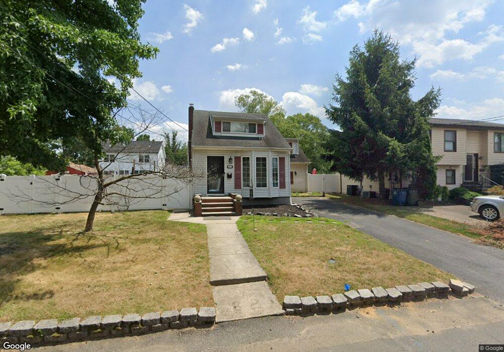
82 Furman Blvd Keyport, NJ 07735
Estimated Value: $417,000 - $614,000
3
Beds
3
Baths
1,700
Sq Ft
$290/Sq Ft
Est. Value
About This Home
This home is located at 82 Furman Blvd, Keyport, NJ 07735 and is currently estimated at $493,032, approximately $290 per square foot. 82 Furman Blvd is a home located in Middlesex County with nearby schools including Old Bridge High School, Icob Academy, and St. Joseph Elementary School.
Ownership History
Date
Name
Owned For
Owner Type
Purchase Details
Closed on
Aug 15, 2018
Sold by
Thompson Robert C and Thompson Roseann
Bought by
Simonetti Toni
Current Estimated Value
Home Financials for this Owner
Home Financials are based on the most recent Mortgage that was taken out on this home.
Original Mortgage
$266,000
Outstanding Balance
$231,010
Interest Rate
4.5%
Mortgage Type
New Conventional
Estimated Equity
$262,022
Purchase Details
Closed on
May 9, 1986
Bought by
Thompson Robert and Thompson Roseann
Create a Home Valuation Report for This Property
The Home Valuation Report is an in-depth analysis detailing your home's value as well as a comparison with similar homes in the area
Home Values in the Area
Average Home Value in this Area
Purchase History
| Date | Buyer | Sale Price | Title Company |
|---|---|---|---|
| Simonetti Toni | $320,000 | None Available | |
| Thompson Robert | -- | -- |
Source: Public Records
Mortgage History
| Date | Status | Borrower | Loan Amount |
|---|---|---|---|
| Open | Simonetti Toni | $266,000 |
Source: Public Records
Tax History Compared to Growth
Tax History
| Year | Tax Paid | Tax Assessment Tax Assessment Total Assessment is a certain percentage of the fair market value that is determined by local assessors to be the total taxable value of land and additions on the property. | Land | Improvement |
|---|---|---|---|---|
| 2025 | $6,176 | $107,800 | $47,000 | $60,800 |
| 2024 | $5,923 | $107,800 | $47,000 | $60,800 |
| 2023 | $5,923 | $107,800 | $47,000 | $60,800 |
| 2022 | $5,763 | $107,800 | $47,000 | $60,800 |
| 2021 | $4,225 | $107,800 | $47,000 | $60,800 |
| 2020 | $5,588 | $107,800 | $47,000 | $60,800 |
| 2019 | $5,499 | $107,800 | $47,000 | $60,800 |
| 2018 | $5,437 | $107,800 | $47,000 | $60,800 |
| 2017 | $5,268 | $107,800 | $47,000 | $60,800 |
| 2016 | $5,164 | $107,800 | $47,000 | $60,800 |
| 2015 | $5,073 | $107,800 | $47,000 | $60,800 |
| 2014 | $5,012 | $107,800 | $47,000 | $60,800 |
Source: Public Records
Map
Nearby Homes
- 125 Raritan Blvd
- 103 Furman Blvd
- 106 Boulevard W
- 107 Boulevard W
- 363 Ocean Blvd
- 42 Boulevard E
- 136 Hilltop Blvd
- 112 Lcpl Phillip E Frank Way
- 38 Lcpl Phillip E Frank Way Unit 38
- 281 Prospect Ave
- 250 Brookside Ave
- 940 Grove Ave
- 615 Greenwood Ave
- 146 Orchard Ave
- 235 Garfield Ave
- 21 Stemler Dr
- 438 Brookside Ave
- 737 Prospect Ave
- 169 Norwood Ave
- 181 Norwood Ave
- 79 Furman Blvd
- 139 Raritan Blvd
- 86 Furman Blvd
- 73 Ocean Blvd
- 139 Raritan Blvd
- 150 Furman Blvd
- 73 Ocean Blvd
- 75 Ocean Blvd
- 77 Ocean Blvd
- 149 Furman Blvd
- 152 Furman Blvd
- 71 Ocean Blvd
- 88 Furman Blvd
- 154 Furman Blvd
- 148 Furman Blvd
- 134 Raritan Blvd
- 156 Furman Blvd
- 84 Furman Blvd
- 90 Furman Blvd
- 146 Furman Blvd