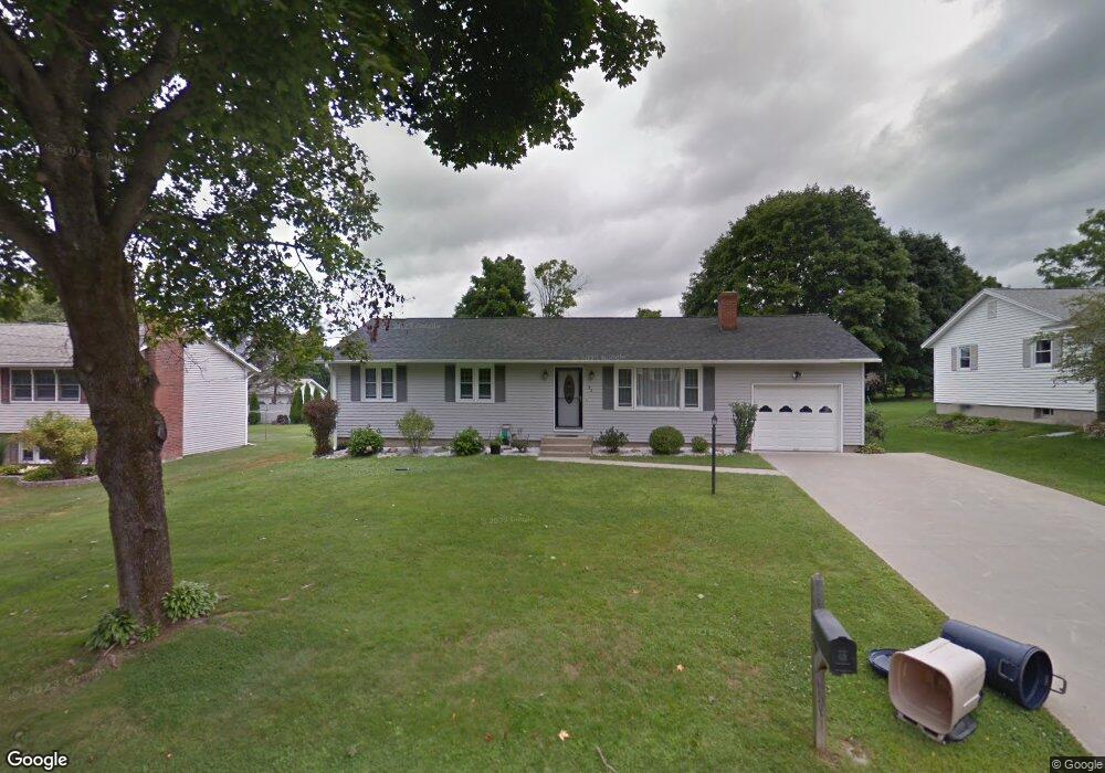
82 Joseph Dr Pittsfield, MA 01201
Estimated Value: $353,927 - $366,000
3
Beds
2
Baths
1,170
Sq Ft
$307/Sq Ft
Est. Value
About This Home
This home is located at 82 Joseph Dr, Pittsfield, MA 01201 and is currently estimated at $359,482, approximately $307 per square foot. 82 Joseph Dr is a home located in Berkshire County with nearby schools including Egremont Elementary School, Theodore Herberg Middle School, and Pittsfield High School.
Ownership History
Date
Name
Owned For
Owner Type
Purchase Details
Closed on
Sep 9, 2009
Sold by
Hartley Kyle T and Hartley Audrey A
Bought by
Hartley Audrey A
Current Estimated Value
Purchase Details
Closed on
Sep 6, 2007
Sold by
Leaphart Elizabeth G and Hartley Janett A
Bought by
Hartley Audrey A and Hartley Kyle T
Purchase Details
Closed on
Nov 2, 2006
Sold by
Leaphart Elizabeth G and Leaphart Glen D
Bought by
Leaphart Elizabeth G and Hartley Janett A
Purchase Details
Closed on
Oct 27, 1989
Sold by
Shank George L
Bought by
Leaphart Glen D
Create a Home Valuation Report for This Property
The Home Valuation Report is an in-depth analysis detailing your home's value as well as a comparison with similar homes in the area
Home Values in the Area
Average Home Value in this Area
Purchase History
| Date | Buyer | Sale Price | Title Company |
|---|---|---|---|
| Hartley Audrey A | -- | -- | |
| Hartley Audrey A | -- | -- | |
| Hartley Audrey A | -- | -- | |
| Hartley Audrey A | $170,000 | -- | |
| Hartley Audrey A | $170,000 | -- | |
| Hartley Audrey A | $170,000 | -- | |
| Leaphart Elizabeth G | -- | -- | |
| Leaphart Elizabeth G | -- | -- | |
| Leaphart Elizabeth G | -- | -- | |
| Leaphart Glen D | $134,500 | -- | |
| Leaphart Glen D | $134,500 | -- |
Source: Public Records
Mortgage History
| Date | Status | Borrower | Loan Amount |
|---|---|---|---|
| Open | Leaphart Glen D | $175,000 | |
| Closed | Leaphart Glen D | $10,000 |
Source: Public Records
Tax History
| Year | Tax Paid | Tax Assessment Tax Assessment Total Assessment is a certain percentage of the fair market value that is determined by local assessors to be the total taxable value of land and additions on the property. | Land | Improvement |
|---|---|---|---|---|
| 2025 | $5,129 | $285,900 | $90,500 | $195,400 |
| 2024 | $5,077 | $275,200 | $90,500 | $184,700 |
| 2023 | $4,738 | $258,600 | $90,500 | $168,100 |
| 2022 | $4,432 | $238,800 | $90,500 | $148,300 |
| 2021 | $4,291 | $222,900 | $90,500 | $132,400 |
| 2020 | $4,044 | $205,200 | $75,500 | $129,700 |
| 2019 | $3,799 | $195,600 | $70,500 | $125,100 |
| 2018 | $3,754 | $187,600 | $65,500 | $122,100 |
| 2017 | $3,394 | $172,900 | $55,500 | $117,400 |
| 2016 | $3,296 | $175,700 | $55,500 | $120,200 |
| 2015 | $3,173 | $175,700 | $55,500 | $120,200 |
Source: Public Records
Map
Nearby Homes
Your Personal Tour Guide
Ask me questions while you tour the home.