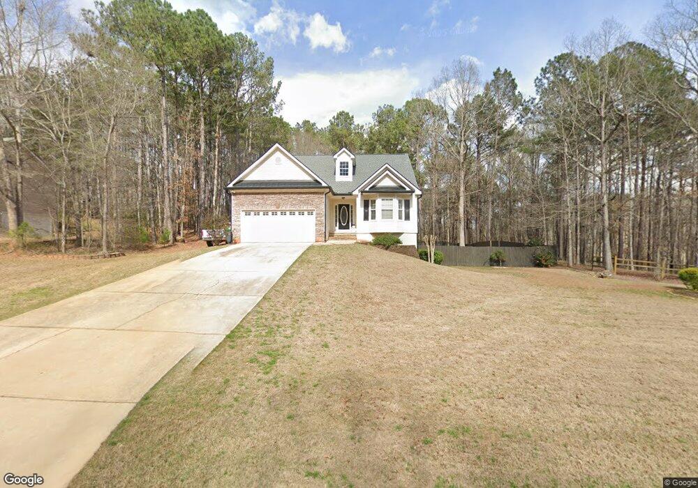
82 Kimbell Farm Dr Unit 5 Locust Grove, GA 30248
Estimated Value: $299,000 - $323,000
3
Beds
2
Baths
1,570
Sq Ft
$198/Sq Ft
Est. Value
About This Home
This home is located at 82 Kimbell Farm Dr Unit 5, Locust Grove, GA 30248 and is currently estimated at $310,131, approximately $197 per square foot. 82 Kimbell Farm Dr Unit 5 is a home located in Henry County with nearby schools including Unity Grove Elementary School, Locust Grove Middle School, and Locust Grove High School.
Ownership History
Date
Name
Owned For
Owner Type
Purchase Details
Closed on
Aug 5, 2016
Sold by
Mothershed Nathaniel R and Mothershed Kelly M
Bought by
Brock Douglas Shane and Brock Kimberly Gaynell
Current Estimated Value
Home Financials for this Owner
Home Financials are based on the most recent Mortgage that was taken out on this home.
Original Mortgage
$157,102
Outstanding Balance
$126,098
Interest Rate
3.75%
Mortgage Type
FHA
Estimated Equity
$184,033
Purchase Details
Closed on
Aug 1, 2005
Sold by
Easler Construction Co Llc
Bought by
Mothershed Nathaniel R and Lowenthal Kelly M
Home Financials for this Owner
Home Financials are based on the most recent Mortgage that was taken out on this home.
Original Mortgage
$127,900
Interest Rate
5.48%
Mortgage Type
New Conventional
Create a Home Valuation Report for This Property
The Home Valuation Report is an in-depth analysis detailing your home's value as well as a comparison with similar homes in the area
Home Values in the Area
Average Home Value in this Area
Purchase History
| Date | Buyer | Sale Price | Title Company |
|---|---|---|---|
| Brock Douglas Shane | $160,000 | -- | |
| Mothershed Nathaniel R | $159,900 | -- |
Source: Public Records
Mortgage History
| Date | Status | Borrower | Loan Amount |
|---|---|---|---|
| Open | Brock Douglas Shane | $157,102 | |
| Previous Owner | Mothershed Nathaniel R | $127,900 |
Source: Public Records
Tax History Compared to Growth
Tax History
| Year | Tax Paid | Tax Assessment Tax Assessment Total Assessment is a certain percentage of the fair market value that is determined by local assessors to be the total taxable value of land and additions on the property. | Land | Improvement |
|---|---|---|---|---|
| 2025 | $3,434 | $120,220 | $16,000 | $104,220 |
| 2024 | $3,434 | $138,480 | $16,000 | $122,480 |
| 2023 | $2,905 | $115,240 | $14,800 | $100,440 |
| 2022 | $3,208 | $106,760 | $14,800 | $91,960 |
| 2021 | $2,726 | $86,480 | $14,800 | $71,680 |
| 2020 | $2,590 | $80,720 | $12,000 | $68,720 |
| 2019 | $2,414 | $73,360 | $12,000 | $61,360 |
| 2018 | $2,356 | $70,880 | $10,800 | $60,080 |
| 2016 | $2,394 | $61,360 | $10,000 | $51,360 |
| 2015 | $2,172 | $53,920 | $10,000 | $43,920 |
| 2014 | $2,115 | $51,840 | $10,000 | $41,840 |
Source: Public Records
Map
Nearby Homes
- 604 Onieda Dr
- 601 Amerigo Ct
- 521 Deadwood Trail
- 218 Baxter Ln
- 305 Annie Ln Unit 2
- 705 Seabolt Rd
- 165 Caraway Rd
- 1000 Coan Dr
- 678 Seabolt Rd
- 143 Kimbell Farm Dr
- 1850 Old Jackson Rd
- 108 Caraway Rd
- 230 Leguin Mill Rd
- 1627 Leguin Mill Rd
- 1680 Leguin Mill Rd
- 100 Harbin Trail
- 1126 Old Jackson Rd
- 121, 125, 129 Case Dr
- 560 Coan Dr
- 943 Colvin Dr
- 84 Kimbell Farm Dr Unit 5
- 570 Miles Ct
- 601 Onieda Dr
- 560 Miles Ct
- 88 Kimbell Farm Dr
- 80 Kimbell Farm Dr
- 530 Miles Ct
- 510 Miles Ct
- 709 Emertrey Dr
- 90 Kimbell Farm Dr
- 565 Miles Ct Unit 555
- 565 Miles Ct
- 600 Onieda Dr
- 600 Onieda Dr Unit 5
- 85 Kimbell Farm Dr
- 711 Emertrey Dr
- 711 Emertrey Dr Unit 538
- 81 Kimbell Farm Dr Unit 514
- 81 Kimbell Farm Dr
- 81 Kimbell Farm Dr