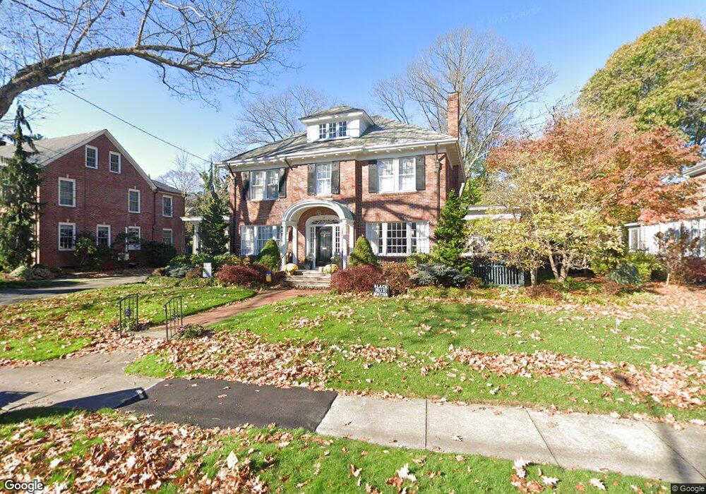
82 Laurel Ave Providence, RI 02906
Blackstone NeighborhoodEstimated Value: $1,172,000 - $1,490,000
4
Beds
3
Baths
3,376
Sq Ft
$410/Sq Ft
Est. Value
About This Home
This home is located at 82 Laurel Ave, Providence, RI 02906 and is currently estimated at $1,383,218, approximately $409 per square foot. 82 Laurel Ave is a home located in Providence County with nearby schools including Montessori Childrens House, Moses Brown School, and The Croft School - Providence.
Ownership History
Date
Name
Owned For
Owner Type
Purchase Details
Closed on
Jan 20, 2017
Sold by
Lieberman Paul B
Bought by
Bailey Lieberman Ft
Current Estimated Value
Purchase Details
Closed on
Jul 29, 1991
Sold by
Paradis Maurice C
Bought by
Dunstan Christopher D
Create a Home Valuation Report for This Property
The Home Valuation Report is an in-depth analysis detailing your home's value as well as a comparison with similar homes in the area
Home Values in the Area
Average Home Value in this Area
Purchase History
| Date | Buyer | Sale Price | Title Company |
|---|---|---|---|
| Bailey Lieberman Ft | -- | -- | |
| Dunstan Christopher D | $346,000 | -- |
Source: Public Records
Mortgage History
| Date | Status | Borrower | Loan Amount |
|---|---|---|---|
| Previous Owner | Dunstan Christopher D | $478,000 | |
| Previous Owner | Dunstan Christopher D | $80,000 | |
| Previous Owner | Dunstan Christopher D | $400,000 | |
| Previous Owner | Dunstan Christopher D | $203,000 |
Source: Public Records
Tax History
| Year | Tax Paid | Tax Assessment Tax Assessment Total Assessment is a certain percentage of the fair market value that is determined by local assessors to be the total taxable value of land and additions on the property. | Land | Improvement |
|---|---|---|---|---|
| 2025 | $10,260 | $1,221,400 | $576,500 | $644,900 |
| 2024 | $18,407 | $1,003,100 | $385,000 | $618,100 |
| 2023 | $18,407 | $1,003,100 | $385,000 | $618,100 |
| 2022 | $17,855 | $1,003,100 | $385,000 | $618,100 |
| 2021 | $19,292 | $785,500 | $324,500 | $461,000 |
| 2020 | $19,292 | $785,500 | $324,500 | $461,000 |
| 2019 | $19,292 | $785,500 | $324,500 | $461,000 |
| 2018 | $24,133 | $755,100 | $294,900 | $460,200 |
| 2017 | $24,133 | $755,100 | $294,900 | $460,200 |
| 2016 | $24,133 | $755,100 | $294,900 | $460,200 |
| 2015 | $22,478 | $679,100 | $284,500 | $394,600 |
| 2014 | $22,920 | $679,100 | $284,500 | $394,600 |
| 2013 | $22,920 | $679,100 | $284,500 | $394,600 |
Source: Public Records
Map
Nearby Homes
- 22 Miles Ave Unit 8
- 189 Laurel Ave Unit 189
- 269 Doyle Ave
- 125 Taber Ave
- 90 University Ave
- 12 University Ave
- 181 Cole Ave Unit 2
- 41 Stadium Rd
- 219 Cole Ave
- 233 Cole Ave
- 134 Irving Ave
- 127 Irving Ave Unit 5
- 156 Blackstone Blvd
- 296 Cole Ave
- 15 Humboldt Ave
- 218 Howell St Unit 2
- 236 Pleasant St
- 20 Taber Ave
- 71 Savoy St
- 94 Larch St
Your Personal Tour Guide
Ask me questions while you tour the home.