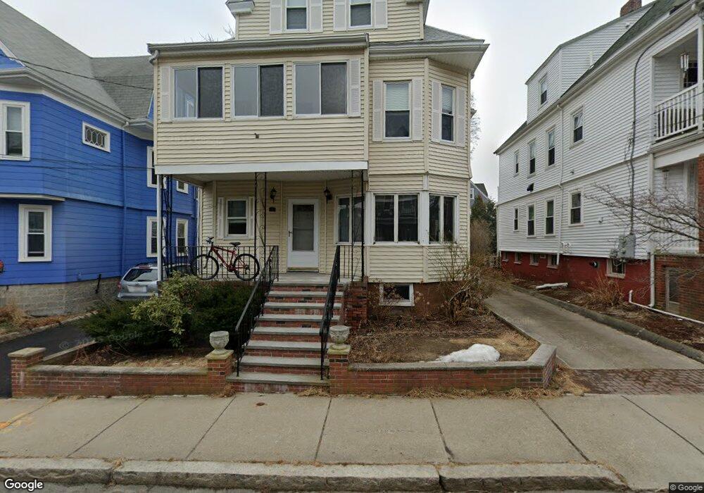
82 Lowden Ave Unit 2 Somerville, MA 02144
Davis Square NeighborhoodEstimated Value: $940,000 - $1,356,000
4
Beds
2
Baths
1,800
Sq Ft
$628/Sq Ft
Est. Value
About This Home
This home is located at 82 Lowden Ave Unit 2, Somerville, MA 02144 and is currently estimated at $1,130,657, approximately $628 per square foot. 82 Lowden Ave Unit 2 is a home located in Middlesex County with nearby schools including Somerville High School, St. Clement Elementary School, and Wild Rose Montessori School.
Ownership History
Date
Name
Owned For
Owner Type
Purchase Details
Closed on
Dec 1, 2004
Sold by
Grealish John J and Grealish Marilyn J
Bought by
Luongo-Fix Alicia and Fix Michael
Current Estimated Value
Home Financials for this Owner
Home Financials are based on the most recent Mortgage that was taken out on this home.
Original Mortgage
$333,700
Outstanding Balance
$166,672
Interest Rate
5.69%
Mortgage Type
Purchase Money Mortgage
Estimated Equity
$963,985
Create a Home Valuation Report for This Property
The Home Valuation Report is an in-depth analysis detailing your home's value as well as a comparison with similar homes in the area
Home Values in the Area
Average Home Value in this Area
Purchase History
| Date | Buyer | Sale Price | Title Company |
|---|---|---|---|
| Luongo-Fix Alicia | $420,000 | -- |
Source: Public Records
Mortgage History
| Date | Status | Borrower | Loan Amount |
|---|---|---|---|
| Open | Luongo-Fix Alicia | $333,700 |
Source: Public Records
Tax History Compared to Growth
Tax History
| Year | Tax Paid | Tax Assessment Tax Assessment Total Assessment is a certain percentage of the fair market value that is determined by local assessors to be the total taxable value of land and additions on the property. | Land | Improvement |
|---|---|---|---|---|
| 2025 | $9,923 | $909,500 | $0 | $909,500 |
| 2024 | $9,376 | $891,300 | $0 | $891,300 |
| 2023 | $9,096 | $879,700 | $0 | $879,700 |
| 2022 | $8,619 | $846,700 | $0 | $846,700 |
| 2021 | $8,442 | $828,500 | $0 | $828,500 |
| 2020 | $8,093 | $802,100 | $0 | $802,100 |
| 2019 | $8,364 | $777,300 | $0 | $777,300 |
| 2018 | $8,478 | $749,600 | $0 | $749,600 |
| 2017 | $8,611 | $737,900 | $0 | $737,900 |
| 2016 | $8,078 | $644,700 | $0 | $644,700 |
| 2015 | $7,041 | $558,400 | $0 | $558,400 |
Source: Public Records
Map
Nearby Homes
- 39 Rogers Ave
- 31 Rogers Ave
- 23 Highland Rd
- 26 Warner St
- 371 Highland Ave
- 27 Boston Ave
- 595 Broadway Unit 302
- 595 Broadway Unit 101
- 595 Broadway Unit 202
- 12 Windsor Rd Unit 1
- 353 Summer St Unit 310
- 13 Warwick St
- 3 Fairlee St
- 561 Broadway Unit C1
- 156 Albion St Unit B
- 10 Roberts St Unit 14
- 20 Electric Ave Unit 2
- 34 Day St
- 32 Richardson St
- 23 Ossipee Rd
- 82 Lowden Ave Unit 1
- 80 Lowden Ave
- 86 Lowden Ave
- 95 Kidder Ave
- 95 Kidder Ave Unit 1
- 95 Kidder Ave Unit 2
- 196 Willow Ave
- 93 Kidder Ave
- 93 Kidder Ave Unit 1
- 93 Kidder Ave Unit A
- 192 Willow Ave
- 192 Willow Ave Unit 1
- 11 Foskett St
- 11 Foskett St
- 11 Foskett St Unit 2
- 11 Foskett St Unit 1
- 200 Willow Ave
- 200 Willow Ave Unit 3
- 200 Willow Ave Unit 1
- 13 Foskett St