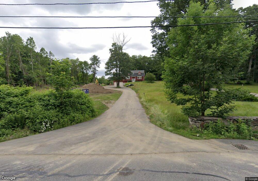
82 Mccracken Rd Millbury, MA 01527
Estimated Value: $693,814 - $806,000
3
Beds
3
Baths
2,800
Sq Ft
$269/Sq Ft
Est. Value
About This Home
This home is located at 82 Mccracken Rd, Millbury, MA 01527 and is currently estimated at $754,454, approximately $269 per square foot. 82 Mccracken Rd is a home located in Worcester County with nearby schools including Elmwood Street Elementary School, Raymond E. Shaw Elementary School, and Millbury Junior/Senior High School.
Ownership History
Date
Name
Owned For
Owner Type
Purchase Details
Closed on
Dec 8, 1995
Sold by
Zanadu Inc
Bought by
Decaro Michael G and Decaro Patricia
Current Estimated Value
Home Financials for this Owner
Home Financials are based on the most recent Mortgage that was taken out on this home.
Original Mortgage
$172,000
Interest Rate
7.44%
Mortgage Type
Purchase Money Mortgage
Create a Home Valuation Report for This Property
The Home Valuation Report is an in-depth analysis detailing your home's value as well as a comparison with similar homes in the area
Home Values in the Area
Average Home Value in this Area
Purchase History
| Date | Buyer | Sale Price | Title Company |
|---|---|---|---|
| Decaro Michael G | $195,000 | -- |
Source: Public Records
Mortgage History
| Date | Status | Borrower | Loan Amount |
|---|---|---|---|
| Open | Decaro Michael G | $190,000 | |
| Closed | Decaro Michael G | $67,800 | |
| Closed | Decaro Michael G | $187,500 | |
| Closed | Decaro Michael G | $172,000 |
Source: Public Records
Tax History Compared to Growth
Tax History
| Year | Tax Paid | Tax Assessment Tax Assessment Total Assessment is a certain percentage of the fair market value that is determined by local assessors to be the total taxable value of land and additions on the property. | Land | Improvement |
|---|---|---|---|---|
| 2025 | $8,457 | $631,600 | $137,900 | $493,700 |
| 2024 | $7,744 | $585,300 | $127,800 | $457,500 |
| 2023 | $7,112 | $492,200 | $90,000 | $402,200 |
| 2022 | $6,483 | $432,200 | $100,100 | $332,100 |
| 2021 | $5,113 | $414,600 | $100,100 | $314,500 |
| 2020 | $8,085 | $408,800 | $100,100 | $308,700 |
| 2019 | $6,237 | $393,500 | $99,600 | $293,900 |
| 2018 | $6,190 | $378,800 | $99,600 | $279,200 |
| 2017 | $5,709 | $347,500 | $99,600 | $247,900 |
| 2016 | $5,573 | $338,600 | $99,600 | $239,000 |
| 2015 | $5,410 | $328,700 | $101,100 | $227,600 |
| 2014 | $5,289 | $309,300 | $105,400 | $203,900 |
Source: Public Records
Map
Nearby Homes
- 557 SW Cutoff Unit 79
- 557 SW Cutoff Unit 107
- 557 SW Cutoff Unit 17
- 47 Washington St Unit 26
- 33 Tainter Hill Rd Unit 33B
- 14 Auburn Rd
- 24 Upper Windbrook
- 2 Breezy Bend
- 3 Lower Windbrook Dr
- 5- 33 Tainter Hill Rd Unit 33A
- 5- 33 Tainter Hill Rd
- 55 Old Common Rd
- 0 Auburn Rd
- 2 Camden Dr
- 2 Victoria Dr Unit 1
- 15 Clearview Terrace Unit 68
- 1295 Millbury St Unit B
- 90 Park Hill Ave
- 326 Pakachoag St
- 32 Horne Way
- 80 Mccracken Rd
- 88 Mccracken Rd
- 76 Mccracken Rd
- 92 Mccracken Rd
- 87 Mccracken Rd
- 91 Mccracken Rd
- 75 Mccracken Rd
- 100 Mccracken Rd
- 73 Mccracken Rd
- 73 Mccracken Rd
- 73 Mccracken Rd
- Lot 1 Mccracken Rd
- Lot 2 Mccracken Rd
- B Dwinell Rd
- A Dwinell Rd
- 0 Dwinell Rd
- 95 Mccracken Rd
- 104 Mccracken Rd
- 104 Mccracken Rd
- 104 Mccracken Rd