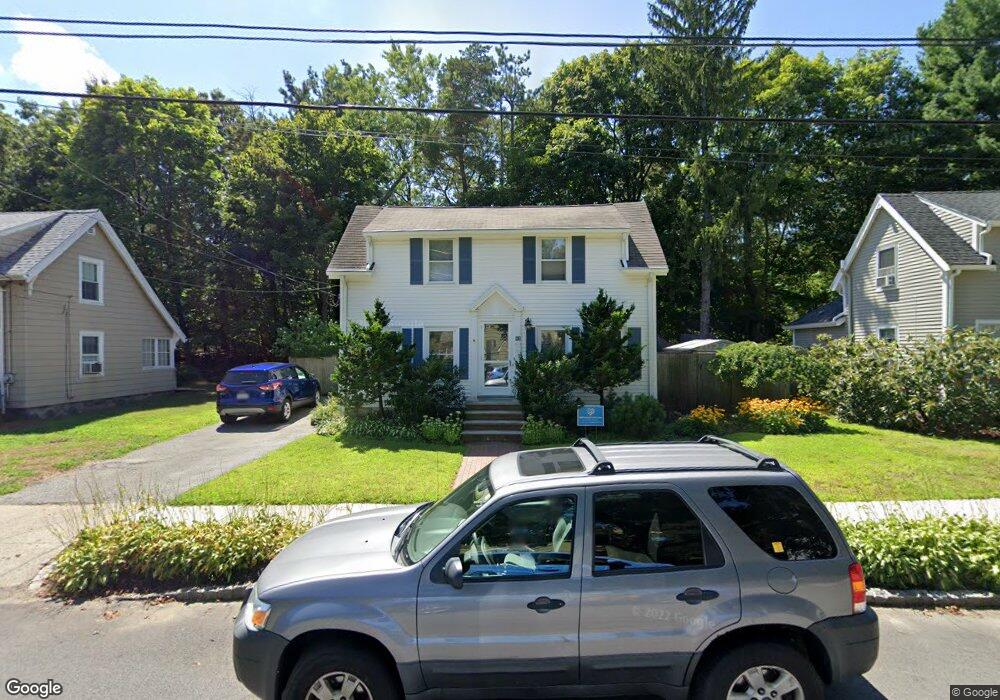
82 Middlesex St Winchester, MA 01890
North Main NeighborhoodEstimated Value: $970,000 - $1,302,000
3
Beds
2
Baths
1,508
Sq Ft
$712/Sq Ft
Est. Value
About This Home
This home is located at 82 Middlesex St, Winchester, MA 01890 and is currently estimated at $1,073,025, approximately $711 per square foot. 82 Middlesex St is a home located in Middlesex County with nearby schools including Lynch Elementary School, McCall Middle School, and Winchester High School.
Ownership History
Date
Name
Owned For
Owner Type
Purchase Details
Closed on
Jun 24, 2024
Sold by
Sharma Suvas
Bought by
Deluca Devin A
Current Estimated Value
Home Financials for this Owner
Home Financials are based on the most recent Mortgage that was taken out on this home.
Original Mortgage
$301,000
Outstanding Balance
$296,011
Interest Rate
6.95%
Mortgage Type
New Conventional
Estimated Equity
$777,014
Purchase Details
Closed on
Nov 20, 2023
Sold by
35 Ayer Street Llc
Bought by
Loiselle Melissa A
Home Financials for this Owner
Home Financials are based on the most recent Mortgage that was taken out on this home.
Original Mortgage
$218,500
Interest Rate
7.49%
Mortgage Type
Purchase Money Mortgage
Purchase Details
Closed on
Nov 15, 2022
Sold by
Drown Scott A and Fried Melanie
Bought by
Fried Drown Lt and Drown
Purchase Details
Closed on
May 19, 2021
Sold by
Fried Drown Lt and Drown
Bought by
Drown Scott A and Fried Melanie
Home Financials for this Owner
Home Financials are based on the most recent Mortgage that was taken out on this home.
Original Mortgage
$199,000
Interest Rate
2.9%
Mortgage Type
New Conventional
Purchase Details
Closed on
Sep 8, 2016
Sold by
Drown Scott A and Fried Melanie S
Bought by
Fried-Drown Lt and Drown
Purchase Details
Closed on
May 31, 2001
Sold by
Donovan Margaret A
Bought by
Fried Melanie S and Fried Scott A
Purchase Details
Closed on
Dec 4, 1995
Sold by
Middlesex St Rt and Leahy Tr
Bought by
Donovan Margaret A
Create a Home Valuation Report for This Property
The Home Valuation Report is an in-depth analysis detailing your home's value as well as a comparison with similar homes in the area
Home Values in the Area
Average Home Value in this Area
Purchase History
| Date | Buyer | Sale Price | Title Company |
|---|---|---|---|
| Deluca Devin A | $331,000 | None Available | |
| Deluca Devin A | $331,000 | None Available | |
| Loiselle Melissa A | $425,000 | None Available | |
| Loiselle Melissa A | $425,000 | None Available | |
| Fried Drown Lt | -- | None Available | |
| Fried Drown Lt | -- | None Available | |
| Fried Drown Lt | -- | None Available | |
| Drown Scott A | -- | None Available | |
| Drown Scott A | -- | None Available | |
| Drown Scott A | -- | None Available | |
| Fried-Drown Lt | -- | -- | |
| Fried-Drown Lt | -- | -- | |
| Donovan Margaret A | $118,500 | -- | |
| Fried-Drown Lt | -- | -- | |
| Fried Melanie S | $449,900 | -- | |
| Donovan Margaret A | $118,500 | -- |
Source: Public Records
Mortgage History
| Date | Status | Borrower | Loan Amount |
|---|---|---|---|
| Open | Deluca Devin A | $301,000 | |
| Closed | Deluca Devin A | $301,000 | |
| Previous Owner | Loiselle Melissa A | $218,500 | |
| Previous Owner | Drown Scott A | $199,000 | |
| Previous Owner | Donovan Margaret A | $281,500 |
Source: Public Records
Tax History
| Year | Tax Paid | Tax Assessment Tax Assessment Total Assessment is a certain percentage of the fair market value that is determined by local assessors to be the total taxable value of land and additions on the property. | Land | Improvement |
|---|---|---|---|---|
| 2025 | $98 | $879,900 | $543,600 | $336,300 |
| 2024 | $9,451 | $834,200 | $515,000 | $319,200 |
| 2023 | $9,238 | $782,900 | $472,100 | $310,800 |
| 2022 | $9,151 | $731,500 | $429,200 | $302,300 |
| 2021 | $8,559 | $667,100 | $364,800 | $302,300 |
| 2020 | $8,265 | $667,100 | $364,800 | $302,300 |
| 2019 | $7,213 | $595,600 | $293,300 | $302,300 |
| 2018 | $7,086 | $581,300 | $279,000 | $302,300 |
| 2017 | $6,648 | $541,400 | $264,700 | $276,700 |
| 2016 | $6,107 | $522,900 | $264,700 | $258,200 |
| 2015 | $6,043 | $497,800 | $239,600 | $258,200 |
| 2014 | $5,703 | $450,500 | $207,400 | $243,100 |
Source: Public Records
Map
Nearby Homes
- 62 Richardson St
- 53 Lake St
- 149 Horn Pond Brook Rd
- 200 Swanton St Unit 228
- 200 Swanton St Unit T28
- 237 Swanton St
- 20 Arthur St
- 8 Russell Rd Unit 10
- 6 Ivy Cir
- 76 Woodside Rd
- 666 Main St Unit 315
- 40 Pickering St
- 38 Pickering St Unit A
- 15 Wildwood St
- 171 Swanton St Unit 73
- 10 Dartmouth St
- 2 Maria Ct
- 4 Dartmouth St
- 9 Charles Rd
- 20 Charles Rd
- 86 Middlesex St
- 78 Middlesex St
- 74 Middlesex St
- 90 - 94 Middlesex
- 81 Middlesex St
- 87 Middlesex St
- 90 Middlesex St Unit 90
- 90 Middlesex St Unit 1
- 90 Middlesex St Unit 94
- 90 Middlesex St
- 92 Middlesex St
- 92 Middlesex St
- 92 Middlesex St Unit 92
- 92 Middlesex St Unit 1
- 77 Middlesex St
- 70 Middlesex St
- 75 Middlesex St
- 66 Middlesex St
- 98 Middlesex St
- 91 Middlesex St
Your Personal Tour Guide
Ask me questions while you tour the home.