--
Bed
--
Bath
2,400
Sq Ft
0.67
Acres
About This Home
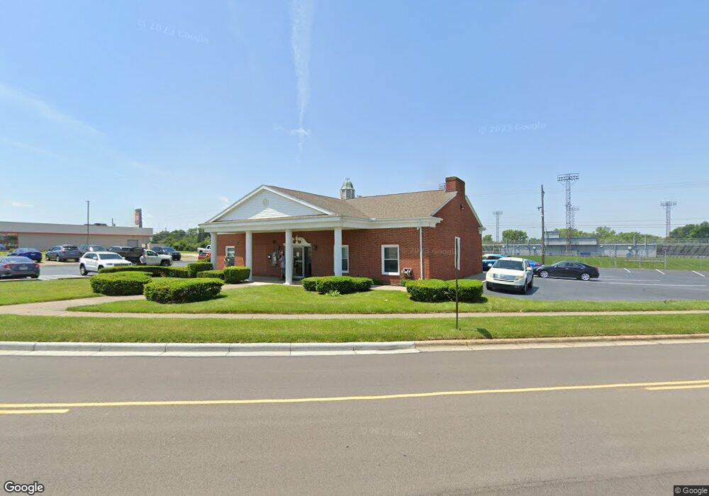
This home is located at 82 N Allison Ave, Xenia, OH 45385. 82 N Allison Ave is a home located in Greene County with nearby schools including Xenia High School, Summit Academy Community School for Alternative Learners - Xenia, and Legacy Christian Academy.
Ownership History
Date
Name
Owned For
Owner Type
Purchase Details
Closed on
Sep 30, 2019
Sold by
Security National Bank
Bought by
Capital Commercial Equities Llc
Home Financials for this Owner
Home Financials are based on the most recent Mortgage that was taken out on this home.
Original Mortgage
$127,500
Outstanding Balance
$111,924
Interest Rate
3.6%
Mortgage Type
Future Advance Clause Open End Mortgage
Purchase Details
Closed on
Jan 1, 2005
Sold by
Pavlatos Thales N and Pavlatos Nancy
Bought by
Xenia Plaza Llc
Purchase Details
Closed on
Mar 21, 2001
Sold by
Davis J S Company
Bought by
Security National Bank & Trust Company
Create a Home Valuation Report for This Property
The Home Valuation Report is an in-depth analysis detailing your home's value as well as a comparison with similar homes in the area
Home Values in the Area
Average Home Value in this Area
Purchase History
| Date | Buyer | Sale Price | Title Company |
|---|---|---|---|
| Capital Commercial Equities Llc | $170,000 | None Available | |
| Xenia Plaza Llc | -- | -- | |
| Security National Bank & Trust Company | $400,000 | -- |
Source: Public Records
Mortgage History
| Date | Status | Borrower | Loan Amount |
|---|---|---|---|
| Open | Capital Commercial Equities Llc | $127,500 |
Source: Public Records
Tax History Compared to Growth
Tax History
| Year | Tax Paid | Tax Assessment Tax Assessment Total Assessment is a certain percentage of the fair market value that is determined by local assessors to be the total taxable value of land and additions on the property. | Land | Improvement |
|---|---|---|---|---|
| 2024 | $3,585 | $70,760 | $30,960 | $39,800 |
| 2023 | $3,585 | $70,760 | $30,960 | $39,800 |
| 2022 | $3,541 | $59,500 | $36,130 | $23,370 |
| 2021 | $3,596 | $59,500 | $36,130 | $23,370 |
| 2020 | $3,463 | $59,500 | $36,130 | $23,370 |
| 2019 | $9,074 | $149,950 | $36,130 | $113,820 |
| 2018 | $9,153 | $149,950 | $36,130 | $113,820 |
| 2017 | $9,334 | $149,950 | $36,130 | $113,820 |
| 2016 | $9,334 | $151,620 | $36,130 | $115,490 |
| 2015 | $9,364 | $151,620 | $36,130 | $115,490 |
| 2014 | $9,045 | $151,620 | $36,130 | $115,490 |
Source: Public Records
Map
Nearby Homes
- 131 N Allison Ave
- 101 N Allison Ave
- 755 Vine St
- 722 Vine St
- 141 Little Vine St
- 716 Vine St
- 723 Vine St
- 696 Vine St
- 26 S Allison Ave
- 96 Hillcrest Ave
- 114 Hillcrest Ave
- 717 Vine St
- 128 Hillcrest Ave
- 134 Hillcrest Ave
- 701 Vine St
- 276 Dayton Ave
- 693 Vine St
- 93 Hillcrest Ave
- 99 Hillcrest Ave
- 38 S Allison Ave