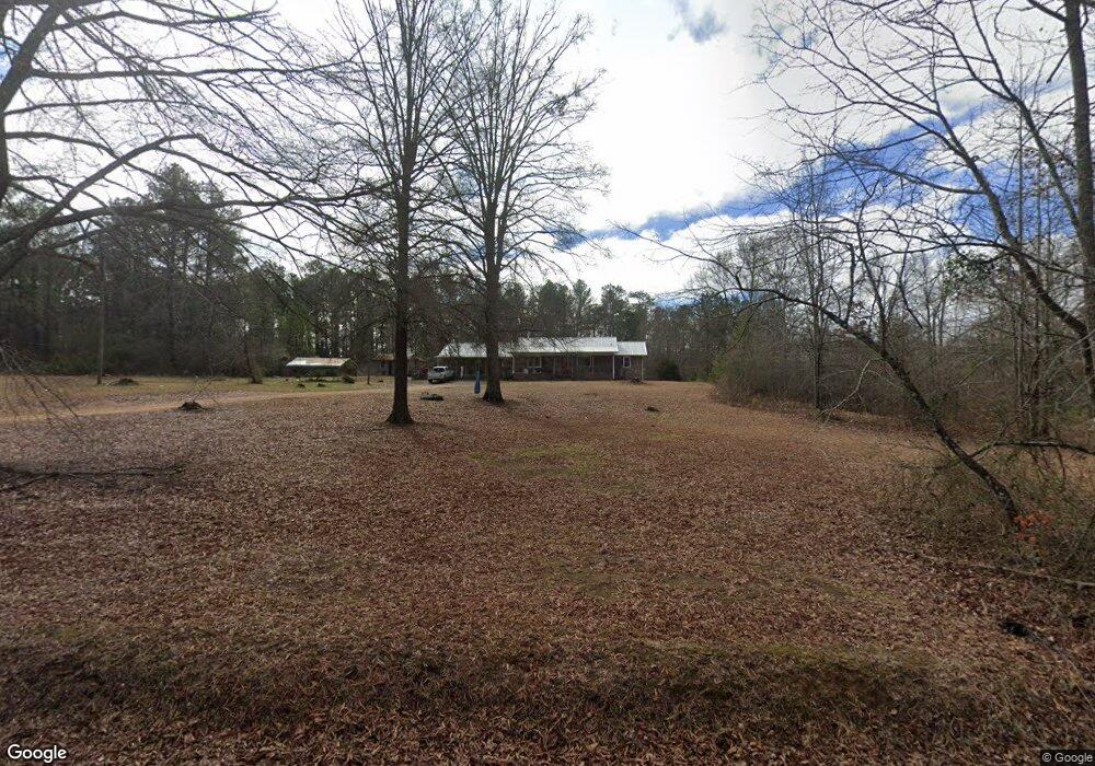
82 Pettit Rd Cedartown, GA 30125
Estimated Value: $220,000 - $244,000
2
Beds
3
Baths
1,098
Sq Ft
$214/Sq Ft
Est. Value
About This Home
This home is located at 82 Pettit Rd, Cedartown, GA 30125 and is currently estimated at $234,885, approximately $213 per square foot. 82 Pettit Rd is a home located in Polk County.
Ownership History
Date
Name
Owned For
Owner Type
Purchase Details
Closed on
May 25, 2016
Sold by
Thomas G
Bought by
Molidor Hattie R
Current Estimated Value
Purchase Details
Closed on
Feb 5, 1973
Sold by
Peek Buddy Dale
Bought by
Pettit Thomas G
Purchase Details
Closed on
Feb 4, 1972
Sold by
Landrum G W
Bought by
Peek Buddy Dale
Purchase Details
Closed on
Feb 1, 1962
Sold by
Reeves Ora O Mrs
Bought by
Landrum G W
Purchase Details
Closed on
Jul 31, 1956
Bought by
Reeves Ora O Mrs
Create a Home Valuation Report for This Property
The Home Valuation Report is an in-depth analysis detailing your home's value as well as a comparison with similar homes in the area
Home Values in the Area
Average Home Value in this Area
Purchase History
| Date | Buyer | Sale Price | Title Company |
|---|---|---|---|
| Molidor Hattie R | $24,000 | -- | |
| Pettit Thomas G | -- | -- | |
| Peek Buddy Dale | -- | -- | |
| Landrum G W | -- | -- | |
| Reeves Ora O Mrs | -- | -- |
Source: Public Records
Tax History Compared to Growth
Tax History
| Year | Tax Paid | Tax Assessment Tax Assessment Total Assessment is a certain percentage of the fair market value that is determined by local assessors to be the total taxable value of land and additions on the property. | Land | Improvement |
|---|---|---|---|---|
| 2024 | $2,298 | $109,936 | $11,050 | $98,886 |
| 2023 | $1,690 | $71,216 | $11,050 | $60,166 |
| 2022 | $1,373 | $57,843 | $7,367 | $50,476 |
| 2021 | $1,391 | $57,843 | $7,367 | $50,476 |
| 2020 | $1,393 | $57,843 | $7,367 | $50,476 |
| 2019 | $1,574 | $58,607 | $7,367 | $51,240 |
| 2018 | $1,564 | $56,777 | $7,367 | $49,410 |
| 2017 | $1,545 | $56,777 | $7,367 | $49,410 |
| 2016 | $2,777 | $102,051 | $18,095 | $83,956 |
| 2015 | $2,993 | $111,649 | $18,095 | $93,554 |
| 2014 | $3,015 | $111,649 | $18,095 | $93,554 |
Source: Public Records
Map
Nearby Homes
- 0 Culp Lake Rd Unit 25460774
- 0 Culp Lake Rd Unit 1025-H 10390344
- 0 Culp Lake Rd Unit 25460775
- 0 Culp Lake Rd Unit 1025-K 10390361
- 0 Culp Lake Rd Unit 1025-J 10390355
- 0 Culp Lake Rd Unit 1025-I 10390347
- 0 Culp Lake Rd (Tract 3)
- 0 Culp Lake Rd (Tract 2)
- 0 Akes Station Rd Unit 25208781
- 0 Akes Station Rd Unit 25208783
- 0 Akes Station Rd Unit 25208784
- 0 Akes Station Rd Unit 25208785
- 0 Akes Station Rd Unit 25208782
- 1810 Piedmont Hwy
- 1806 Piedmont Hwy
- 1719 Tallapoosa Hwy
- 1870 Tallapoosa Hwy
- 966 Judkin Mill Rd
- 0 Judkin Mill Rd Unit LotWP001 19369404
- 0 Brewster Field Rd Unit 10623054
- 134 Pettit Rd
- 136 Pettit Rd Unit 544
- 3415 Johnson Lake Rd
- 3417 Johnson Lake Rd
- 3259 Johnson Lake Rd
- 3298 Johnson Lake Rd
- 197 Pettit Rd
- 3367 Johnson Lake Rd
- 243 Bentley Rd
- 202 Pettit Rd
- 3405 Johnson Lake Rd
- 3416 Johnson Lake Rd
- 3266 Johnson Lake Rd
- 3549 Johnson Lake Rd
- 3426 Johnson Lake Rd
- 3442 Johnson Lake Rd
- 3452 Johnson Lake Rd
- 3462 Johnson Lake Rd
- 3507 Johnson Lake Rd
- 3472 Johnson Lake Rd