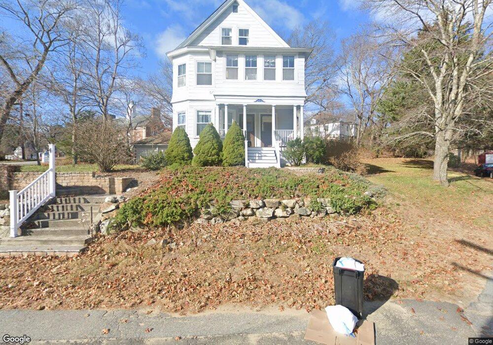
82 Poor St Unit 2 Andover, MA 01810
Shawsheen Heights NeighborhoodEstimated Value: $655,000 - $767,000
3
Beds
2
Baths
1,759
Sq Ft
$400/Sq Ft
Est. Value
About This Home
This home is located at 82 Poor St Unit 2, Andover, MA 01810 and is currently estimated at $703,963, approximately $400 per square foot. 82 Poor St Unit 2 is a home located in Essex County with nearby schools including West Elementary School, Andover West Middle School, and Andover High School.
Ownership History
Date
Name
Owned For
Owner Type
Purchase Details
Closed on
Jan 13, 2011
Sold by
Samii Sharokh and Samii Priscilla C
Bought by
Heise James R and Roderick Amy H
Current Estimated Value
Home Financials for this Owner
Home Financials are based on the most recent Mortgage that was taken out on this home.
Original Mortgage
$185,900
Outstanding Balance
$121,432
Interest Rate
4.46%
Mortgage Type
Purchase Money Mortgage
Estimated Equity
$582,531
Purchase Details
Closed on
Sep 14, 2007
Sold by
Engelberg Mark E
Bought by
Samii Shahrokh and Samii Priscilla C
Create a Home Valuation Report for This Property
The Home Valuation Report is an in-depth analysis detailing your home's value as well as a comparison with similar homes in the area
Home Values in the Area
Average Home Value in this Area
Purchase History
| Date | Buyer | Sale Price | Title Company |
|---|---|---|---|
| Heise James R | $285,900 | -- | |
| Samii Sharokh | -- | -- | |
| Samii Shahrokh | $350,000 | -- |
Source: Public Records
Mortgage History
| Date | Status | Borrower | Loan Amount |
|---|---|---|---|
| Open | Heise James R | $185,900 |
Source: Public Records
Tax History
| Year | Tax Paid | Tax Assessment Tax Assessment Total Assessment is a certain percentage of the fair market value that is determined by local assessors to be the total taxable value of land and additions on the property. | Land | Improvement |
|---|---|---|---|---|
| 2025 | $7,614 | $609,600 | $0 | $609,600 |
| 2024 | $6,919 | $537,200 | $0 | $537,200 |
| 2023 | $6,641 | $486,200 | $0 | $486,200 |
| 2022 | $6,573 | $450,200 | $0 | $450,200 |
| 2021 | $6,786 | $443,800 | $0 | $443,800 |
| 2020 | $6,186 | $412,100 | $0 | $412,100 |
| 2019 | $6,035 | $395,200 | $0 | $395,200 |
| 2018 | $5,746 | $367,400 | $0 | $367,400 |
| 2017 | $5,351 | $352,500 | $0 | $352,500 |
| 2016 | $5,128 | $346,000 | $0 | $346,000 |
| 2015 | $4,861 | $324,700 | $0 | $324,700 |
Source: Public Records
Map
Nearby Homes
- 361-363 N Main St
- 34 Martingale Ln Unit 34
- 42 York St
- 116 Weare St
- 42 Canterbury St
- 21 Clubview Dr Unit 21
- 70 Washington Park Dr Unit 6
- 40 Lincoln Cir E
- 20 Washington Park Dr Unit 12
- 5 Lafayette Ave
- 11 Swan Ln Unit 11
- 6 Danforth St
- 25 Clubview Dr Unit 25
- 16R High St
- 2 Cyr Cir
- 2 Dove Ln Unit 2
- 3 Caileigh Ct
- 4 Andover Country Club Ln
- 79 Cheever Cir
- 170 Haverhill St Unit 138
Your Personal Tour Guide
Ask me questions while you tour the home.