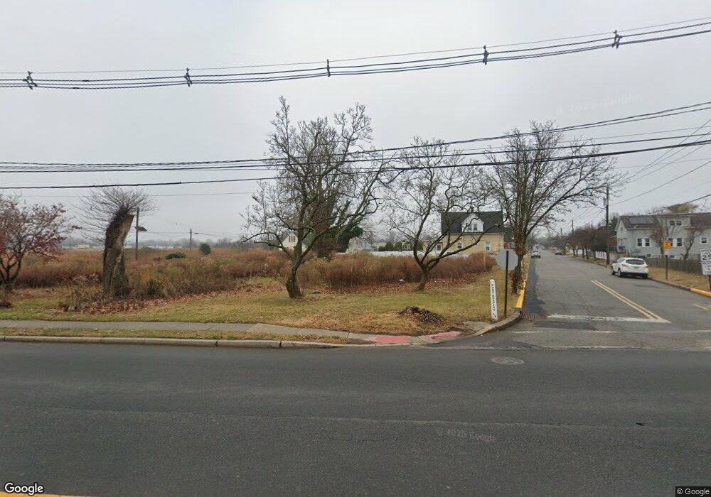
82 Port Reading Ave Woodbridge, NJ 07095
Estimated Value: $282,869
--
Bed
--
Bath
600
Sq Ft
$471/Sq Ft
Est. Value
About This Home
This home is located at 82 Port Reading Ave, Woodbridge, NJ 07095 and is currently estimated at $282,869, approximately $471 per square foot. 82 Port Reading Ave is a home located in Middlesex County with nearby schools including Ross Street Elementary School, Woodbridge Middle School, and Woodbridge High School.
Ownership History
Date
Name
Owned For
Owner Type
Purchase Details
Closed on
Jul 3, 2019
Sold by
Farooq Ahmed and Farooq Sohaila
Bought by
State Of New Jersey
Current Estimated Value
Purchase Details
Closed on
Oct 5, 2000
Sold by
Miller Tereence
Bought by
Farooq Ahmed Farooq and Farooq Sohalla
Home Financials for this Owner
Home Financials are based on the most recent Mortgage that was taken out on this home.
Original Mortgage
$133,750
Interest Rate
7.88%
Mortgage Type
FHA
Purchase Details
Closed on
Jan 28, 1994
Sold by
Barone Alan
Bought by
Miller Terrence
Home Financials for this Owner
Home Financials are based on the most recent Mortgage that was taken out on this home.
Original Mortgage
$116,000
Interest Rate
7.12%
Mortgage Type
VA
Create a Home Valuation Report for This Property
The Home Valuation Report is an in-depth analysis detailing your home's value as well as a comparison with similar homes in the area
Home Values in the Area
Average Home Value in this Area
Purchase History
| Date | Buyer | Sale Price | Title Company |
|---|---|---|---|
| State Of New Jersey | $216,268 | None Available | |
| Farooq Ahmed Farooq | $134,900 | -- | |
| Miller Terrence | $113,000 | -- |
Source: Public Records
Mortgage History
| Date | Status | Borrower | Loan Amount |
|---|---|---|---|
| Previous Owner | Farooq Ahmed Farooq | $133,750 | |
| Previous Owner | Miller Terrence | $116,000 |
Source: Public Records
Tax History Compared to Growth
Tax History
| Year | Tax Paid | Tax Assessment Tax Assessment Total Assessment is a certain percentage of the fair market value that is determined by local assessors to be the total taxable value of land and additions on the property. | Land | Improvement |
|---|---|---|---|---|
| 2025 | -- | $19,100 | $19,100 | -- |
| 2024 | -- | $19,100 | $19,100 | $0 |
| 2023 | -- | $19,100 | $19,100 | $0 |
| 2022 | $0 | $19,100 | $19,100 | $0 |
| 2021 | $4,954 | $19,100 | $19,100 | $0 |
| 2020 | $0 | $19,100 | $19,100 | $0 |
| 2019 | $4,954 | $44,000 | $19,100 | $24,900 |
| 2018 | $4,753 | $44,000 | $19,100 | $24,900 |
| 2017 | $4,854 | $44,000 | $19,100 | $24,900 |
| 2016 | $4,808 | $44,000 | $19,100 | $24,900 |
| 2015 | $4,713 | $44,000 | $19,100 | $24,900 |
| 2014 | $4,601 | $44,000 | $19,100 | $24,900 |
Source: Public Records
Map
Nearby Homes
- 660 Leone St
- 59 Trinity Ln
- 68 Port Reading Ave
- 682 Leone St
- 607 Almon Ave
- 608 Garden Ave
- 78 Schoder Ave
- 532 Bamford Ave
- 29 Claire Ave
- 9 Winston Dr
- 532 Olive Place
- 13 Melbourne Ct
- 104 Bucknell Ave
- 633 Harrell Ave
- 637 Harrell Ave
- 116 Harrell Ave
- 110 Church St
- 65 Green St
- 638 Linden Ave
- 7 Coke Ave Unit 56
- 640 Bamford Ave
- 88 Port Reading Ave
- 639 Watson Ave
- 639 Watson Ave Unit 2ND
- 501 Bamford Ave
- 74 Port Reading Ave
- 634 Bamford Ave
- 633 Bamford Ave
- 633 Watson Ave
- 630 Bamford Ave
- 500 Bamford Ave
- 627 Watson Ave
- 624 Bamford Ave
- 634 Almon Ave
- 619 Watson Ave
- 641 Lewis St
- 646 Lewis St
- 622 Bamford Ave
- 619 Bamford Ave
- 628 Almon Ave
