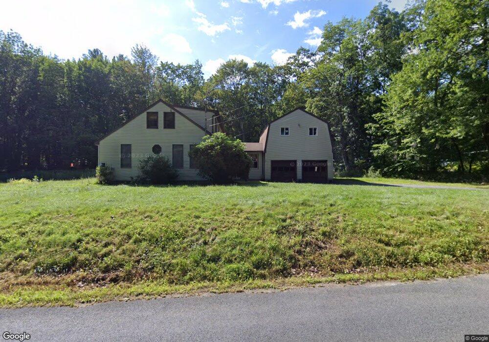
82 Ramshorn Rd Charlton, MA 01507
Estimated Value: $359,000 - $596,000
4
Beds
2
Baths
2,154
Sq Ft
$213/Sq Ft
Est. Value
About This Home
This home is located at 82 Ramshorn Rd, Charlton, MA 01507 and is currently estimated at $459,159, approximately $213 per square foot. 82 Ramshorn Rd is a home located in Worcester County with nearby schools including Shepherd Hill Regional High School.
Ownership History
Date
Name
Owned For
Owner Type
Purchase Details
Closed on
Sep 8, 2025
Sold by
Seifert Bonnie and Seifert Gary
Bought by
Kopacz Rachel and Seifert Timothy
Current Estimated Value
Home Financials for this Owner
Home Financials are based on the most recent Mortgage that was taken out on this home.
Original Mortgage
$305,000
Outstanding Balance
$304,472
Interest Rate
6.74%
Mortgage Type
New Conventional
Estimated Equity
$154,687
Purchase Details
Closed on
Jan 13, 2020
Sold by
Kuehl Cathleen
Bought by
Kuehl Cathleen and Pratt Ginger L
Purchase Details
Closed on
Feb 4, 1983
Bought by
Kuehl Cathleen
Create a Home Valuation Report for This Property
The Home Valuation Report is an in-depth analysis detailing your home's value as well as a comparison with similar homes in the area
Home Values in the Area
Average Home Value in this Area
Purchase History
| Date | Buyer | Sale Price | Title Company |
|---|---|---|---|
| Kopacz Rachel | $360,000 | -- | |
| Kopacz Rachel | $360,000 | -- | |
| Kuehl Cathleen | -- | None Available | |
| Kuehl Cathleen | -- | None Available | |
| Kuehl Cathleen | -- | -- |
Source: Public Records
Mortgage History
| Date | Status | Borrower | Loan Amount |
|---|---|---|---|
| Open | Kopacz Rachel | $305,000 | |
| Closed | Kopacz Rachel | $305,000 |
Source: Public Records
Tax History Compared to Growth
Tax History
| Year | Tax Paid | Tax Assessment Tax Assessment Total Assessment is a certain percentage of the fair market value that is determined by local assessors to be the total taxable value of land and additions on the property. | Land | Improvement |
|---|---|---|---|---|
| 2025 | $3,652 | $328,100 | $90,100 | $238,000 |
| 2024 | $3,576 | $315,300 | $90,100 | $225,200 |
| 2023 | $3,305 | $271,600 | $87,100 | $184,500 |
| 2022 | $3,045 | $229,100 | $79,300 | $149,800 |
| 2021 | $3,092 | $206,000 | $75,100 | $130,900 |
| 2020 | $3,033 | $203,000 | $72,100 | $130,900 |
| 2019 | $2,998 | $203,000 | $72,100 | $130,900 |
| 2018 | $2,741 | $203,000 | $72,100 | $130,900 |
| 2017 | $2,418 | $171,500 | $66,100 | $105,400 |
| 2016 | $2,363 | $171,500 | $66,100 | $105,400 |
| 2015 | $2,302 | $171,500 | $66,100 | $105,400 |
| 2014 | $2,203 | $174,000 | $68,600 | $105,400 |
Source: Public Records
Map
Nearby Homes
- 65 Haggerty Rd
- 76 Number 6 Schoolhouse Rd
- 2 Lelandville Rd
- 3 Lelandville Rd
- 2 Potter Village Rd
- 58 Colburn Rd
- 0 Partridge Hill Rd
- 16 Sandersdale Rd
- 0 Freeman Rd Unit 73369281
- 60 Saundersdale Rd
- Lot 1A Sandersdale Rd
- Lot 3A Sandersdale Rd
- Lot 2A Sandersdale Rd
- 6 Blackwell Dr
- 0 Sandersdale Rd
- 0 Blood Rd
- 18 Mckinstry Dr
- Lot 1 Mason Road Extension
- 9 Piehl Dr
- 91 Burlingame Rd
- lot AA Ramshorn Rd
- lot 14 Ramshorn Rd
- 76 Ramshorn Rd
- 74 Ramshorn Rd
- 88 Ramshorn Rd
- 0 Lincoln Point Rd
- 7 Ramshorn Rd
- 93 Ramshorn Rd
- 72 Ramshorn Rd
- 64 Ramshorn Rd
- 61 Ramshorn Rd
- 61 Ramshorn Rd-Option 2
- 61 Ramshorn Rd L:7
- 70 Ramshorn Rd
- 98 Ramshorn Rd
- 97 Ramshorn Rd
- 14 Lincoln Point Rd
- 62 Ramshorn Rd
- 59A Ramshorn Rd
- 59 Ramshorn Rd