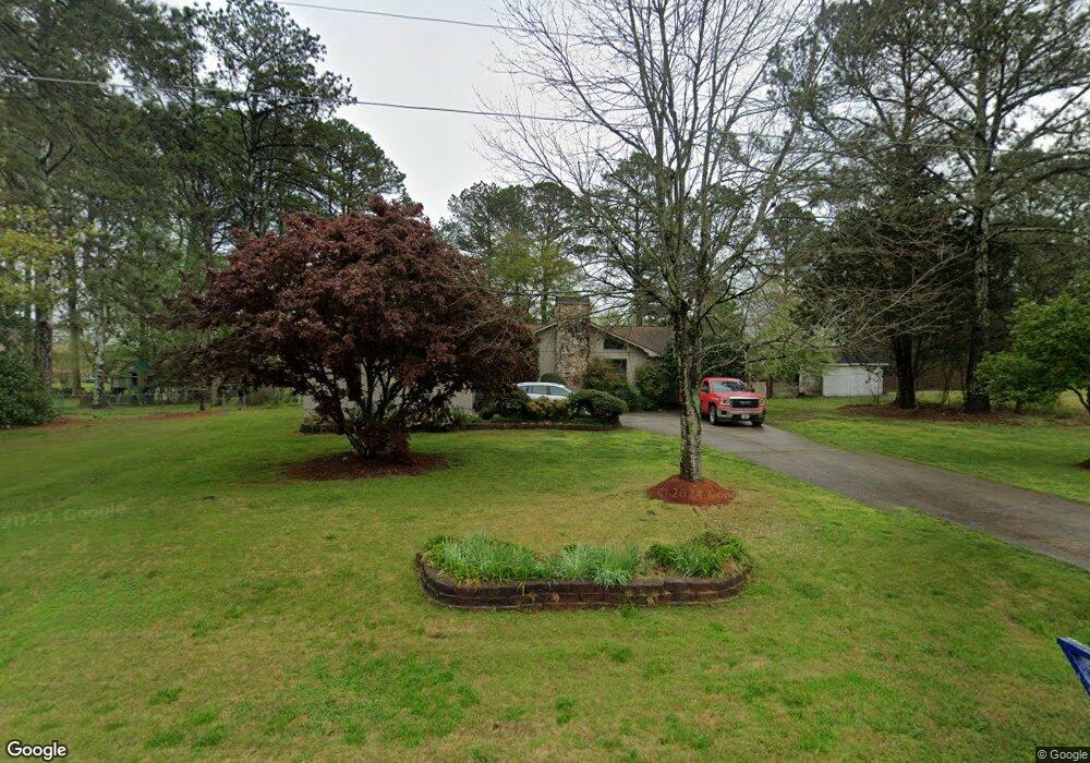
82 Sherwood Dr Cedartown, GA 30125
Estimated Value: $253,000 - $284,000
3
Beds
2
Baths
1,797
Sq Ft
$147/Sq Ft
Est. Value
About This Home
This home is located at 82 Sherwood Dr, Cedartown, GA 30125 and is currently estimated at $264,917, approximately $147 per square foot. 82 Sherwood Dr is a home located in Polk County with nearby schools including Vineyard Harvester Christian Academy and Cedar Christian School.
Ownership History
Date
Name
Owned For
Owner Type
Purchase Details
Closed on
Jul 31, 1993
Sold by
Williams David L
Bought by
Holbrooks Randy P
Current Estimated Value
Purchase Details
Closed on
Sep 1, 1983
Sold by
Housing & Urban Deve
Bought by
Williams David Lee
Purchase Details
Closed on
Jan 5, 1983
Sold by
1St Family Mort Corp
Bought by
Housing & Urban Deve
Purchase Details
Closed on
Jan 4, 1983
Sold by
Colbert Larry B
Bought by
1St Family Mort Corp
Purchase Details
Closed on
Sep 29, 1980
Sold by
Massie John S
Bought by
Colbert Larry B
Purchase Details
Closed on
Aug 29, 1978
Sold by
Grant William J
Bought by
Massie John S
Purchase Details
Closed on
May 1, 1977
Sold by
Benefield J H
Bought by
Grant William J
Purchase Details
Closed on
Nov 1, 1976
Sold by
Hackney H Olin
Bought by
Benefield J H
Purchase Details
Closed on
Apr 1, 1976
Bought by
Hackney H Olin
Create a Home Valuation Report for This Property
The Home Valuation Report is an in-depth analysis detailing your home's value as well as a comparison with similar homes in the area
Home Values in the Area
Average Home Value in this Area
Purchase History
| Date | Buyer | Sale Price | Title Company |
|---|---|---|---|
| Holbrooks Randy P | $63,900 | -- | |
| Williams David Lee | -- | -- | |
| Housing & Urban Deve | -- | -- | |
| 1St Family Mort Corp | -- | -- | |
| Colbert Larry B | -- | -- | |
| Massie John S | -- | -- | |
| Grant William J | -- | -- | |
| Benefield J H | -- | -- | |
| Hackney H Olin | -- | -- |
Source: Public Records
Tax History Compared to Growth
Tax History
| Year | Tax Paid | Tax Assessment Tax Assessment Total Assessment is a certain percentage of the fair market value that is determined by local assessors to be the total taxable value of land and additions on the property. | Land | Improvement |
|---|---|---|---|---|
| 2024 | $1,746 | $98,263 | $12,000 | $86,263 |
| 2023 | $1,260 | $66,495 | $12,000 | $54,495 |
| 2022 | $958 | $53,746 | $7,200 | $46,546 |
| 2021 | $970 | $53,746 | $7,200 | $46,546 |
| 2020 | $972 | $53,746 | $7,200 | $46,546 |
| 2019 | $724 | $40,306 | $4,280 | $36,026 |
| 2018 | $992 | $38,006 | $4,280 | $33,726 |
| 2017 | $980 | $38,006 | $4,280 | $33,726 |
| 2016 | $980 | $38,006 | $4,280 | $33,726 |
| 2015 | $983 | $38,006 | $4,280 | $33,726 |
| 2014 | $990 | $38,006 | $4,280 | $33,726 |
Source: Public Records
Map
Nearby Homes
- 727 Cherokee Rd
- 828 N College Dr
- 217 Cherokee Cir
- 232 Stephens Rd
- 00 Oak Crest Dr
- LOT 21 Cherokee Cir
- 621 N College Dr
- 600 Miller Rd
- 133 Virginia Cir
- 0 Rome Hwy Unit 10521649
- 64 Virginia Cir
- 88 Sequoyah Ct
- 0 Woodlawn Dr Unit 7638056
- 0 Woodlawn Dr Unit 10590789
- 113 Cherokee Estates Dr
- 0 Cave Spring Rd Unit 10631588
- 0 Cave Spring Rd Unit 7671027
- 220 Greenbriar Dr
- 208 Silverthorn Way
- 1200 N Cave Spring St
- 120 Sherwood Dr
- 42 Sherwood Dr
- 67 Robinson Rd
- 87 Sherwood Dr
- 79 Robinson Rd
- 55 Robinson Rd
- 103 Sherwood Dr
- 73 Sherwood Dr
- 91 Robinson Rd
- 110 Sherwood Dr
- 45 Robinson Rd
- 63 Sherwood Dr
- 115 Sherwood Dr
- 111 Robinson Rd
- 522 Cherokee Rd
- 532 Cherokee Rd
- 512 Cherokee Rd
- 127 Robinson Rd
- 128 Sherwood Dr
- 500 Cherokee Rd