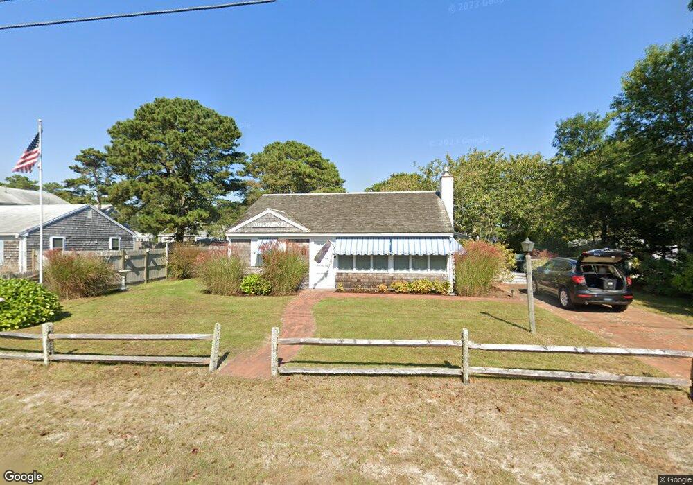
82 Shore Rd West Dennis, MA 02670
West Dennis NeighborhoodEstimated Value: $603,000 - $942,000
2
Beds
1
Bath
896
Sq Ft
$825/Sq Ft
Est. Value
About This Home
This home is located at 82 Shore Rd, West Dennis, MA 02670 and is currently estimated at $739,214, approximately $825 per square foot. 82 Shore Rd is a home located in Barnstable County with nearby schools including Dennis-Yarmouth Regional High School and St. Pius X. School.
Ownership History
Date
Name
Owned For
Owner Type
Purchase Details
Closed on
Aug 17, 2017
Sold by
Healy Michael R and Healy Penelope A
Bought by
Michael R Healy Irt and Balunas
Current Estimated Value
Purchase Details
Closed on
Jul 26, 2005
Sold by
Monti Lucia L
Bought by
Healy Michael R and Healy Penelope A
Home Financials for this Owner
Home Financials are based on the most recent Mortgage that was taken out on this home.
Original Mortgage
$380,000
Interest Rate
5.59%
Mortgage Type
Purchase Money Mortgage
Purchase Details
Closed on
May 24, 1991
Sold by
Jason Rt
Bought by
Suliman Douglas and Suliman Patricia
Create a Home Valuation Report for This Property
The Home Valuation Report is an in-depth analysis detailing your home's value as well as a comparison with similar homes in the area
Home Values in the Area
Average Home Value in this Area
Purchase History
| Date | Buyer | Sale Price | Title Company |
|---|---|---|---|
| Michael R Healy Irt | -- | -- | |
| Healy Michael R | $475,000 | -- | |
| Suliman Douglas | $340,000 | -- | |
| Michael R Healy Irt | -- | -- | |
| Healy Michael R | $475,000 | -- | |
| Suliman Douglas | $340,000 | -- |
Source: Public Records
Mortgage History
| Date | Status | Borrower | Loan Amount |
|---|---|---|---|
| Previous Owner | Healy Michael R | $380,000 | |
| Closed | Suliman Douglas | $0 |
Source: Public Records
Tax History Compared to Growth
Tax History
| Year | Tax Paid | Tax Assessment Tax Assessment Total Assessment is a certain percentage of the fair market value that is determined by local assessors to be the total taxable value of land and additions on the property. | Land | Improvement |
|---|---|---|---|---|
| 2025 | $3,040 | $702,100 | $390,000 | $312,100 |
| 2024 | $2,581 | $587,900 | $312,500 | $275,400 |
| 2023 | $2,497 | $534,600 | $284,100 | $250,500 |
| 2022 | $2,460 | $439,200 | $255,900 | $183,300 |
| 2021 | $2,419 | $401,100 | $250,900 | $150,200 |
| 2020 | $2,532 | $415,000 | $278,800 | $136,200 |
| 2019 | $2,432 | $394,100 | $273,300 | $120,800 |
| 2018 | $3,807 | $371,300 | $260,200 | $111,100 |
| 2017 | $2,101 | $341,600 | $234,200 | $107,400 |
| 2016 | $2,163 | $331,200 | $239,400 | $91,800 |
| 2015 | $2,120 | $331,200 | $239,400 | $91,800 |
| 2014 | $2,103 | $331,200 | $239,400 | $91,800 |
Source: Public Records
Map
Nearby Homes
- 2 Rita Mary Way
- 178 School St
- 14 Schoolhouse Ln
- 209 Main St Unit 3
- 209 Main St Unit 6
- 209 Main St Unit 1
- 209 Main St Unit 2
- 209 Main St Unit 4
- 209 Main St Unit 5
- 23 Doric Ave
- 401 Main St Unit 201
- 401 Main St Unit 101
- 467 Main St
- 308 Old Main St
- 6 Baker Way
- 45 Seth Ln
- 181 Pleasant St
- 61 Trotters Ln
- 40 Kelley Rd
- 29 Bass River Rd