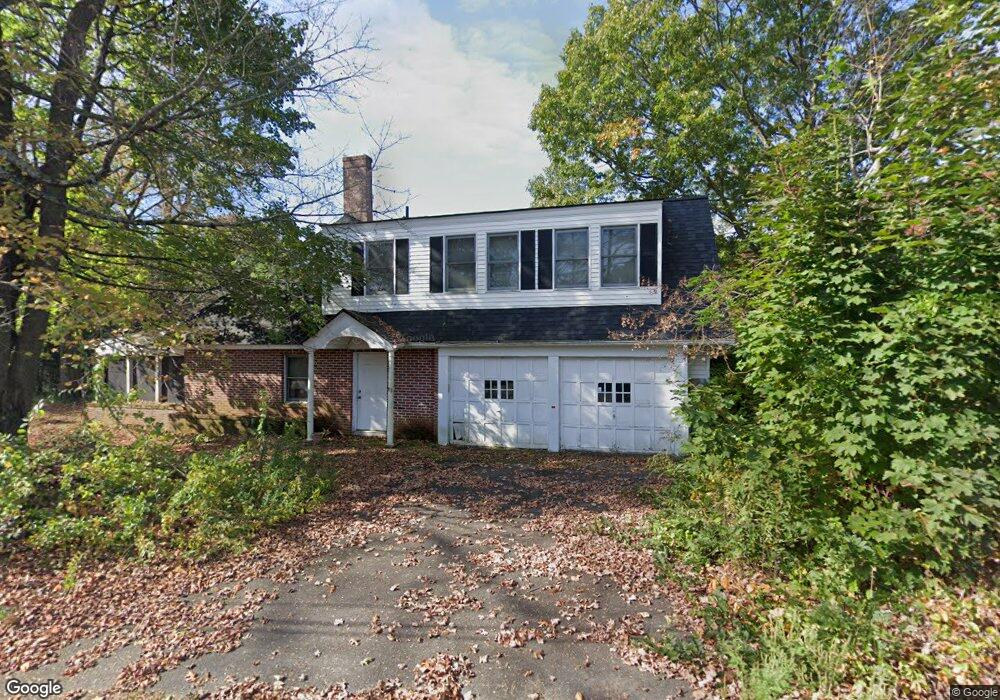
82 Southwest Rd Waterbury, CT 06708
West End District NeighborhoodEstimated Value: $508,104 - $972,000
5
Beds
3
Baths
4,921
Sq Ft
$137/Sq Ft
Est. Value
About This Home
This home is located at 82 Southwest Rd, Waterbury, CT 06708 and is currently estimated at $672,526, approximately $136 per square foot. 82 Southwest Rd is a home located in New Haven County with nearby schools including B.W. Tinker School, West Side Middle School, and John F. Kennedy High School.
Ownership History
Date
Name
Owned For
Owner Type
Purchase Details
Closed on
May 6, 1997
Sold by
Kotsaftis Constantine and Kotsaftis Gina
Bought by
Kaelke Michael and Kaelke Ludania
Current Estimated Value
Home Financials for this Owner
Home Financials are based on the most recent Mortgage that was taken out on this home.
Original Mortgage
$200,000
Interest Rate
7.85%
Mortgage Type
Purchase Money Mortgage
Create a Home Valuation Report for This Property
The Home Valuation Report is an in-depth analysis detailing your home's value as well as a comparison with similar homes in the area
Home Values in the Area
Average Home Value in this Area
Purchase History
| Date | Buyer | Sale Price | Title Company |
|---|---|---|---|
| Kaelke Michael | $222,500 | -- |
Source: Public Records
Mortgage History
| Date | Status | Borrower | Loan Amount |
|---|---|---|---|
| Closed | Kaelke Michael | $74,262 | |
| Closed | Kaelke Michael | $131,050 | |
| Closed | Kaelke Michael | $200,000 | |
| Previous Owner | Kaelke Michael | $135,000 |
Source: Public Records
Tax History Compared to Growth
Tax History
| Year | Tax Paid | Tax Assessment Tax Assessment Total Assessment is a certain percentage of the fair market value that is determined by local assessors to be the total taxable value of land and additions on the property. | Land | Improvement |
|---|---|---|---|---|
| 2025 | $12,308 | $273,630 | $98,700 | $174,930 |
| 2024 | $13,528 | $273,630 | $98,700 | $174,930 |
| 2023 | $14,828 | $273,630 | $98,700 | $174,930 |
| 2022 | $12,426 | $206,370 | $98,680 | $107,690 |
| 2021 | $12,426 | $206,370 | $98,680 | $107,690 |
| 2020 | $12,426 | $206,370 | $98,680 | $107,690 |
| 2019 | $12,426 | $206,370 | $98,680 | $107,690 |
| 2018 | $12,426 | $206,370 | $98,680 | $107,690 |
| 2017 | $12,604 | $209,340 | $98,680 | $110,660 |
| 2016 | $12,604 | $209,340 | $98,680 | $110,660 |
| 2015 | $12,188 | $209,340 | $98,680 | $110,660 |
| 2014 | $12,188 | $209,340 | $98,680 | $110,660 |
Source: Public Records
Map
Nearby Homes
- 141 Joshua Town Rd
- 116 Joshua Town Rd
- 1 Umberfield Rd
- 104 Eastfield Rd
- 197 Hickory Hill Dr
- 55 Eastfield Rd
- 77 Eastfield Rd
- 0 Mason Ave
- 120 Mason Ave
- 37 Mason Ave
- 110 Wooster Ave
- 0 Ferndale Ave
- 67 Barrington Ln
- 49 Southridge Dr
- 1 Richardson Dr
- 116 Yale Ave
- 62 Cheryl Dr
- 36 Ernest Ave
- 39 Taft Point
- 354 Bradley Ave
- 75 Southwest Rd
- 57 Southwest Rd
- 97 Southwest Rd
- 104 Southwest Rd
- 41 Southwest Rd
- 911 Country Club Rd
- 39 Southwind Rd
- 915 Country Club Rd
- 59 Southwind Rd
- 26 Southwind Rd
- 75 Southwind Rd
- 40 Southwind Rd
- 1 Joshua Town Rd
- 3 Joshua Town Rd
- Lot 21 Joshua Town Rd
- 7 Joshua Town Rd
- 9 Joshua Town Rd
- 11 Joshua Town Rd
- 126 Southwest Rd
- 50 Southwind Rd