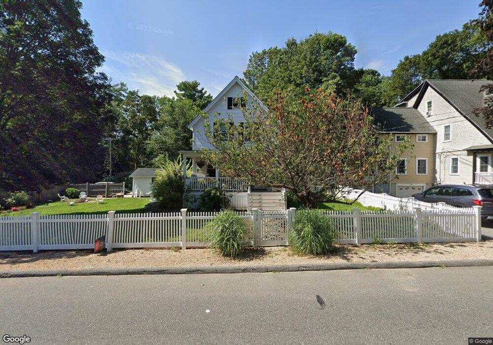
82 Spring St Wakefield, MA 01880
Greenwood NeighborhoodEstimated Value: $640,000 - $757,000
4
Beds
2
Baths
1,458
Sq Ft
$486/Sq Ft
Est. Value
About This Home
This home is located at 82 Spring St, Wakefield, MA 01880 and is currently estimated at $708,517, approximately $485 per square foot. 82 Spring St is a home located in Middlesex County with nearby schools including Wakefield Memorial High School, St. Patrick Elementary School, and Melrose Montessori School.
Ownership History
Date
Name
Owned For
Owner Type
Purchase Details
Closed on
Jul 21, 1997
Sold by
Taylor Viola C and Taylor Richard S
Bought by
Porter John J and Porter Erin T
Current Estimated Value
Home Financials for this Owner
Home Financials are based on the most recent Mortgage that was taken out on this home.
Original Mortgage
$127,500
Interest Rate
7.79%
Mortgage Type
Purchase Money Mortgage
Create a Home Valuation Report for This Property
The Home Valuation Report is an in-depth analysis detailing your home's value as well as a comparison with similar homes in the area
Home Values in the Area
Average Home Value in this Area
Purchase History
| Date | Buyer | Sale Price | Title Company |
|---|---|---|---|
| Porter John J | $170,000 | -- |
Source: Public Records
Mortgage History
| Date | Status | Borrower | Loan Amount |
|---|---|---|---|
| Open | Porter John J | $265,000 | |
| Closed | Porter John J | $136,000 | |
| Closed | Porter John J | $127,500 |
Source: Public Records
Tax History
| Year | Tax Paid | Tax Assessment Tax Assessment Total Assessment is a certain percentage of the fair market value that is determined by local assessors to be the total taxable value of land and additions on the property. | Land | Improvement |
|---|---|---|---|---|
| 2025 | $7,238 | $637,700 | $380,400 | $257,300 |
| 2024 | $6,965 | $619,100 | $369,200 | $249,900 |
| 2023 | $6,730 | $573,700 | $341,900 | $231,800 |
| 2022 | $6,432 | $522,100 | $310,800 | $211,300 |
| 2021 | $6,191 | $486,300 | $288,800 | $197,500 |
| 2020 | $82 | $466,100 | $276,800 | $189,300 |
| 2019 | $5,775 | $450,100 | $267,300 | $182,800 |
| 2018 | $5,466 | $422,100 | $250,600 | $171,500 |
| 2017 | $90 | $402,100 | $238,700 | $163,400 |
| 2016 | $5,138 | $380,900 | $220,600 | $160,300 |
| 2015 | $4,804 | $356,400 | $206,200 | $150,200 |
| 2014 | $4,415 | $345,500 | $199,800 | $145,700 |
Source: Public Records
Map
Nearby Homes
- 11 Ludlow Ave
- 12 Lovis Ave
- 33 Lake Ave
- 9 Lovis Ave
- 601 Franklin St Unit 2
- 159 Franklin St Unit D2
- 159 Franklin St Unit C2
- 159 Franklin St Unit E6
- 23 Ellsworth Ave
- 24 Ellsworth Ave
- 53 Perkins St
- 17 Franklin St
- 5 Chapel Way
- 34-36 W Highland Ave
- 51 Spring St
- 824 Main St Unit 1
- 35 Maple Rd
- 137 Franklin St Unit 102
- 43-51 Albion St Unit C9
- 60 Franklin St Unit 60
- 84 Spring St
- 86 Spring St
- 79 Spring St
- 78 Spring St
- 81 Spring St
- 81 Spring St Unit 1
- 88 Spring St
- 76 Spring St
- 1 Druid Hill Ave
- 95 Spring St
- 7 Druid Hill Ave
- 1 Washington Ave
- 75 Spring St
- 9 Druid Hill Ave
- 74 Spring St
- 5 Druid Hill Ave
- 5 Druid Hill Ave Unit 1
- 90 Spring St
- 3 Washington Ave
- 72 Spring St
Your Personal Tour Guide
Ask me questions while you tour the home.