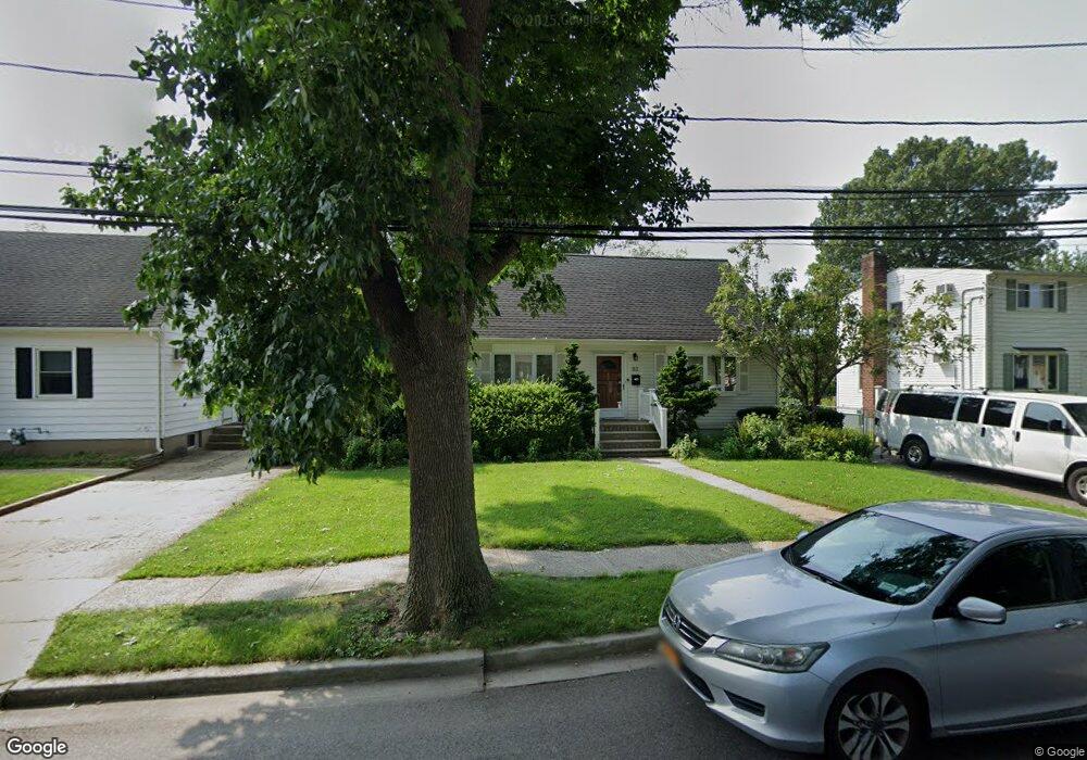
82 Sullivan Rd Farmingdale, NY 11735
Estimated Value: $603,000 - $739,990
5
Beds
2
Baths
1,502
Sq Ft
$447/Sq Ft
Est. Value
About This Home
This home is located at 82 Sullivan Rd, Farmingdale, NY 11735 and is currently estimated at $671,495, approximately $447 per square foot. 82 Sullivan Rd is a home located in Nassau County with nearby schools including Northside Elementary School, Weldon E. Howitt Middle School, and Farmingdale Senior High School.
Ownership History
Date
Name
Owned For
Owner Type
Purchase Details
Closed on
Nov 5, 2024
Sold by
Gannon Francis and Lwt Of Theresa Gannon
Bought by
Sylvester Anthony and See Yuen Yee
Current Estimated Value
Home Financials for this Owner
Home Financials are based on the most recent Mortgage that was taken out on this home.
Original Mortgage
$642,200
Outstanding Balance
$635,807
Interest Rate
6.12%
Mortgage Type
New Conventional
Estimated Equity
$35,688
Create a Home Valuation Report for This Property
The Home Valuation Report is an in-depth analysis detailing your home's value as well as a comparison with similar homes in the area
Home Values in the Area
Average Home Value in this Area
Purchase History
| Date | Buyer | Sale Price | Title Company |
|---|---|---|---|
| Sylvester Anthony | $676,000 | None Available | |
| Sylvester Anthony | $676,000 | None Available |
Source: Public Records
Mortgage History
| Date | Status | Borrower | Loan Amount |
|---|---|---|---|
| Open | Sylvester Anthony | $642,200 | |
| Closed | Sylvester Anthony | $642,200 |
Source: Public Records
Tax History Compared to Growth
Tax History
| Year | Tax Paid | Tax Assessment Tax Assessment Total Assessment is a certain percentage of the fair market value that is determined by local assessors to be the total taxable value of land and additions on the property. | Land | Improvement |
|---|---|---|---|---|
| 2025 | $8,958 | $461 | $234 | $227 |
| 2024 | $2,646 | $461 | $234 | $227 |
| 2023 | $8,467 | $461 | $234 | $227 |
| 2022 | $8,467 | $461 | $234 | $227 |
| 2021 | $8,442 | $445 | $226 | $219 |
| 2020 | $8,244 | $645 | $547 | $98 |
| 2019 | $7,825 | $645 | $547 | $98 |
| 2018 | $7,152 | $645 | $0 | $0 |
| 2017 | $4,118 | $645 | $426 | $219 |
| 2016 | $6,289 | $829 | $547 | $282 |
| 2015 | $2,293 | $829 | $547 | $282 |
| 2014 | $2,293 | $829 | $547 | $282 |
| 2013 | $2,126 | $829 | $547 | $282 |
Source: Public Records
Map
Nearby Homes
- 18 Ivy St Unit 1B
- 14 Ivy St Unit 2B
- 65 Sullivan Rd
- 19 Ivy St
- 76 Balcom Rd
- 29 Manetto Rd
- 18 Sullivan Rd
- 290 Eastern Pkwy
- 591 Conklin St
- 32 Beechwood St
- 25 Elizabeth St Unit 2E
- 159 Oakview Ave
- 129 Elizabeth St
- 82 Jervis Ave Unit 82
- 98 Jervis Ave Unit 98
- 114 Jervis Ave
- 530 Melville Rd
- 7 Dogwood St
- 5 Columbia St
- 457 Secatogue Ave
- 86 Sullivan Rd
- 78 Sullivan Rd
- 2 Ivy St
- 74 Sullivan Rd
- 10 Ivy St Unit B5
- 10 Ivy St
- 10 Ivy St Unit 4E
- 10 Ivy St Unit 2A
- 10 Ivy St Unit 5A
- 10 Ivy St Unit 3B
- 10 Ivy St Unit 6B
- 10 Ivy St Unit 8B
- 10 Ivy St Unit 7B
- 10 Ivy St Unit 7A
- 10 Ivy St Unit 10
- 10 Ivy St Unit 8A
- 10 Ivy St Unit 1B
- 77 Sullivan Rd
- 77 Sullivan Rd
- 69 Sullivan Rd