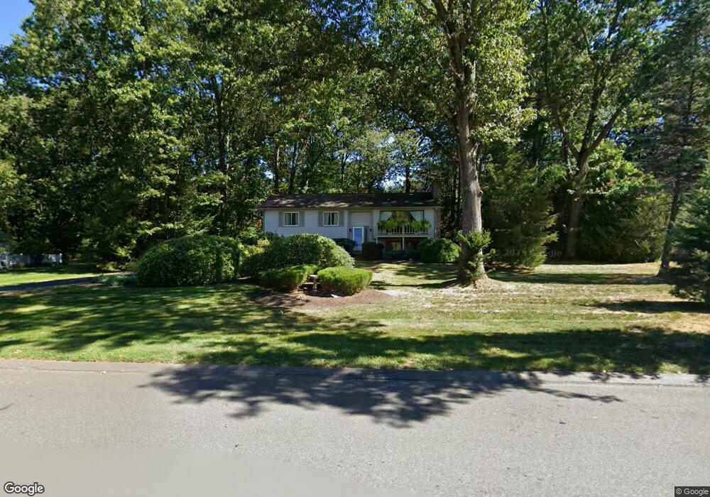
82 Sweetfern Dr West Springfield, MA 01089
Estimated Value: $387,000 - $421,000
3
Beds
2
Baths
1,216
Sq Ft
$333/Sq Ft
Est. Value
About This Home
This home is located at 82 Sweetfern Dr, West Springfield, MA 01089 and is currently estimated at $404,950, approximately $333 per square foot. 82 Sweetfern Dr is a home located in Hampden County with nearby schools including Holyoke Community Charter School, Hampden Charter School of Science West, and St Thomas The Apostle School.
Ownership History
Date
Name
Owned For
Owner Type
Purchase Details
Closed on
May 2, 2018
Sold by
Dziadzio David A
Bought by
Espinoza Nancy A
Current Estimated Value
Purchase Details
Closed on
Dec 10, 2010
Sold by
Dziadzio Phyllis H and Dziadzio Phyllis R
Bought by
Dziadzio David A and Espinoza Nancy A
Purchase Details
Closed on
Aug 29, 1988
Sold by
Stjohn Lawrence
Bought by
Dziadzio Daniel J
Create a Home Valuation Report for This Property
The Home Valuation Report is an in-depth analysis detailing your home's value as well as a comparison with similar homes in the area
Home Values in the Area
Average Home Value in this Area
Purchase History
| Date | Buyer | Sale Price | Title Company |
|---|---|---|---|
| Espinoza Nancy A | -- | -- | |
| Dziadzio David A | -- | -- | |
| Dziadzio Daniel J | $172,000 | -- |
Source: Public Records
Tax History Compared to Growth
Tax History
| Year | Tax Paid | Tax Assessment Tax Assessment Total Assessment is a certain percentage of the fair market value that is determined by local assessors to be the total taxable value of land and additions on the property. | Land | Improvement |
|---|---|---|---|---|
| 2025 | $5,106 | $343,400 | $141,700 | $201,700 |
| 2024 | $5,102 | $344,500 | $141,700 | $202,800 |
| 2023 | $4,881 | $314,100 | $156,900 | $157,200 |
| 2022 | $4,495 | $285,200 | $142,400 | $142,800 |
| 2021 | $4,433 | $262,300 | $135,100 | $127,200 |
| 2020 | $4,446 | $261,700 | $135,100 | $126,600 |
| 2019 | $4,438 | $261,700 | $135,100 | $126,600 |
| 2018 | $4,443 | $260,600 | $135,100 | $125,500 |
| 2017 | $4,443 | $260,600 | $135,100 | $125,500 |
| 2016 | $4,304 | $253,300 | $129,800 | $123,500 |
| 2015 | $4,217 | $248,200 | $127,100 | $121,100 |
| 2014 | $922 | $248,200 | $127,100 | $121,100 |
Source: Public Records
Map
Nearby Homes
- 86 Birnie Ave
- 42 Gregory Ln
- 11 Annie's Way
- 64 Apple Ridge Rd
- 59 Clayton Dr
- 80 Brush Hill Ave Unit 28
- 80 Brush Hill Ave Unit 32
- 36 Shady Brook
- 50 Overlook Dr
- 39 Bonnie Brae Dr
- 34 High Meadow Dr
- 43 Wishing Well Way
- 32 Windpath E
- 147 Grandview Ave
- 81 Laurence Dr
- 31 Stone Path Ln
- 89-111 Whitney Ave
- 1304 Elm St Unit 4C
- 87 Blanchwood Ave
- 66 Wayfield Ave
- 68 Sweetfern Dr
- 96 Sweetfern Dr
- 265 Woodbrook Terrace
- 277 Woodbrook Terrace
- 85 Sweetfern Dr
- 71 Sweetfern Dr
- 58 Sweetfern Dr
- 249 Woodbrook Terrace
- 110 Sweetfern Dr
- 59 Sweetfern Dr
- 75 Hemlock Hill Rd
- 237 Woodbrook Terrace
- 44 Sweetfern Dr
- 62 Hemlock Hill Rd
- 45 Sweetfern Dr
- 124 Sweetfern Dr
- 276 Woodbrook Terrace
- 276 Woodbrook Terrace
- 276 Woodbrook Terrace
- 225 Woodbrook Terrace