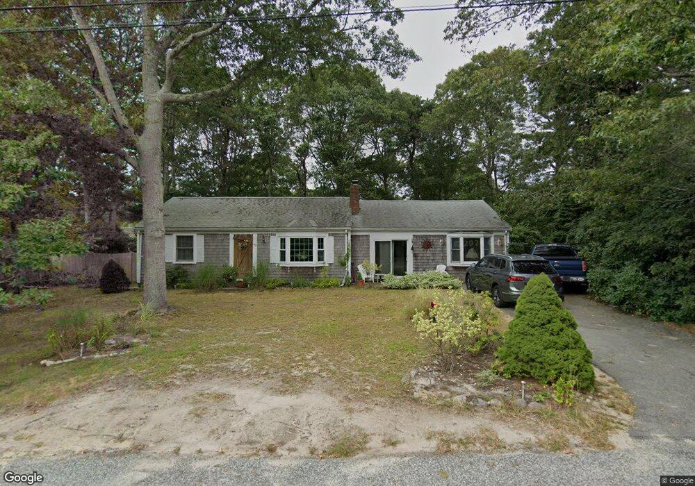
82 Swift Brook Rd South Yarmouth, MA 02664
South Yarmouth NeighborhoodEstimated Value: $566,000 - $597,000
2
Beds
2
Baths
1,276
Sq Ft
$461/Sq Ft
Est. Value
About This Home
This home is located at 82 Swift Brook Rd, South Yarmouth, MA 02664 and is currently estimated at $587,929, approximately $460 per square foot. 82 Swift Brook Rd is a home located in Barnstable County with nearby schools including Dennis-Yarmouth Regional High School and St. Pius X. School.
Ownership History
Date
Name
Owned For
Owner Type
Purchase Details
Closed on
Nov 10, 2006
Sold by
Byrne Anita E and Byrne Audrey A
Bought by
Heidtmann-Marlin Cynthia
Current Estimated Value
Home Financials for this Owner
Home Financials are based on the most recent Mortgage that was taken out on this home.
Original Mortgage
$247,600
Outstanding Balance
$147,279
Interest Rate
6.31%
Mortgage Type
Purchase Money Mortgage
Estimated Equity
$440,650
Purchase Details
Closed on
Sep 22, 2000
Sold by
Johnson Alice C
Bought by
Byrne Anita E and Byrne Audrey A
Home Financials for this Owner
Home Financials are based on the most recent Mortgage that was taken out on this home.
Original Mortgage
$144,400
Interest Rate
8%
Mortgage Type
Purchase Money Mortgage
Create a Home Valuation Report for This Property
The Home Valuation Report is an in-depth analysis detailing your home's value as well as a comparison with similar homes in the area
Home Values in the Area
Average Home Value in this Area
Purchase History
| Date | Buyer | Sale Price | Title Company |
|---|---|---|---|
| Heidtmann-Marlin Cynthia | $309,500 | -- | |
| Byrne Anita E | $153,000 | -- |
Source: Public Records
Mortgage History
| Date | Status | Borrower | Loan Amount |
|---|---|---|---|
| Open | Heidtmann-Marlin Cynthia | $247,600 | |
| Previous Owner | Byrne Anita E | $144,400 |
Source: Public Records
Tax History Compared to Growth
Tax History
| Year | Tax Paid | Tax Assessment Tax Assessment Total Assessment is a certain percentage of the fair market value that is determined by local assessors to be the total taxable value of land and additions on the property. | Land | Improvement |
|---|---|---|---|---|
| 2025 | $3,877 | $547,600 | $177,800 | $369,800 |
| 2024 | $3,617 | $490,100 | $150,400 | $339,700 |
| 2023 | $3,502 | $431,800 | $130,200 | $301,600 |
| 2022 | $3,583 | $390,300 | $118,300 | $272,000 |
| 2021 | $3,335 | $348,800 | $118,300 | $230,500 |
| 2020 | $3,240 | $324,000 | $118,400 | $205,600 |
| 2019 | $2,967 | $293,800 | $118,400 | $175,400 |
| 2018 | $9,539 | $276,200 | $100,800 | $175,400 |
| 2017 | $2,723 | $271,800 | $96,400 | $175,400 |
| 2016 | $2,626 | $263,100 | $87,700 | $175,400 |
| 2015 | $2,492 | $248,200 | $87,700 | $160,500 |
Source: Public Records
Map
Nearby Homes
- 48 Captain Dore Rd
- 35 Captain Percival Rd
- 18 Captain Stanley Rd
- 49 Captain Besse Rd
- 147 Captain Bacon Rd
- 24 Fast Brook Rd
- 3 Saturn Ln
- 21 Hazelmoor Rd
- 11 Bob-O-link Ln
- 72 Quartermaster Row
- 68 Bob-O-link Ln
- 33 Sparrow Way
- 299 Winslow Gray Rd
- 299-301 Winslow Gray Rd
- 33 Lake Rd
- 22 Powhatan Rd
- 15 Sharon Rd
- 23 Circuit Rd N
- 7 Sunset Pines Rd
- 0 Forsyth Ave
- 120 Winding Brook Rd
- 76 Swift Brook Rd
- 102 Captain Noyes Rd
- 108 Captain Noyes Rd
- 58 Village Brook Rd
- 96 Captain Noyes Rd
- 112 Winding Brook Rd
- 72 Swift Brook Rd
- 73 Swift Brook Rd
- 112 Captain Noyes Rd
- 119 Winding Brook Rd
- 54 Village Brook Rd
- 108 Winding Brook Rd
- 101 Captain Noyes Rd
- 113 Winding Brook Rd
- 125 Winding Brook Rd
- 298 Captain Noyes Rd
- 53 Village Brook Rd
- 58 Capt Blount Rd
- 58 Captain Blount Rd