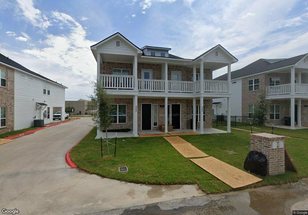
820 Avenue A College Station, TX 77840
Eastgate NeighborhoodEstimated Value: $281,000 - $443,000
--
Bed
--
Bath
1,398
Sq Ft
$251/Sq Ft
Est. Value
About This Home
This home is located at 820 Avenue A, College Station, TX 77840 and is currently estimated at $351,443, approximately $251 per square foot. 820 Avenue A is a home located in Brazos County with nearby schools including College Hills Elementary School, A&M Consolidated Middle School, and Oakwood Intermediate School.
Ownership History
Date
Name
Owned For
Owner Type
Purchase Details
Closed on
Apr 19, 2024
Sold by
Jaffar Shabeer
Bought by
826 Avenue A Llc
Current Estimated Value
Home Financials for this Owner
Home Financials are based on the most recent Mortgage that was taken out on this home.
Original Mortgage
$3,412,000
Outstanding Balance
$3,361,019
Interest Rate
6.88%
Mortgage Type
Construction
Estimated Equity
-$3,009,576
Create a Home Valuation Report for This Property
The Home Valuation Report is an in-depth analysis detailing your home's value as well as a comparison with similar homes in the area
Home Values in the Area
Average Home Value in this Area
Purchase History
| Date | Buyer | Sale Price | Title Company |
|---|---|---|---|
| 826 Avenue A Llc | -- | University Title Company |
Source: Public Records
Mortgage History
| Date | Status | Borrower | Loan Amount |
|---|---|---|---|
| Open | 826 Avenue A Llc | $3,412,000 |
Source: Public Records
Tax History Compared to Growth
Tax History
| Year | Tax Paid | Tax Assessment Tax Assessment Total Assessment is a certain percentage of the fair market value that is determined by local assessors to be the total taxable value of land and additions on the property. | Land | Improvement |
|---|---|---|---|---|
| 2025 | $6,313 | $161,582 | $161,582 | -- |
| 2024 | $6,313 | $331,251 | $157,828 | $173,423 |
| 2023 | $6,313 | $368,010 | $144,298 | $223,712 |
| 2022 | $5,750 | $269,665 | $131,174 | $138,491 |
| 2021 | $5,990 | $265,205 | $174,898 | $90,307 |
| 2020 | $5,746 | $253,000 | $174,898 | $78,102 |
| 2019 | $6,049 | $256,000 | $169,400 | $86,600 |
| 2018 | $6,196 | $260,280 | $151,080 | $109,200 |
| 2017 | $4,592 | $195,100 | $118,880 | $76,220 |
| 2016 | $4,475 | $190,125 | $84,700 | $105,425 |
| 2015 | $3,427 | $166,170 | $67,200 | $98,970 |
| 2014 | $3,427 | $147,880 | $63,950 | $83,930 |
Source: Public Records
Map
Nearby Homes
- 406 Ash St Unit CS
- 1008 Puryear Dr
- 1010 Milner Dr
- 1017 Milner Dr
- 304 Cooner St
- 304 Cooner St Unit A
- The Poppy Plan at Greens Prairie Reserve
- The Lily Plan at Greens Prairie Reserve
- The Laurel Plan at Greens Prairie Reserve
- The Jasmine Plan at Greens Prairie Reserve
- The Iris Plan at Greens Prairie Reserve
- The Dahlia Plan at Greens Prairie Reserve
- The Violet Plan at Greens Prairie Reserve
- The Rose Plan at Greens Prairie Reserve
- The Lavender Plan at Greens Prairie Reserve
- The Orchid Plan at Greens Prairie Reserve
- The Azalea Plan at Greens Prairie Reserve
- The Sage Plan at Greens Prairie Reserve
- 1201 Walton Dr
- 908 Munson Ave