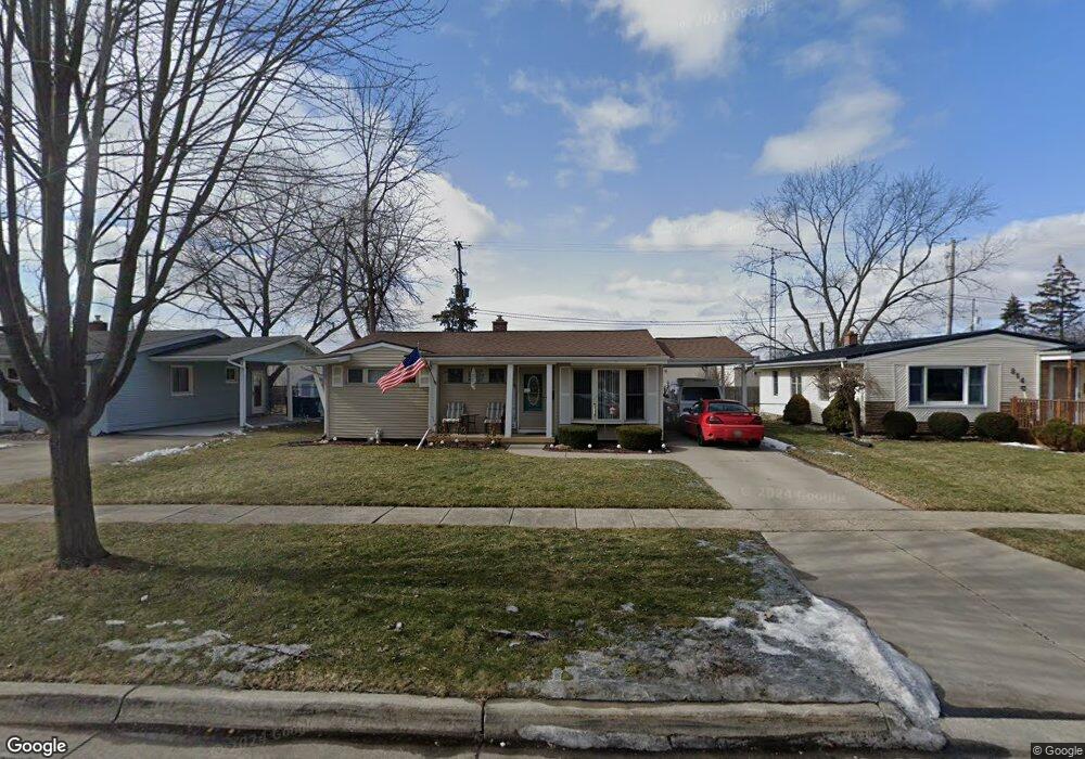
820 Cypress Dr Davison, MI 48423
Estimated Value: $196,485 - $214,000
3
Beds
1
Bath
1,047
Sq Ft
$199/Sq Ft
Est. Value
About This Home
This home is located at 820 Cypress Dr, Davison, MI 48423 and is currently estimated at $208,121, approximately $198 per square foot. 820 Cypress Dr is a home located in Genesee County with nearby schools including Thomson Elementary School, Hill Elementary School, and Gates Elementary School.
Ownership History
Date
Name
Owned For
Owner Type
Purchase Details
Closed on
Feb 11, 2025
Sold by
Cole Billy W
Bought by
Cole Billy W and Cole Raymond Peter
Current Estimated Value
Purchase Details
Closed on
Oct 31, 2012
Sold by
Barton Clifford J
Bought by
Cole Billy W
Home Financials for this Owner
Home Financials are based on the most recent Mortgage that was taken out on this home.
Original Mortgage
$55,200
Interest Rate
3.3%
Mortgage Type
New Conventional
Purchase Details
Closed on
Jan 27, 2012
Sold by
Barton Stacey Lynn
Bought by
Barton Clifford J and Clifford J Barton Family Trust #1
Purchase Details
Closed on
Jul 25, 2011
Sold by
Barton Clifford J
Bought by
Barton Stacey Lynn
Purchase Details
Closed on
Jul 22, 2011
Sold by
Barton Clifford J
Bought by
Barton Clifford J and Clifford J Barton Jr Family Trust #1
Purchase Details
Closed on
Jun 21, 2011
Sold by
Hobson Cheryl G and Gilmer Cheryl Genneen
Bought by
Barton Clifford J
Create a Home Valuation Report for This Property
The Home Valuation Report is an in-depth analysis detailing your home's value as well as a comparison with similar homes in the area
Home Values in the Area
Average Home Value in this Area
Purchase History
| Date | Buyer | Sale Price | Title Company |
|---|---|---|---|
| Cole Billy W | -- | None Listed On Document | |
| Cole Billy W | -- | None Listed On Document | |
| Cole Billy W | $69,000 | Lighthouse Title Inc | |
| Barton Clifford J | -- | None Available | |
| Barton Stacey Lynn | -- | None Available | |
| Barton Clifford J | -- | None Available | |
| Barton Clifford J | $62,000 | Lighthouse Title Inc |
Source: Public Records
Mortgage History
| Date | Status | Borrower | Loan Amount |
|---|---|---|---|
| Previous Owner | Cole Billy W | $55,200 |
Source: Public Records
Tax History
| Year | Tax Paid | Tax Assessment Tax Assessment Total Assessment is a certain percentage of the fair market value that is determined by local assessors to be the total taxable value of land and additions on the property. | Land | Improvement |
|---|---|---|---|---|
| 2025 | $2,555 | $81,500 | $0 | $0 |
| 2024 | $1,623 | $72,800 | $0 | $0 |
| 2023 | $1,558 | $67,100 | $0 | $0 |
| 2022 | $2,331 | $59,400 | $0 | $0 |
| 2021 | $2,199 | $55,900 | $0 | $0 |
| 2020 | $1,352 | $54,500 | $0 | $0 |
| 2019 | $1,335 | $51,400 | $0 | $0 |
| 2018 | $1,950 | $46,500 | $0 | $0 |
| 2017 | $1,858 | $47,300 | $0 | $0 |
| 2016 | $1,844 | $43,000 | $0 | $0 |
| 2015 | $1,838 | $37,900 | $0 | $0 |
| 2012 | -- | $36,200 | $36,200 | $0 |
Source: Public Records
Map
Nearby Homes
- 0000 S State Rd
- 514 Tamarac Dr
- 9469 Parkwood N Unit 2B
- 801 Hemlock Dr
- 334 E Clark St Unit 340 344
- 817 Hemlock Dr
- 1084 Linda Dr
- 322 North Dr
- 1024 Foxglove Ln
- 000 Foxglove Ln
- 10.63(+/-) Acres Lapeer Rd
- 216 N Genesee St
- 10294 Carriage Way
- 612 Carriage Way
- 1137 Canary Dr Unit 187
- 00 Lapeer Rd
- 9166 Emily Dr Unit 150
- 1136 Jenna Dr Unit 207
- 505 N Main St
- 85 Cherryhill Dr
Your Personal Tour Guide
Ask me questions while you tour the home.