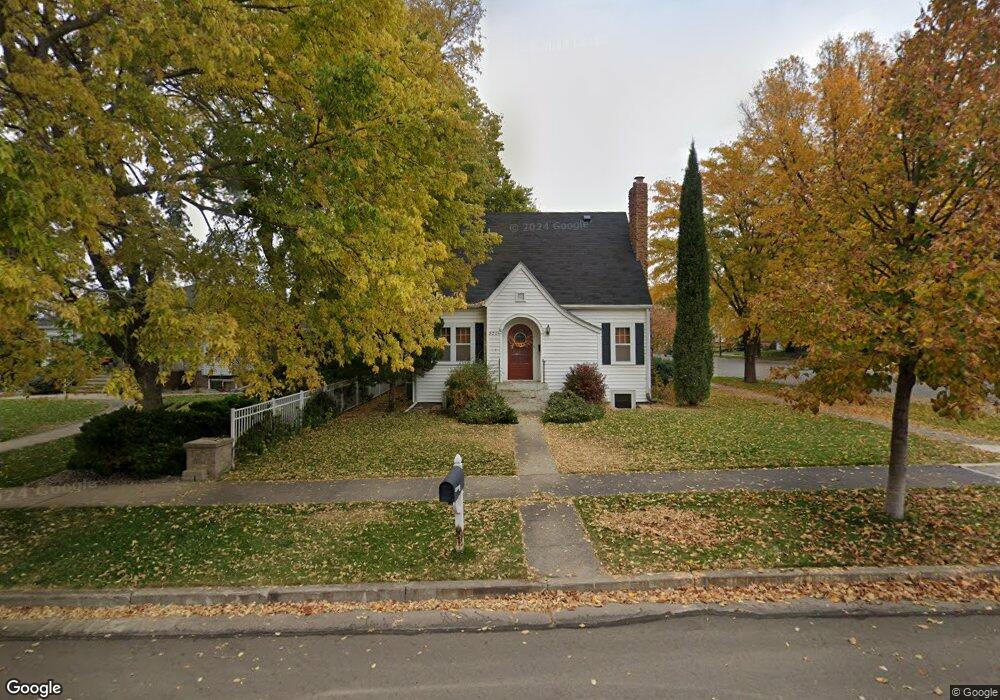
820 E Cabot St Pierre, SD 57501
Estimated Value: $321,000 - $449,000
5
Beds
4
Baths
2,158
Sq Ft
$181/Sq Ft
Est. Value
About This Home
This home is located at 820 E Cabot St, Pierre, SD 57501 and is currently estimated at $391,305, approximately $181 per square foot. 820 E Cabot St is a home with nearby schools including T.F. Riggs High School and Pierre SDA School.
Ownership History
Date
Name
Owned For
Owner Type
Purchase Details
Closed on
Jun 21, 2016
Bought by
Zilverberg Cody and Fletcher Joyce Welsey
Current Estimated Value
Purchase Details
Closed on
Feb 18, 2008
Sold by
Dodge N P
Bought by
Riter-Rapp Lindsey and Rapp Jonathan
Home Financials for this Owner
Home Financials are based on the most recent Mortgage that was taken out on this home.
Original Mortgage
$199,920
Interest Rate
5.74%
Create a Home Valuation Report for This Property
The Home Valuation Report is an in-depth analysis detailing your home's value as well as a comparison with similar homes in the area
Home Values in the Area
Average Home Value in this Area
Purchase History
| Date | Buyer | Sale Price | Title Company |
|---|---|---|---|
| Zilverberg Cody | $290,000 | -- | |
| Riter-Rapp Lindsey | $250,000 | -- |
Source: Public Records
Mortgage History
| Date | Status | Borrower | Loan Amount |
|---|---|---|---|
| Previous Owner | Riter-Rapp Lindsey | $199,920 |
Source: Public Records
Tax History
| Year | Tax Paid | Tax Assessment Tax Assessment Total Assessment is a certain percentage of the fair market value that is determined by local assessors to be the total taxable value of land and additions on the property. | Land | Improvement |
|---|---|---|---|---|
| 2025 | $4,341 | $377,704 | $37,020 | $340,684 |
| 2024 | $4,338 | $361,481 | $37,020 | $324,461 |
| 2023 | $3,983 | $351,973 | $35,426 | $316,547 |
| 2022 | $3,745 | $297,528 | $33,739 | $263,789 |
| 2021 | $3,283 | $265,650 | $30,124 | $235,526 |
| 2020 | $3,362 | $230,484 | $29,247 | $201,237 |
| 2019 | $3,356 | $230,484 | $29,247 | $201,237 |
| 2018 | $3,212 | $223,771 | $28,395 | $195,376 |
| 2017 | -- | $213,115 | $27,043 | $186,072 |
| 2016 | $3,364 | $213,115 | $27,043 | $186,072 |
| 2015 | -- | $206,907 | $26,255 | $180,652 |
| 2014 | -- | $200,880 | $25,490 | $175,390 |
| 2013 | -- | $200,880 | $25,490 | $175,390 |
| 2011 | -- | $167,201 | $25,490 | $141,711 |
Source: Public Records
Map
Nearby Homes
- 1204 E Cabot St
- 304 N Highland Ave
- 1501 E Capitol Ave
- 219 N Highland Ave
- 1511 E Capitol Ave
- 1515 E Capitol Ave
- 616 E Dakota Ave
- 302 E Wynoka St
- 220 S Van Buren Ave
- 1602 E Cabot St
- 615 E Dakota Ave
- 338 N Highland Ave
- 115 S Tyler Ave
- 620 N Harrison Ave
- 107 E Wynoka St
- 1007 E Marina Ave
- 203 N Tyler Ave
- 101 #15 W Prospect
- 330 N Grand Ave
- 1420 E Dakota Ave
- 814 E Cabot St
- 810 E Cabot St
- 200 N Washington Ave
- 206 N Washington Ave
- 210 N Washington Ave
- 806 E Cabot St
- 214 N Washington Ave
- 124 N Washington Ave
- 802 E Cabot St
- 210 Governors Dr
- 122 N Washington Ave
- 220 N Washington Ave
- 224 N Washington Ave
- 118 N Washington Ave
- 912 E Cabot St
- 112 N Washington Ave
- 918 E Cabot St
- 215 N Adams Ave
- 225 N Adams Ave
- 123 N Adams Ave
Your Personal Tour Guide
Ask me questions while you tour the home.