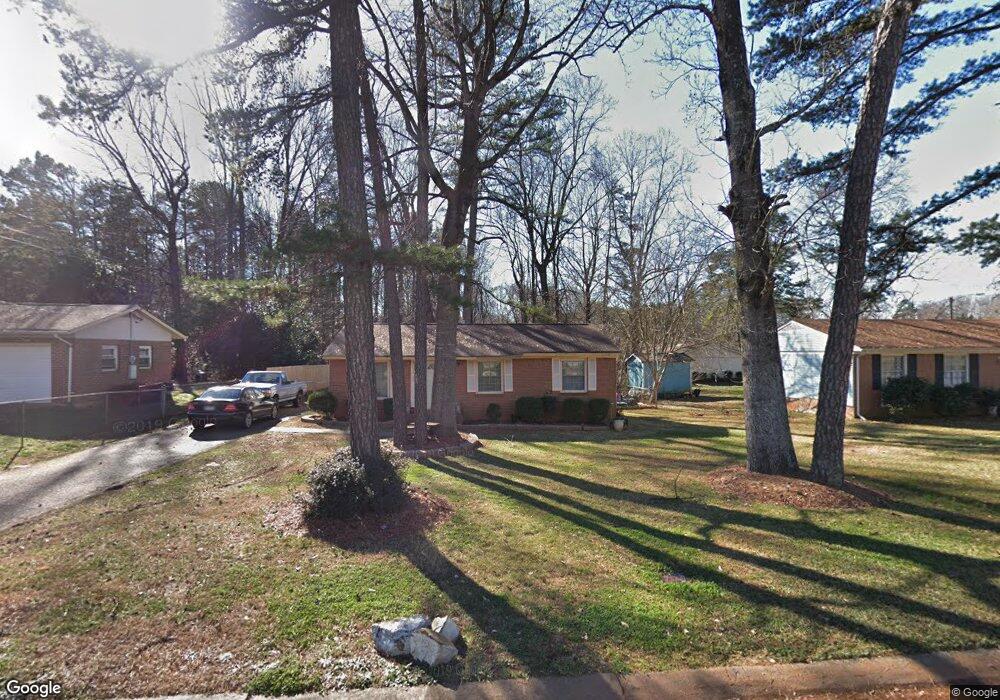
820 Lightspun Ln Charlotte, NC 28216
Firestone-Garden Park NeighborhoodEstimated Value: $203,000 - $219,000
3
Beds
1
Bath
1,000
Sq Ft
$212/Sq Ft
Est. Value
About This Home
This home is located at 820 Lightspun Ln, Charlotte, NC 28216 and is currently estimated at $211,628, approximately $211 per square foot. 820 Lightspun Ln is a home located in Mecklenburg County with nearby schools including Oakdale Elementary School, Ranson Middle School, and West Charlotte High School.
Ownership History
Date
Name
Owned For
Owner Type
Purchase Details
Closed on
Mar 1, 2011
Sold by
Porter Makeah S
Bought by
Porter Cynthia W
Current Estimated Value
Purchase Details
Closed on
Jan 29, 1998
Sold by
Morequity Inc
Bought by
Porter Cynthia W and Porter Makeah S
Home Financials for this Owner
Home Financials are based on the most recent Mortgage that was taken out on this home.
Original Mortgage
$56,748
Outstanding Balance
$10,108
Interest Rate
7.07%
Mortgage Type
FHA
Estimated Equity
$201,520
Create a Home Valuation Report for This Property
The Home Valuation Report is an in-depth analysis detailing your home's value as well as a comparison with similar homes in the area
Home Values in the Area
Average Home Value in this Area
Purchase History
| Date | Buyer | Sale Price | Title Company |
|---|---|---|---|
| Porter Cynthia W | -- | None Available | |
| Porter Cynthia W | $58,000 | -- |
Source: Public Records
Mortgage History
| Date | Status | Borrower | Loan Amount |
|---|---|---|---|
| Open | Porter Cynthia W | $56,748 | |
| Closed | Porter Cynthia W | $294,000 |
Source: Public Records
Tax History Compared to Growth
Tax History
| Year | Tax Paid | Tax Assessment Tax Assessment Total Assessment is a certain percentage of the fair market value that is determined by local assessors to be the total taxable value of land and additions on the property. | Land | Improvement |
|---|---|---|---|---|
| 2025 | $1,429 | $168,400 | $50,000 | $118,400 |
| 2024 | $1,429 | $168,400 | $50,000 | $118,400 |
| 2023 | $1,374 | $168,400 | $50,000 | $118,400 |
| 2022 | $1,047 | $95,500 | $25,000 | $70,500 |
| 2021 | $1,036 | $95,500 | $25,000 | $70,500 |
| 2020 | $1,029 | $95,500 | $25,000 | $70,500 |
| 2019 | $1,013 | $95,500 | $25,000 | $70,500 |
| 2018 | $632 | $42,600 | $12,000 | $30,600 |
| 2017 | $614 | $42,600 | $12,000 | $30,600 |
| 2016 | $605 | $42,600 | $12,000 | $30,600 |
| 2015 | $593 | $42,600 | $12,000 | $30,600 |
| 2014 | $609 | $44,800 | $12,000 | $32,800 |
Source: Public Records
Map
Nearby Homes
- 719 Lightspun Ln
- 728 Dedmon Dr
- 4920 Rockwood Rd
- 615 Milan Rd E
- 1113 Swearngan Ridge Ct
- 3231 Richway Ct
- 1413 Crandon Dr
- 3610 Maggie Laney Dr
- 5541 Peachwood Dr
- 5204 Grass Ridge Dr
- 3703 Silver Ore Ln
- 5320 Barley Ln
- 1424 Griers Grove Rd
- 5424 Beam Lake Dr
- 604 Touch Me Not Ln
- 600 Touch Me Not Ln
- 705 Wild Oak Ct
- 3008 Cricketeer Dr
- 3104 Yvonne Ln
- 1837 Slater Rd
- 804 Lightspun Ln
- 826 Lightspun Ln
- 1146 Milan Rd
- 1200 Milan Rd
- 1140 Milan Rd
- 922 Dedmon Dr
- 726 Lightspun Ln
- 1206 Milan Rd
- 1134 Milan Rd
- 916 Dedmon Dr
- 1007 Dedmon Dr
- 1011 Dedmon Dr
- 1143 Milan Rd
- 1143 Milan Rd Unit 15
- 720 Lightspun Ln
- 925 Dedmon Dr
- 1137 Milan Rd
- 910 Dedmon Dr
- 1128 Milan Rd
- 1212 Milan Rd