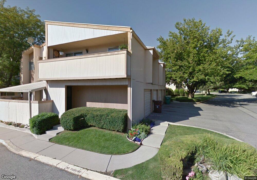
820 S 1650 E Unit A Clearfield, UT 84015
Estimated Value: $279,000 - $313,000
4
Beds
2
Baths
1,872
Sq Ft
$158/Sq Ft
Est. Value
About This Home
This home is located at 820 S 1650 E Unit A, Clearfield, UT 84015 and is currently estimated at $295,668, approximately $157 per square foot. 820 S 1650 E Unit A is a home located in Davis County with nearby schools including South Clearfield Elementary School, North Davis Junior High School, and Northridge High School.
Ownership History
Date
Name
Owned For
Owner Type
Purchase Details
Closed on
Feb 3, 2020
Sold by
Casias Paul W and Thiele Rick
Bought by
Leisgang Eileen
Current Estimated Value
Home Financials for this Owner
Home Financials are based on the most recent Mortgage that was taken out on this home.
Original Mortgage
$175,000
Outstanding Balance
$154,917
Interest Rate
3.7%
Mortgage Type
New Conventional
Estimated Equity
$140,751
Purchase Details
Closed on
Aug 7, 2013
Sold by
Casias Chrestino and Casias Lillian T
Bought by
Casias Chrestino and Casias Lillian T
Purchase Details
Closed on
Apr 17, 2012
Sold by
Varner Jean D
Bought by
Casias Chrestino and Casias Lillian T
Home Financials for this Owner
Home Financials are based on the most recent Mortgage that was taken out on this home.
Original Mortgage
$76,500
Interest Rate
4.05%
Mortgage Type
New Conventional
Create a Home Valuation Report for This Property
The Home Valuation Report is an in-depth analysis detailing your home's value as well as a comparison with similar homes in the area
Home Values in the Area
Average Home Value in this Area
Purchase History
| Date | Buyer | Sale Price | Title Company |
|---|---|---|---|
| Leisgang Eileen | -- | Stewart Title Ins Ag | |
| Casias Chrestino | -- | None Available | |
| Casias Chrestino | -- | Eagle Gate Title Ins |
Source: Public Records
Mortgage History
| Date | Status | Borrower | Loan Amount |
|---|---|---|---|
| Open | Leisgang Eileen | $175,000 | |
| Previous Owner | Casias Chrestino | $76,500 |
Source: Public Records
Tax History
| Year | Tax Paid | Tax Assessment Tax Assessment Total Assessment is a certain percentage of the fair market value that is determined by local assessors to be the total taxable value of land and additions on the property. | Land | Improvement |
|---|---|---|---|---|
| 2025 | $1,651 | $147,950 | $0 | $147,950 |
| 2024 | $1,645 | $148,500 | $0 | $148,500 |
| 2023 | $1,557 | $258,000 | $0 | $258,000 |
| 2022 | $1,577 | $141,350 | $30,250 | $111,100 |
| 2021 | $1,389 | $188,000 | $44,600 | $143,400 |
| 2020 | $1,205 | $162,000 | $34,500 | $127,500 |
| 2019 | $906 | $151,000 | $30,000 | $121,000 |
| 2018 | $0 | $135,000 | $30,000 | $105,000 |
| 2016 | $910 | $61,545 | $14,300 | $47,245 |
| 2015 | $838 | $54,010 | $14,300 | $39,710 |
| 2014 | $895 | $58,487 | $18,333 | $40,154 |
| 2013 | $963 | $60,157 | $17,600 | $42,557 |
Source: Public Records
Map
Nearby Homes
- 870 S 1625 E Unit A
- 865 S 1650 E Unit A
- 1644 E 700 S
- 1543 E 750 S Unit C5
- 1560 E 800 S Unit C
- 1612 E 925 S
- 911 S 1500 E
- 2931 N 1175 W
- 2896 N 1175 W
- 1520 E 1100 S
- 1127 E 1050 S
- 1012 W 2525 N
- 2320 N 1085 W
- 2298 N 1085 W
- 876 S 1000 E
- 709 W Highway 193
- 1021 E 1225 S Unit A
- 820 W 2350 N
- 897 E 1000 S
- 2386 N 800 W
- 820 S 1650 E Unit C
- 820 S 1650 E Unit D
- 820 S 1650 E Unit B
- 840 S 1650 E
- 1644 E 800 S Unit C
- 1644 E 800 S
- 1644 E 800 S Unit A
- 1644 E 800 S Unit D12
- 1644 E 800 S Unit D
- 1644 E 800 S Unit B
- 1644 E 800 S Unit 12C
- 1644 E 800 S Unit B
- 1644 E 800 S Unit B12
- 1642 E 800 S Unit A
- 1642 E 800 S Unit D
- 1642 E 800 S Unit C
- 1642 E 800 S Unit B
- 1642 E 800 S
- 850 S 1650 E Unit C
- 850 S 1650 E Unit 22D
Your Personal Tour Guide
Ask me questions while you tour the home.