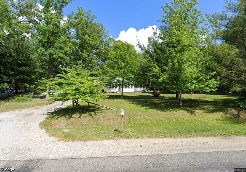
820 S Brooks Rd Muskegon, MI 49442
Estimated Value: $214,000 - $261,000
4
Beds
1
Bath
1,152
Sq Ft
$204/Sq Ft
Est. Value
About This Home
This home is located at 820 S Brooks Rd, Muskegon, MI 49442 and is currently estimated at $235,366, approximately $204 per square foot. 820 S Brooks Rd is a home located in Muskegon County with nearby schools including Oakridge Lower Elementary School, Oakridge Upper Elementary School, and Oakridge Middle School.
Ownership History
Date
Name
Owned For
Owner Type
Purchase Details
Closed on
Nov 12, 2024
Sold by
Harrington Orrin
Bought by
Pulsifer Lois and Harrington Orrin
Current Estimated Value
Purchase Details
Closed on
Dec 28, 2022
Sold by
Pulsifer Lois
Bought by
Harrington Orrin
Home Financials for this Owner
Home Financials are based on the most recent Mortgage that was taken out on this home.
Original Mortgage
$46,000
Interest Rate
5.9%
Mortgage Type
New Conventional
Purchase Details
Closed on
May 11, 2017
Sold by
Harrington Orrin
Bought by
Pulsifer Lois and Harrington Orrin
Purchase Details
Closed on
Dec 6, 2016
Sold by
Fauble Dennis and Bryant Lois E
Bought by
Harrington Orrin
Home Financials for this Owner
Home Financials are based on the most recent Mortgage that was taken out on this home.
Original Mortgage
$71,677
Interest Rate
3.62%
Mortgage Type
FHA
Create a Home Valuation Report for This Property
The Home Valuation Report is an in-depth analysis detailing your home's value as well as a comparison with similar homes in the area
Home Values in the Area
Average Home Value in this Area
Purchase History
| Date | Buyer | Sale Price | Title Company |
|---|---|---|---|
| Pulsifer Lois | -- | None Listed On Document | |
| Harrington Orrin | -- | None Listed On Document | |
| Harrington Orrin | -- | -- | |
| Pulsifer Lois | -- | None Available | |
| Harrington Orrin | -- | None Available |
Source: Public Records
Mortgage History
| Date | Status | Borrower | Loan Amount |
|---|---|---|---|
| Previous Owner | Harrington Orrin | $46,000 | |
| Previous Owner | Harrington Orrin | $71,677 |
Source: Public Records
Tax History Compared to Growth
Tax History
| Year | Tax Paid | Tax Assessment Tax Assessment Total Assessment is a certain percentage of the fair market value that is determined by local assessors to be the total taxable value of land and additions on the property. | Land | Improvement |
|---|---|---|---|---|
| 2025 | $2,278 | $103,300 | $0 | $0 |
| 2024 | $620 | $100,500 | $0 | $0 |
| 2023 | $593 | $85,500 | $0 | $0 |
| 2022 | $2,091 | $74,600 | $0 | $0 |
| 2021 | $2,008 | $66,600 | $0 | $0 |
| 2020 | $1,801 | $49,900 | $0 | $0 |
| 2019 | $1,738 | $46,200 | $0 | $0 |
| 2018 | $1,679 | $41,200 | $0 | $0 |
| 2017 | $2,243 | $37,400 | $0 | $0 |
| 2016 | $376 | $35,300 | $0 | $0 |
| 2015 | -- | $32,700 | $0 | $0 |
| 2014 | -- | $32,500 | $0 | $0 |
| 2013 | -- | $32,200 | $0 | $0 |
Source: Public Records
Map
Nearby Homes
- 3884 E Apple Ave
- VL E Apple Ave Unit 17 & 18
- V/L E Apple Ave
- 4502 E Apple Ave
- 3861 Forest Edge Rd
- 1440 S Brooks Rd
- 1441 S Brooks Rd
- 4639 Pine Hollow Rd
- 170 S Brooks Rd
- 4825 Pullman Ave
- 4228 Hall Rd
- 4884 E Apple Ave
- 4493 Hall Rd
- 261 Taffy Ln Unit 602
- 556 S Macintosh Ln
- 3186 E Apple Ave
- 587 Harvest Ln
- 4927 Winesap Dr
- 110 Willow Wood Dr
- 3878 E Laketon Ave
- 796 S Brooks Rd
- 866 S Brooks Rd
- 875 S Brooks Rd
- 843 S Brooks Rd
- 780 S Brooks Rd
- 811 S Brooks Rd
- 766 S Brooks Rd
- 758 S Brooks Rd
- 757 S Brooks Rd
- 911 S Brooks Rd
- 785 S Brooks Rd
- 4042 E Apple Ave
- 4040 E Apple Ave
- 749 S Brooks Rd
- 4056 E Apple Ave
- 3974 E Apple Ave
- 3972 & 74 E Apple Ave
- 4086 E Apple Ave
- 4104 E Apple Ave
- 731 S Brooks Rd