82020 S 8000 W Grouse Creek, UT 84313
Estimated payment $758/month
Highlights
- 265 Acre Lot
- No HOA
- No Heating
- Mountain View
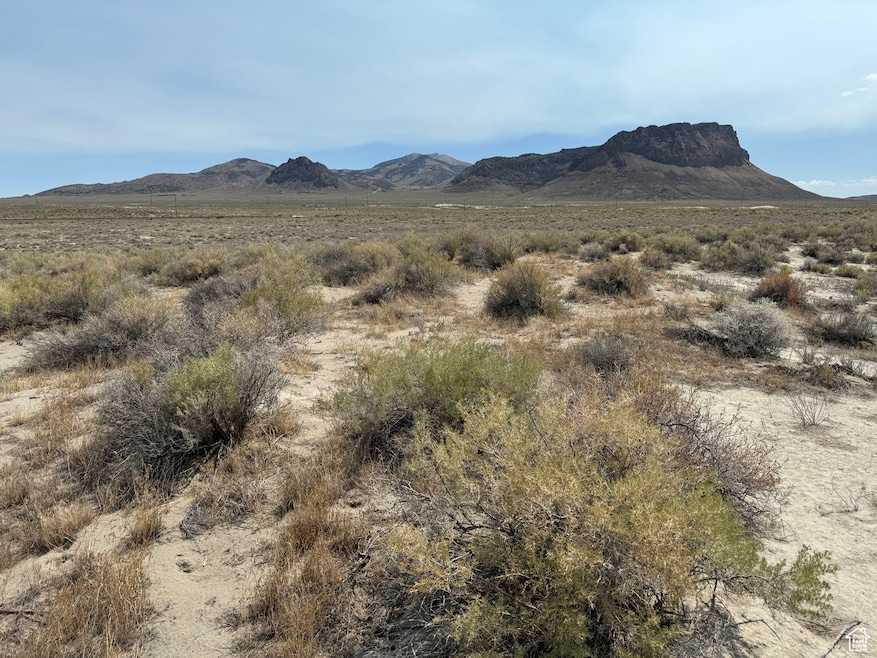
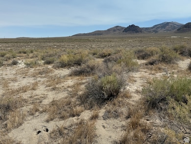
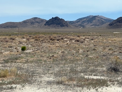
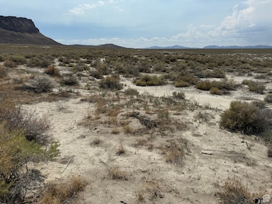
About This Lot
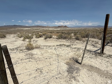
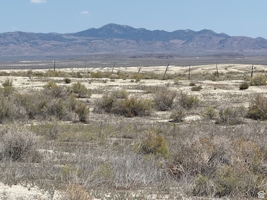
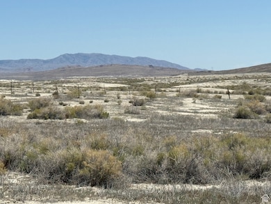
A Great Opportunity To Own Land Near The Utah/ Nevada Border With Many Possibilities! This sale includes two parcels of land: Parcel # 01-077-0004 is 165 acres and sits south of HWY 30 about a mile and a quarter with GPS Coordinates of 41.35158 -114.0159; Parcel # 02-021-0015 is 100 Acres, sits south of HWY 30 about a half of a mile and is located about a third of a mile North East of the larger parcel with GPS Coordinates of 41.36701 -114.00655. The two parcels total 265 Acres, have partial barbed wire fencing and both border BLM Land on two sides. Come enjoy gorgeous views, wildlife, hunting, recreating, relaxing and the solitude that surrounds it. Don't miss out on this amazing opportunity! Please contact listing agent for all showings. Buyer, Buyer's Agent, Contractors, and others involved to verify the accuracy of all information including parcel size, location, zoning, access, usage, utilities, schools, etc. Information was provided as a courtesy only. Seller Financing Available!
Listing Agent
Laron Kent
Coldwell Banker Realty (South Ogden) License #13639785 Listed on: 07/25/2025
Property Details
Property Type
- Land
Est. Annual Taxes
- $360
Lot Details
- 265 Acre Lot
- Property is zoned Agricultural, AG
Property Views
- Mountain
- Valley
Schools
- Grouse Creek Elementary School
- Bear River Middle School
- Bear River High School
Utilities
- Electricity Not Available
- Natural Gas Not Available
- Sewer Not Available
Community Details
- No Home Owners Association
Listing and Financial Details
- Assessor Parcel Number 01-077-0004
Map
Home Values in the Area
Average Home Value in this Area
Tax History
| Year | Tax Paid | Tax Assessment Tax Assessment Total Assessment is a certain percentage of the fair market value that is determined by local assessors to be the total taxable value of land and additions on the property. | Land | Improvement |
|---|---|---|---|---|
| 2025 | $314 | $33,825 | $33,825 | $0 |
| 2024 | $269 | $33,000 | $33,000 | $0 |
| 2023 | $233 | $28,875 | $28,875 | $0 |
| 2022 | $141 | $16,500 | $16,500 | $0 |
| 2021 | $38 | $3,999 | $3,199 | $800 |
| 2020 | $40 | $3,999 | $3,199 | $800 |
| 2019 | $41 | $6,398 | $3,199 | $3,199 |
| 2018 | $44 | $3,999 | $3,199 | $800 |
| 2017 | $46 | $3,999 | $3,199 | $800 |
| 2016 | $45 | $3,999 | $3,199 | $800 |
| 2015 | $46 | $3,999 | $3,199 | $800 |
| 2014 | $46 | $4,000 | $3,200 | $800 |
| 2013 | -- | $4,000 | $0 | $4,000 |
Property History
| Date | Event | Price | List to Sale | Price per Sq Ft |
|---|---|---|---|---|
| 07/25/2025 07/25/25 | For Sale | $138,000 | -- | -- |
Source: UtahRealEstate.com
MLS Number: 2100999
APN: 01-077-0004
Disclaimer: Certain information contained herein is derived from information provided by parties other than Homes.com. All information provided is deemed reliable, but is not guaranteed to be accurate and should be independently verified.
![]() IDX information is provided exclusively for consumers’ personal, non-commercial use, that it may not be used for any purpose other than to identify prospective properties consumers may be interested in purchasing, and that the data is deemed reliable but is not guaranteed accurate by the MLS. Licensor is only providing the MLS Content and not other sources of data provided in the Product.
IDX information is provided exclusively for consumers’ personal, non-commercial use, that it may not be used for any purpose other than to identify prospective properties consumers may be interested in purchasing, and that the data is deemed reliable but is not guaranteed accurate by the MLS. Licensor is only providing the MLS Content and not other sources of data provided in the Product.
Based on information from the Wasatch Front Regional Multiple Listing Service, Inc.. All data, including all measurements and calculations of area, is obtained from various sources and has not been, and will not be, verified by broker or the MLS. All information should be independently reviewed and verified for accuracy. Properties may or may not be listed by the office/agent presenting the information.
- 01081A001 Gamble District
- 0 010-81d-003 Sec 19 Twp 40n Rge 70e Unit 3627012
- 0 Montello Rd
- Antelope Rd
- 0 01059f041 Unit 3626248
- 0 010-58g-010; Sec 11 Twp 39n Rge 69e Mdb&m Unit 3624631
- 0 Stonehenge Dr
- 0 Tbd- 10 Acre Unit 3625857
- 0 Tbd- 10 Acre Unit 3625856
- 0 Pilot Mountain Rd
- 0 Sec 29 Twp 38nrge 70e Unit 3626286
- 0 Sec 19 Twp 39n Rng 70e Mdb&m Unit 3626614
- 0 Sec 29 Twp 39n Rge 70e Mdb&m Nv Unit 3626348
- 0 010-59e-052 Unit 3626413
- 0 Tdb- 20 Acre Parcel Unit 3626182
- 0 01058n033 S23 T39n R69e Unit 3626071
- 0 Sec 23 Twp 39n Rge 69e Mdb&m Nv Unit 3626149
- 10 Acres Church Rd
- 0 Church Rd
- 0 Montello Unit 3626032