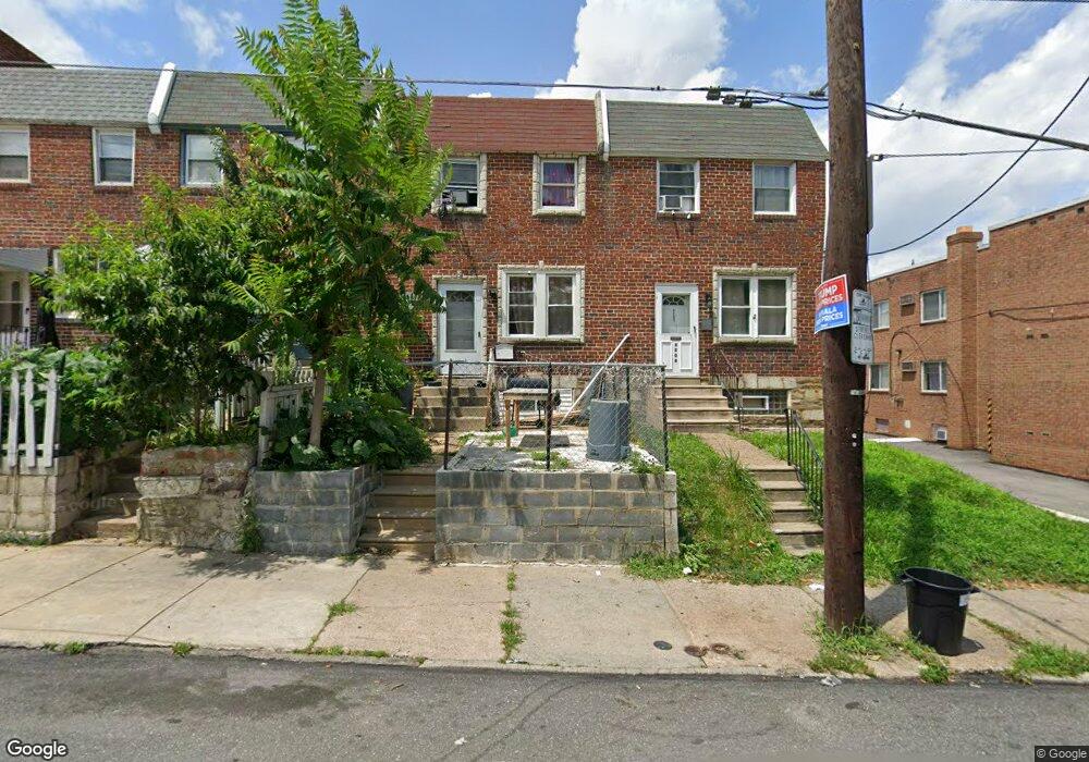
8206 Frankford Ave Philadelphia, PA 19136
Holmesburg NeighborhoodEstimated Value: $172,000 - $256,000
3
Beds
1
Bath
1,126
Sq Ft
$196/Sq Ft
Est. Value
About This Home
This home is located at 8206 Frankford Ave, Philadelphia, PA 19136 and is currently estimated at $220,412, approximately $195 per square foot. 8206 Frankford Ave is a home located in Philadelphia County with nearby schools including Lincoln High School, Joseph H. Brown School, and Meehan Austin Middle School.
Ownership History
Date
Name
Owned For
Owner Type
Purchase Details
Closed on
Jul 1, 2008
Sold by
Rubis Vlad and Rubis Irina
Bought by
Ceylan Halil
Current Estimated Value
Purchase Details
Closed on
Jun 28, 2004
Sold by
Bruse Rosa
Bought by
Rubis Vladimir and Rubis Irine
Home Financials for this Owner
Home Financials are based on the most recent Mortgage that was taken out on this home.
Original Mortgage
$72,980
Interest Rate
6.01%
Mortgage Type
Purchase Money Mortgage
Create a Home Valuation Report for This Property
The Home Valuation Report is an in-depth analysis detailing your home's value as well as a comparison with similar homes in the area
Home Values in the Area
Average Home Value in this Area
Purchase History
| Date | Buyer | Sale Price | Title Company |
|---|---|---|---|
| Ceylan Halil | $92,000 | None Available | |
| Rubis Vladimir | $82,000 | -- |
Source: Public Records
Mortgage History
| Date | Status | Borrower | Loan Amount |
|---|---|---|---|
| Previous Owner | Rubis Vladimir | $72,980 |
Source: Public Records
Tax History Compared to Growth
Tax History
| Year | Tax Paid | Tax Assessment Tax Assessment Total Assessment is a certain percentage of the fair market value that is determined by local assessors to be the total taxable value of land and additions on the property. | Land | Improvement |
|---|---|---|---|---|
| 2025 | $2,209 | $196,300 | $39,260 | $157,040 |
| 2024 | $2,209 | $196,300 | $39,260 | $157,040 |
| 2023 | $2,209 | $157,800 | $31,560 | $126,240 |
| 2022 | $1,733 | $157,800 | $31,560 | $126,240 |
| 2021 | $1,733 | $0 | $0 | $0 |
| 2020 | $1,733 | $0 | $0 | $0 |
| 2019 | $1,678 | $0 | $0 | $0 |
| 2018 | $1,659 | $0 | $0 | $0 |
| 2017 | $1,659 | $0 | $0 | $0 |
| 2016 | $1,643 | $0 | $0 | $0 |
| 2015 | $1,588 | $0 | $0 | $0 |
| 2014 | -- | $118,500 | $26,631 | $91,869 |
| 2012 | -- | $12,544 | $1,487 | $11,057 |
Source: Public Records
Map
Nearby Homes
- 3526 Welsh Rd
- 4128 Welsh Rd
- 8072 Erdrick St
- 3427 Arthur St
- 3420 Arthur St
- 8056 Erdrick St
- 4243 Mill St
- 8330 Cottage St
- 8053 Charles St
- 4228 Rhawn St
- 8011 Crispin St
- 8209 Rowland Ave
- 8419 Jackson St
- 4622 Wilbrock St
- 8030 Ditman St Unit 88P
- 8030 Ditman St Unit 134X
- 4016 Decatur St
- 4635 Kraydor St
- 4636 Kraydor St
- 4312 Rhawn St
- 8204 Frankford Ave
- 8208 Frankford Ave
- 8202 Frankford Ave
- 3627 Stanwood St
- 3625 Stanwood St
- 3623 Stanwood St
- 3621 Stanwood St
- 3619 Stanwood St
- 3617 Stanwood St
- 3615 Stanwood St
- 3613 Stanwood St
- 8201 Frankford Ave Unit 5
- 8211 Craig St
- 8213 Craig St
- 8215 Craig St
- 8135 Frankford Ave
- 8201 Craig St
- 8207 Craig St
- 8209 Craig St
- 8205 Craig St