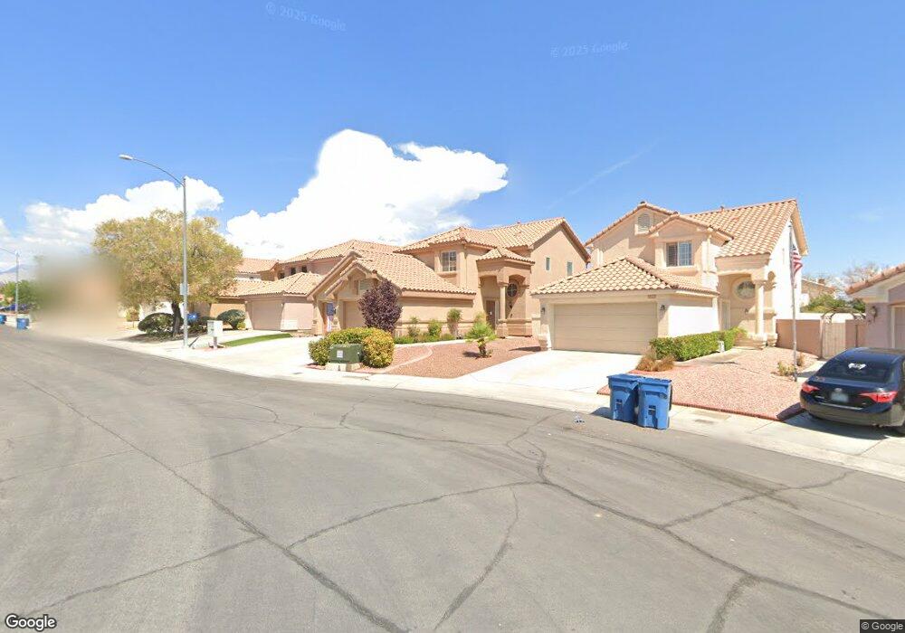
8208 Maplestar Rd Las Vegas, NV 89128
Angel Park NeighborhoodEstimated Value: $428,978 - $446,000
3
Beds
3
Baths
1,636
Sq Ft
$267/Sq Ft
Est. Value
About This Home
This home is located at 8208 Maplestar Rd, Las Vegas, NV 89128 and is currently estimated at $436,995, approximately $267 per square foot. 8208 Maplestar Rd is a home located in Clark County with nearby schools including James B. McMillan Elementary School, Edythe & Lloyd Katz Elementary School, and Walter Johnson Junior High School Academy of International Studies.
Ownership History
Date
Name
Owned For
Owner Type
Purchase Details
Closed on
Feb 10, 1997
Sold by
Varrato Bennett Kelli Ann and Bennett Richard J
Bought by
Jones Thomas B and Jones Suzanne M
Current Estimated Value
Home Financials for this Owner
Home Financials are based on the most recent Mortgage that was taken out on this home.
Original Mortgage
$123,364
Outstanding Balance
$14,376
Interest Rate
7.9%
Mortgage Type
FHA
Estimated Equity
$422,619
Create a Home Valuation Report for This Property
The Home Valuation Report is an in-depth analysis detailing your home's value as well as a comparison with similar homes in the area
Home Values in the Area
Average Home Value in this Area
Purchase History
| Date | Buyer | Sale Price | Title Company |
|---|---|---|---|
| Jones Thomas B | $126,000 | National Title Company |
Source: Public Records
Mortgage History
| Date | Status | Borrower | Loan Amount |
|---|---|---|---|
| Open | Jones Thomas B | $123,364 |
Source: Public Records
Tax History Compared to Growth
Tax History
| Year | Tax Paid | Tax Assessment Tax Assessment Total Assessment is a certain percentage of the fair market value that is determined by local assessors to be the total taxable value of land and additions on the property. | Land | Improvement |
|---|---|---|---|---|
| 2025 | $1,709 | $89,627 | $35,000 | $54,627 |
| 2024 | $1,659 | $89,627 | $35,000 | $54,627 |
| 2023 | $1,659 | $87,287 | $35,000 | $52,287 |
| 2022 | $1,611 | $74,527 | $26,600 | $47,927 |
| 2021 | $1,564 | $71,058 | $25,200 | $45,858 |
| 2020 | $1,516 | $70,106 | $24,500 | $45,606 |
| 2019 | $1,472 | $65,393 | $20,300 | $45,093 |
| 2018 | $1,429 | $60,272 | $16,800 | $43,472 |
| 2017 | $1,932 | $58,908 | $14,700 | $44,208 |
| 2016 | $1,354 | $57,762 | $13,300 | $44,462 |
| 2015 | $1,350 | $47,385 | $9,100 | $38,285 |
| 2014 | $1,311 | $38,773 | $7,350 | $31,423 |
Source: Public Records
Map
Nearby Homes
- 1236 Dusty Creek St
- 1308 Dusty Creek St
- 8128 Bay Springs Dr
- 1205 Dusty Creek St
- 8113 Bay Springs Dr
- 8125 Hercules Dr
- 8109 Sunset Mill Dr
- 8124 Kokoma Dr
- 1001 Padre Island St
- 8414 Elkington Ave
- 1505 Couples St
- 1512 Couples St
- 8141 Sickle Ln
- 8125 Rio de Janeiro Dr
- 901 Nevada Sky St
- 1516 Faldo St
- 8072 Cimarron Ridge Dr Unit 201
- 8029 Cherish Ave
- 8025 Cherish Ave
- 8005 Cetus Cir Unit 201
- 8204 Maplestar Rd
- 8212 Maplestar Rd
- 8216 Maplestar Rd
- 8200 Maplestar Rd
- 8220 Maplestar Rd
- 8220 Maplestar Rd
- 8261 Hercules Dr
- 8224 Maplestar Rd
- 8213 Maplestar Rd
- 8209 Maplestar Rd
- 1224 Barton Green Dr
- 1220 Barton Green Dr
- 8228 Maplestar Rd
- 8221 Maplestar Rd
- 8257 Hercules Dr
- 8236 Carmen Blvd
- 8236 Carmen Blvd
- 1216 Barton Green Dr
- 8225 Maplestar Rd
- 8260 Hercules Dr