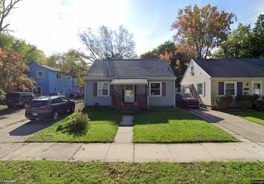
821 Poxson Ave Lansing, MI 48910
Greencroft Park NeighborhoodEstimated Value: $153,021 - $165,000
--
Bed
--
Bath
1,391
Sq Ft
$114/Sq Ft
Est. Value
About This Home
This home is located at 821 Poxson Ave, Lansing, MI 48910 and is currently estimated at $158,005, approximately $113 per square foot. 821 Poxson Ave is a home located in Ingham County with nearby schools including Averill Elementary School, Attwood School, and J.W. Sexton High School.
Ownership History
Date
Name
Owned For
Owner Type
Purchase Details
Closed on
Dec 20, 2022
Sold by
Davis Joseph
Bought by
821 Poxson Llc
Current Estimated Value
Home Financials for this Owner
Home Financials are based on the most recent Mortgage that was taken out on this home.
Original Mortgage
$79,750
Outstanding Balance
$77,204
Interest Rate
6.61%
Mortgage Type
Credit Line Revolving
Estimated Equity
$80,801
Purchase Details
Closed on
May 11, 2017
Sold by
Smith Johnnie S and Hayes Deena D
Bought by
Davis Joseph
Purchase Details
Closed on
Apr 4, 2002
Sold by
Willert Kenneth L and Willert Patricia S
Bought by
Willert Kenneth L and Willert Patricia S
Create a Home Valuation Report for This Property
The Home Valuation Report is an in-depth analysis detailing your home's value as well as a comparison with similar homes in the area
Home Values in the Area
Average Home Value in this Area
Purchase History
| Date | Buyer | Sale Price | Title Company |
|---|---|---|---|
| 821 Poxson Llc | -- | -- | |
| Davis Joseph | $25,000 | Transation Title Ag | |
| Willert Kenneth L | -- | -- |
Source: Public Records
Mortgage History
| Date | Status | Borrower | Loan Amount |
|---|---|---|---|
| Open | 821 Poxson Llc | $79,750 |
Source: Public Records
Tax History Compared to Growth
Tax History
| Year | Tax Paid | Tax Assessment Tax Assessment Total Assessment is a certain percentage of the fair market value that is determined by local assessors to be the total taxable value of land and additions on the property. | Land | Improvement |
|---|---|---|---|---|
| 2025 | $5,227 | $75,300 | $5,700 | $69,600 |
| 2024 | $44 | $69,000 | $5,700 | $63,300 |
| 2023 | $5,116 | $60,100 | $5,700 | $54,400 |
| 2022 | $3,617 | $55,100 | $7,200 | $47,900 |
| 2021 | $3,533 | $51,200 | $7,000 | $44,200 |
| 2020 | $4,446 | $46,200 | $7,000 | $39,200 |
| 2019 | $6,290 | $43,000 | $7,000 | $36,000 |
| 2018 | $3,334 | $42,500 | $7,000 | $35,500 |
| 2017 | $2,278 | $42,500 | $7,000 | $35,500 |
| 2016 | $2,178 | $41,700 | $7,000 | $34,700 |
| 2015 | $2,178 | $39,900 | $14,010 | $25,890 |
| 2014 | $2,178 | $38,700 | $14,010 | $24,690 |
Source: Public Records
Map
Nearby Homes
- 2112 Stirling Ave
- 2310 Stirling Ave
- 2313 S Rundle Ave
- 815 Woodbine Ave
- 907 Lenore Ave
- 2421 Stirling Ave
- 1913 Stirling Ave
- 712 Lenore Ave
- 1032 Kelsey Ave
- 2515 S Martin Luther King Junior Blvd
- 1120 Kelsey Ave
- 2011 Osband Ave
- 1836 Osband Ave
- 2118 Marion Ave
- 511 W Mount Hope Ave
- 1114 Goodrich St
- 1721 Fletcher St
- 1116 George St
- 917 W Barnes Ave
- 1312 W Mount Hope Ave