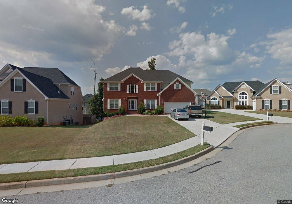
821 Rock Ln Unit /127 McDonough, GA 30253
Estimated Value: $430,217 - $486,000
5
Beds
4
Baths
3,830
Sq Ft
$117/Sq Ft
Est. Value
About This Home
This home is located at 821 Rock Ln Unit /127, McDonough, GA 30253 and is currently estimated at $446,554, approximately $116 per square foot. 821 Rock Ln Unit /127 is a home located in Henry County with nearby schools including Union Grove Middle School, Union Grove High School, and Hickory Flat Elementary School.
Ownership History
Date
Name
Owned For
Owner Type
Purchase Details
Closed on
Jul 14, 2025
Sold by
Linda Alexander Trust
Bought by
Alexander Linda Trust and Linda Alexander Trust
Current Estimated Value
Purchase Details
Closed on
Nov 12, 2019
Sold by
The Bank Of New York Mellon
Bought by
Alexander Linda
Purchase Details
Closed on
Nov 4, 2014
Sold by
Patel Bharat B
Bought by
The Bank Of New York Mellon Tr
Purchase Details
Closed on
Feb 28, 2005
Sold by
Oxford Homes Inc
Bought by
Patel Bharat B
Home Financials for this Owner
Home Financials are based on the most recent Mortgage that was taken out on this home.
Original Mortgage
$288,300
Interest Rate
5.6%
Mortgage Type
New Conventional
Create a Home Valuation Report for This Property
The Home Valuation Report is an in-depth analysis detailing your home's value as well as a comparison with similar homes in the area
Home Values in the Area
Average Home Value in this Area
Purchase History
| Date | Buyer | Sale Price | Title Company |
|---|---|---|---|
| Alexander Linda Trust | -- | -- | |
| Alexander Linda | $212,625 | -- | |
| The Bank Of New York Mellon Tr | $199,750 | -- | |
| Patel Bharat B | $360,400 | -- |
Source: Public Records
Mortgage History
| Date | Status | Borrower | Loan Amount |
|---|---|---|---|
| Previous Owner | Patel Bharat B | $288,300 |
Source: Public Records
Tax History Compared to Growth
Tax History
| Year | Tax Paid | Tax Assessment Tax Assessment Total Assessment is a certain percentage of the fair market value that is determined by local assessors to be the total taxable value of land and additions on the property. | Land | Improvement |
|---|---|---|---|---|
| 2025 | $8,332 | $208,160 | $18,000 | $190,160 |
| 2024 | $8,332 | $194,000 | $18,000 | $176,000 |
| 2023 | $7,700 | $186,440 | $16,000 | $170,440 |
| 2022 | $6,253 | $157,920 | $12,000 | $145,920 |
| 2021 | $4,803 | $119,840 | $12,000 | $107,840 |
| 2020 | $3,481 | $85,080 | $6,892 | $78,188 |
| 2019 | $4,643 | $116,800 | $10,000 | $106,800 |
| 2018 | $4,474 | $112,360 | $10,000 | $102,360 |
| 2016 | $2,996 | $73,840 | $7,200 | $66,640 |
| 2015 | $562 | $73,840 | $7,200 | $66,640 |
| 2014 | $2,676 | $73,840 | $7,200 | $66,640 |
Source: Public Records
Map
Nearby Homes
- 796 Rock Ln
- 248 Brannans Walk
- 209 Brannans Walk
- 153 Rockport Dr
- 152 Rockport Dr
- 214 Kensington Trace
- 200 Kensington Trace
- 228 Kensington Trace
- 401 Crosshaven Way
- 129 Talon Place
- 212 Himalaya Way
- 248 Cranapple Ln
- 146 Himalaya Way
- 236 Himalaya Way
- 479 Crosshaven Way
- 1008 Carlyle Place
- 72 Contour Dr
- 1150 Strath Clyde Way
- 104 Riverside Close
- 1125 Strath Clyde Way
- 821 Rock Ln Unit 1
- 817 Rock Ln
- 825 Rock Ln Unit 1
- 825 Rock Ln Unit / 126
- S Rock Ln Unit / 126
- 908 Needletop Ct
- 904 Needletop Ct
- 912 Needletop Ct
- 829 Rock Ln
- 829 Rock Ln Unit 1
- 813 Rock Ln
- 809 Rock Ln Unit 1
- 916 Needletop Ct
- 916 Needletop Ct Unit 1
- 819 Rock Ln
- 880 Rock Ln Unit 1
- 872 Rock Ln
- 868 Rock Ln
- 805 Rock Ln
- 805 Rock Ln Unit 1