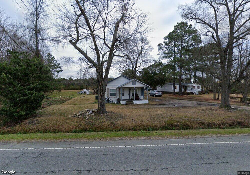
821 Taylors Bridge Hwy Clinton, NC 28328
Estimated Value: $79,448 - $144,000
2
Beds
1
Bath
936
Sq Ft
$129/Sq Ft
Est. Value
About This Home
This home is located at 821 Taylors Bridge Hwy, Clinton, NC 28328 and is currently estimated at $121,112, approximately $129 per square foot. 821 Taylors Bridge Hwy is a home located in Sampson County with nearby schools including Union Elementary School, Union Intermediate School, and Union Middle School.
Ownership History
Date
Name
Owned For
Owner Type
Purchase Details
Closed on
Jul 11, 2023
Sold by
Edwards Patricia Anne
Bought by
Chavez Serafin
Current Estimated Value
Purchase Details
Closed on
Aug 24, 2005
Sold by
Bryant William G and Bryant Marlene H
Bought by
Edwards Patricia and Edwards Joseph
Home Financials for this Owner
Home Financials are based on the most recent Mortgage that was taken out on this home.
Original Mortgage
$51,000
Interest Rate
9.4%
Mortgage Type
Adjustable Rate Mortgage/ARM
Create a Home Valuation Report for This Property
The Home Valuation Report is an in-depth analysis detailing your home's value as well as a comparison with similar homes in the area
Home Values in the Area
Average Home Value in this Area
Purchase History
| Date | Buyer | Sale Price | Title Company |
|---|---|---|---|
| Chavez Serafin | -- | None Listed On Document | |
| Edwards Patricia | $56,000 | -- |
Source: Public Records
Mortgage History
| Date | Status | Borrower | Loan Amount |
|---|---|---|---|
| Previous Owner | Edwards Patricia | $51,000 |
Source: Public Records
Tax History Compared to Growth
Tax History
| Year | Tax Paid | Tax Assessment Tax Assessment Total Assessment is a certain percentage of the fair market value that is determined by local assessors to be the total taxable value of land and additions on the property. | Land | Improvement |
|---|---|---|---|---|
| 2025 | $417 | $53,061 | $29,836 | $23,225 |
| 2024 | $374 | $53,061 | $29,836 | $23,225 |
| 2023 | $387 | $41,856 | $25,944 | $15,912 |
| 2022 | $387 | $41,856 | $25,944 | $15,912 |
| 2021 | $387 | $41,856 | $25,944 | $15,912 |
| 2020 | $387 | $41,856 | $25,944 | $15,912 |
| 2019 | $387 | $41,856 | $0 | $0 |
| 2018 | $326 | $35,265 | $0 | $0 |
| 2017 | $326 | $35,265 | $0 | $0 |
| 2016 | $328 | $35,265 | $0 | $0 |
| 2015 | $328 | $35,265 | $0 | $0 |
| 2014 | $326 | $35,265 | $0 | $0 |
Source: Public Records
Map
Nearby Homes
- 865 Cecil Odie Rd
- 2228 Indian Town Rd
- 500 Rowan Rd
- 0 Reedsford Rd
- 471 John Mark Rd
- 2153 Rowan Rd
- 1206 Southwest Blvd
- 1116 Phillips St
- 393 Moltonville Rd
- 112 Martin Luther King Junior Blvd
- 110 Martin Luther King Junior Blvd
- 111 Colonial Dr
- 603 Pine St
- 0 Boykin Bridge Rd
- 1 Boykin Bridge Rd
- Off of Reedsford Rd Unit LotWP001
- 0 Moltonville Rd
- 107 Miami St
- 335 Sprunt Dr
- 114 Eastover Ave
- 877 Taylors Bridge Hwy
- 804 Taylors Bridge Hwy
- 730 Taylors Bridge Hwy
- 900 Taylors Bridge Hwy
- 217 Cecil Odie Rd
- 946 Taylors Bridge Hwy
- 655 Taylors Bridge Hwy
- 654 Taylors Bridge Hwy
- 206 Cecil Odie Rd
- 4 Cecil-Odie Rd
- 4 Cecil-Odie Rd
- 620 Taylors Bridge Hwy
- 499 Cecil Odie Rd
- 278 Cecil Odie Rd
- 566 Taylors Bridge Hwy
- 370 Cecil Odie Rd
- 380 Cecil Odie Rd
- 1165 Taylors Bridge Hwy
- 1200 Taylors Bridge Hwy
- 1170 Taylors Bridge Hwy