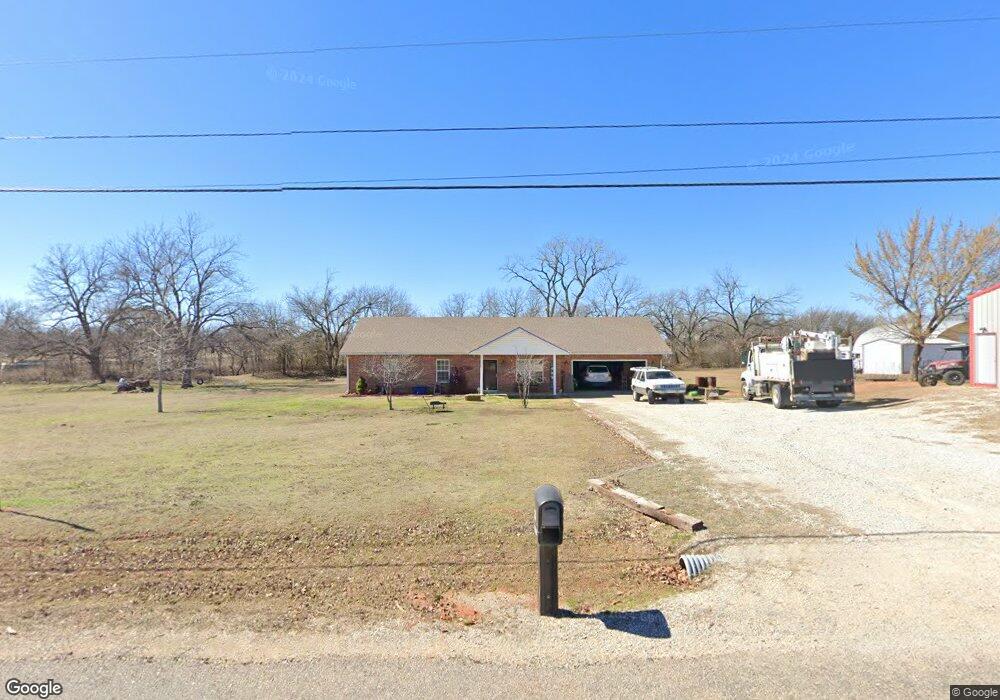
8210 N Bryan Rd Shawnee, OK 74804
Estimated Value: $237,000 - $286,000
3
Beds
2
Baths
1,380
Sq Ft
$185/Sq Ft
Est. Value
About This Home
This home is located at 8210 N Bryan Rd, Shawnee, OK 74804 and is currently estimated at $255,663, approximately $185 per square foot. 8210 N Bryan Rd is a home with nearby schools including Family Of Faith Christian School.
Ownership History
Date
Name
Owned For
Owner Type
Purchase Details
Closed on
May 15, 2013
Sold by
Qualls Jason D and Qualls Autumn N
Bought by
Howell Tommy and Howell Deborah
Current Estimated Value
Home Financials for this Owner
Home Financials are based on the most recent Mortgage that was taken out on this home.
Original Mortgage
$141,179
Outstanding Balance
$99,716
Interest Rate
3.56%
Mortgage Type
FHA
Estimated Equity
$155,947
Purchase Details
Closed on
Dec 8, 2005
Sold by
Grace R E and Grace Virginia L
Bought by
Gorgas Jennifer L
Home Financials for this Owner
Home Financials are based on the most recent Mortgage that was taken out on this home.
Original Mortgage
$97,748
Interest Rate
6.29%
Mortgage Type
Purchase Money Mortgage
Create a Home Valuation Report for This Property
The Home Valuation Report is an in-depth analysis detailing your home's value as well as a comparison with similar homes in the area
Purchase History
| Date | Buyer | Sale Price | Title Company |
|---|---|---|---|
| Howell Tommy | $143,000 | First American Title | |
| Gorgas Jennifer L | $10,500 | A & G Title & Closing |
Source: Public Records
Mortgage History
| Date | Status | Borrower | Loan Amount |
|---|---|---|---|
| Open | Howell Tommy | $141,179 | |
| Previous Owner | Gorgas Jennifer L | $97,748 |
Source: Public Records
Tax History
| Year | Tax Paid | Tax Assessment Tax Assessment Total Assessment is a certain percentage of the fair market value that is determined by local assessors to be the total taxable value of land and additions on the property. | Land | Improvement |
|---|---|---|---|---|
| 2025 | $2,272 | $20,955 | $1,002 | $19,953 |
| 2023 | $2,220 | $20,345 | $973 | $19,372 |
| 2022 | $2,194 | $20,345 | $973 | $19,372 |
| 2021 | $2,260 | $20,345 | $973 | $19,372 |
| 2020 | $2,093 | $18,651 | $973 | $17,678 |
| 2019 | $2,102 | $18,855 | $973 | $17,882 |
| 2018 | $2,024 | $18,777 | $973 | $17,804 |
| 2017 | $1,966 | $18,230 | $973 | $17,257 |
| 2016 | $1,572 | $17,699 | $973 | $16,726 |
| 2015 | $1,521 | $17,184 | $973 | $16,211 |
| 2014 | $1,518 | $17,152 | $973 | $16,179 |
Source: Public Records
Map
Nearby Homes
- 43189 Prairie Ranch Rd
- 43067 Wagon Trail
- 43172 Prairie Ranch Rd
- 43142 Prairie Ranch Rd
- 43201 Prairie Ranch Rd
- 43088 Green Grass Cir
- 43153 Prairie Ranch Rd
- 43159 Prairie Ranch Rd
- 43165 Prairie Ranch Rd
- 43171 Prairie Ranch Rd
- 43177 Prairie Ranch Rd
- 43107 Wagon Trail
- 43259 Prairie Ranch Rd
- 23 Lake Ln
- 43304 Belle Brook Cir
- 0 Carmin Dr
- 43304 Moccasin Trail Rd
- 42829 Garrett's Lake Rd
- 42773 Garrett's Lake Rd
- 43249 Garrett's Lake Rd
- 8330 N Bryan Ave
- 8406 N Bryan Rd
- 103 Prairie Ln
- 43076 Wagon Trail
- 43084 Wagon Trail
- 8607 Bryan Rd
- 4 Lake Ln
- 43091 Wagon Trail
- 43092 Wagon Trail
- 43256 Prairie Ranch Rd
- 43238 Prairie Ranch Rd
- 43244 Prairie Ranch Rd
- 43315 Prairie Ranch Rd
- 43314 Prairie Ranch Rd
- 43218 Prairie Ranch Rd
- 5 Lake Ln
- 9 Lake Ln
- 43100 Wagon Trail
- 42711 Wolverine Rd
- 6 Lake Ln
Your Personal Tour Guide
Ask me questions while you tour the home.