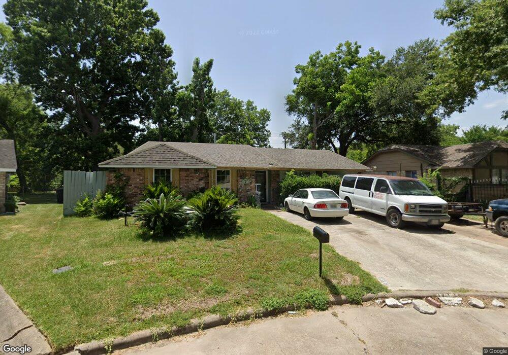
8211 Ponnel Ln Houston, TX 77088
Acres Homes NeighborhoodEstimated Value: $192,087 - $213,000
3
Beds
2
Baths
1,320
Sq Ft
$152/Sq Ft
Est. Value
About This Home
This home is located at 8211 Ponnel Ln, Houston, TX 77088 and is currently estimated at $201,022, approximately $152 per square foot. 8211 Ponnel Ln is a home located in Harris County with nearby schools including Osborne Elementary School, Williams Middle, and Booker T Washington Sr High.
Ownership History
Date
Name
Owned For
Owner Type
Purchase Details
Closed on
May 26, 2011
Sold by
Lsf6 Mercury Reo Investments Trust Serie
Bought by
Condado Joel and Chavez Juana
Current Estimated Value
Purchase Details
Closed on
Jan 10, 2011
Sold by
Sims John Andrew
Bought by
Lsf6 Mercury Reo Investments Trust Serie
Purchase Details
Closed on
Feb 26, 2007
Sold by
Jackson Craig A and Gragg Jacqueline R
Bought by
Sims John A
Purchase Details
Closed on
Feb 15, 2006
Sold by
Jackson Craig A and Gragg Jacqueline R
Bought by
Sims John A
Create a Home Valuation Report for This Property
The Home Valuation Report is an in-depth analysis detailing your home's value as well as a comparison with similar homes in the area
Home Values in the Area
Average Home Value in this Area
Purchase History
| Date | Buyer | Sale Price | Title Company |
|---|---|---|---|
| Condado Joel | -- | First American Title | |
| Lsf6 Mercury Reo Investments Trust Serie | $42,019 | None Available | |
| Sims John A | -- | Stewart Title Company | |
| Sims John A | -- | Stewart Title Co |
Source: Public Records
Tax History Compared to Growth
Tax History
| Year | Tax Paid | Tax Assessment Tax Assessment Total Assessment is a certain percentage of the fair market value that is determined by local assessors to be the total taxable value of land and additions on the property. | Land | Improvement |
|---|---|---|---|---|
| 2025 | $1,766 | $183,784 | $69,394 | $114,390 |
| 2024 | $1,766 | $172,049 | $69,394 | $102,655 |
| 2023 | $1,766 | $142,828 | $69,394 | $73,434 |
| 2022 | $2,968 | $134,815 | $53,622 | $81,193 |
| 2021 | $2,591 | $111,177 | $31,543 | $79,634 |
| 2020 | $2,434 | $100,515 | $28,388 | $72,127 |
| 2019 | $2,384 | $94,198 | $28,388 | $65,810 |
| 2018 | $1,809 | $71,492 | $14,194 | $57,298 |
| 2017 | $1,808 | $71,492 | $14,194 | $57,298 |
| 2016 | $1,808 | $71,492 | $14,194 | $57,298 |
| 2015 | $1,272 | $67,744 | $14,194 | $53,550 |
| 2014 | $1,272 | $49,500 | $14,194 | $35,306 |
Source: Public Records
Map
Nearby Homes
- 8602 De Priest St
- 0 Marcolin St
- 905 Ferguson Way
- 907 Ferguson Way
- 8314 De Priest St
- 854 Junell St
- 958 Conklin St
- 0 Grenshaw
- 8324 Williamsdell St
- 8322 Williamsdell St
- 8320 Williamsdell St
- 8310 Williamsdell St
- 769 Marjorie St
- 934 South Ln
- 936 - A&B South Ln
- 0 Marjorie
- 954A Junell St
- 1314 Tarberry Rd
- 830 Ringold St
- 958 Ringold St
- 8215 Ponnel Ln
- 8207 Ponnel Ln
- 8514 De Priest St Unit A and B
- 8219 Ponnel Ln
- 8202 Ponnel Ln
- 8522 De Priest St
- 8223 Ponnel Ln
- 8214 Ponnel Ln
- 8210 Ponnel Ln
- 8206 Ponnel Ln
- 8218 Ponnel Ln
- 8227 Ponnel Ln
- 901 Conklin St
- 902 Randolph St
- 8606 De Priest St
- 8211 Modley Ct
- 8215 Modley Ct
- 8231 Ponnel Ln
- 8207 Modley Ct
- 890 Conklin St