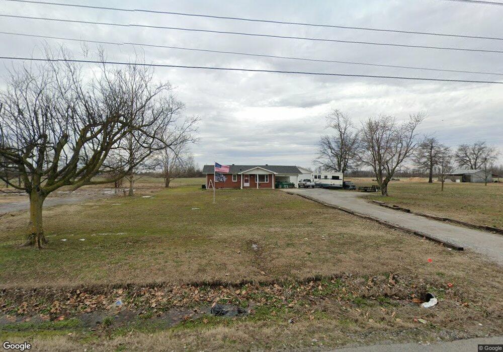
8213 W Highway 62 Bertrand, MO 63823
Estimated Value: $114,000 - $142,000
3
Beds
--
Bath
1,216
Sq Ft
$103/Sq Ft
Est. Value
About This Home
This home is located at 8213 W Highway 62, Bertrand, MO 63823 and is currently estimated at $124,684, approximately $102 per square foot. 8213 W Highway 62 is a home with nearby schools including Warren E. Hearnes Elementary School, Charleston Middle School, and Charleston High School.
Ownership History
Date
Name
Owned For
Owner Type
Purchase Details
Closed on
Mar 19, 2021
Sold by
Michael Laszewski Michael D and Michael Rana R
Bought by
Calvert Patricia A
Current Estimated Value
Home Financials for this Owner
Home Financials are based on the most recent Mortgage that was taken out on this home.
Original Mortgage
$77,077
Outstanding Balance
$68,816
Interest Rate
2.73%
Mortgage Type
FHA
Estimated Equity
$55,868
Purchase Details
Closed on
Aug 15, 2010
Sold by
Roy Roy and Sheard Leroy
Bought by
Laszewski Mike and Beasley Charles
Purchase Details
Closed on
Jan 31, 2008
Sold by
King Walter P and King Barbara L
Bought by
Laszewski Michael D and Laszewski Rana R
Create a Home Valuation Report for This Property
The Home Valuation Report is an in-depth analysis detailing your home's value as well as a comparison with similar homes in the area
Home Values in the Area
Average Home Value in this Area
Purchase History
| Date | Buyer | Sale Price | Title Company |
|---|---|---|---|
| Calvert Patricia A | $77,847 | None Listed On Document | |
| Laszewski Mike | -- | -- | |
| Laszewski Michael D | -- | -- |
Source: Public Records
Mortgage History
| Date | Status | Borrower | Loan Amount |
|---|---|---|---|
| Open | Calvert Patricia A | $77,077 |
Source: Public Records
Tax History Compared to Growth
Tax History
| Year | Tax Paid | Tax Assessment Tax Assessment Total Assessment is a certain percentage of the fair market value that is determined by local assessors to be the total taxable value of land and additions on the property. | Land | Improvement |
|---|---|---|---|---|
| 2025 | $684 | $14,440 | $0 | $0 |
| 2024 | $658 | $13,930 | $0 | $0 |
| 2023 | $659 | $13,930 | $0 | $0 |
| 2022 | $621 | $13,130 | $0 | $0 |
| 2021 | $624 | $13,130 | $0 | $0 |
| 2020 | $624 | $13,210 | $0 | $0 |
| 2019 | $613 | $13,210 | $0 | $0 |
| 2018 | $590 | $12,670 | $0 | $0 |
| 2016 | $0 | $12,670 | $0 | $12,670 |
| 2011 | $524 | $12,070 | $0 | $0 |
Source: Public Records
Map
Nearby Homes
- 78 Little John
- 1394 County Road 538
- 224 S Interstate Dr
- 608 State Highway H
- 0 Mo-Aa Unit MAR25029644
- 101 E Cedar St
- 306 Cravens St
- 211 E Elm St
- 0 County Hwy 544 Unit MAR25013765
- 503 Rodgers St
- 114 Norval Ave
- 209 Russell Ave
- 203 Russell Ave
- 2005 Indiana Ave
- 405 Pam St
- 327 Illinois Ave
- 109 Andrea St
- 0 Ables Rd
- 219 Petroleum St
- 402 Aster