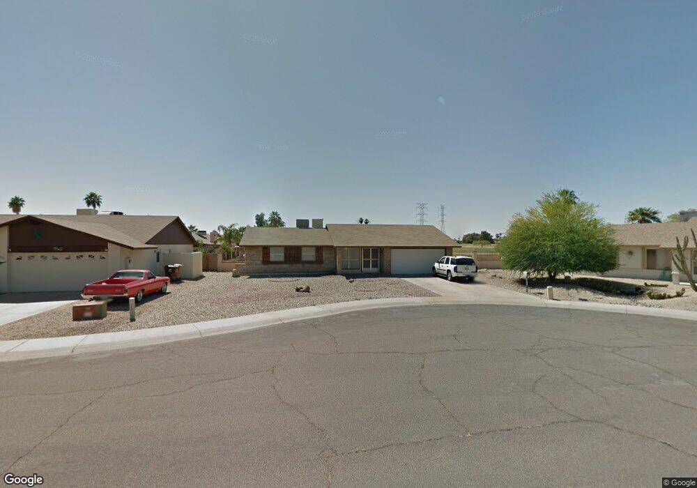
8216 N 103rd Dr Peoria, AZ 85345
Estimated Value: $299,195 - $363,000
--
Bed
2
Baths
1,243
Sq Ft
$276/Sq Ft
Est. Value
About This Home
This home is located at 8216 N 103rd Dr, Peoria, AZ 85345 and is currently estimated at $343,549, approximately $276 per square foot. 8216 N 103rd Dr is a home located in Maricopa County with nearby schools including Country Meadows Elementary School, Raymond S. Kellis, and Brighton Charter School.
Ownership History
Date
Name
Owned For
Owner Type
Purchase Details
Closed on
Jul 20, 2021
Sold by
Stone Linda C
Bought by
Stone Danny Lee and Stone Linda C
Current Estimated Value
Home Financials for this Owner
Home Financials are based on the most recent Mortgage that was taken out on this home.
Original Mortgage
$137,000
Interest Rate
2.96%
Mortgage Type
New Conventional
Purchase Details
Closed on
Mar 19, 2019
Sold by
Stone Linda C and Farran John W
Bought by
Stone Linda C
Create a Home Valuation Report for This Property
The Home Valuation Report is an in-depth analysis detailing your home's value as well as a comparison with similar homes in the area
Home Values in the Area
Average Home Value in this Area
Purchase History
| Date | Buyer | Sale Price | Title Company |
|---|---|---|---|
| Stone Danny Lee | -- | Driggs Title Agency Inc | |
| Stone Linda C | -- | None Available |
Source: Public Records
Mortgage History
| Date | Status | Borrower | Loan Amount |
|---|---|---|---|
| Closed | Stone Danny Lee | $137,000 |
Source: Public Records
Tax History Compared to Growth
Tax History
| Year | Tax Paid | Tax Assessment Tax Assessment Total Assessment is a certain percentage of the fair market value that is determined by local assessors to be the total taxable value of land and additions on the property. | Land | Improvement |
|---|---|---|---|---|
| 2025 | $822 | $10,555 | -- | -- |
| 2024 | $809 | $10,052 | -- | -- |
| 2023 | $809 | $25,670 | $5,130 | $20,540 |
| 2022 | $792 | $19,800 | $3,960 | $15,840 |
| 2021 | $848 | $17,510 | $3,500 | $14,010 |
| 2020 | $856 | $16,380 | $3,270 | $13,110 |
| 2019 | $899 | $14,600 | $2,920 | $11,680 |
| 2018 | $801 | $13,080 | $2,610 | $10,470 |
| 2017 | $802 | $11,520 | $2,300 | $9,220 |
| 2016 | $794 | $10,400 | $2,080 | $8,320 |
| 2015 | $740 | $9,820 | $1,960 | $7,860 |
Source: Public Records
Map
Nearby Homes
- 10516 W Griswold Rd
- 8435 N 104th Dr Unit 3
- 8301 N 103rd Ave Unit 177
- 8301 N 103rd Ave Unit 53
- 8161 N 107th Ave Unit 109
- 10620 W Northern Ave Unit 5
- 10512 W Butler Dr
- 8131 N 107th Ave Unit 74
- 8131 N 107th Ave Unit 66
- 8131 N 107th Ave Unit 82
- 8101 N 107th Ave Unit 23
- 8140 N 107th Ave Unit 125
- 8140 N 107th Ave Unit 287
- 8140 N 107th Ave Unit 134
- 8601 N 103rd Ave Unit 313
- 8601 N 103rd Ave Unit 250
- 8601 N 103rd Ave Unit 271
- 8601 N 103rd Ave Unit 72
- 10603 W Ruth Ave
- 10512 W Ruth Ave
- 8212 N 103rd Dr
- 8220 N 103rd Dr
- 10316 W Griswold Rd
- 8208 N 103rd Dr
- 8219 N 103rd Dr
- 8215 N 103rd Dr
- 10320 W Griswold Rd
- 8211 N 103rd Dr
- 8207 N 103rd Dr
- 10326 W Griswold Rd Unit 4A
- 10313 W Griswold Rd
- 10309 W Griswold Rd
- 10330 W Griswold Rd
- 10317 W Griswold Rd
- 10321 W Griswold Rd
- 8201 N 103rd Dr
- 10325 W Griswold Rd
- 10334 W Griswold Rd
- 10310 W Royal Palm Rd
- 8121 N 103rd Dr