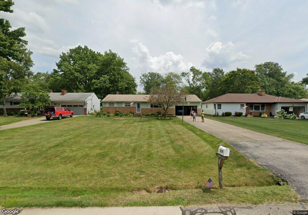
8219 Barbara Dr Strongsville, OH 44136
Estimated Value: $257,000 - $306,000
3
Beds
2
Baths
1,324
Sq Ft
$210/Sq Ft
Est. Value
About This Home
This home is located at 8219 Barbara Dr, Strongsville, OH 44136 and is currently estimated at $278,476, approximately $210 per square foot. 8219 Barbara Dr is a home located in Cuyahoga County with nearby schools including Strongsville High School, Bethel Christian Academy, and The Academy of St. Bartholomew.
Ownership History
Date
Name
Owned For
Owner Type
Purchase Details
Closed on
Feb 14, 1994
Sold by
Szoke Edward G and Szoke Jane C
Bought by
Szoke Jane C
Current Estimated Value
Purchase Details
Closed on
Apr 3, 1985
Sold by
Szoke Edward G and Szoke Jane C
Bought by
Szoke Edward G and Szoke Jane C
Purchase Details
Closed on
Jul 7, 1975
Sold by
Zak Joseph P and Zak Noreen A
Bought by
Szoke Edward G and Szoke Jane C
Purchase Details
Closed on
Jan 1, 1975
Bought by
Zak Joseph P and Zak Noreen A
Create a Home Valuation Report for This Property
The Home Valuation Report is an in-depth analysis detailing your home's value as well as a comparison with similar homes in the area
Home Values in the Area
Average Home Value in this Area
Purchase History
| Date | Buyer | Sale Price | Title Company |
|---|---|---|---|
| Szoke Jane C | -- | -- | |
| Szoke Edward G | -- | -- | |
| Szoke Edward G | $46,200 | -- | |
| Zak Joseph P | -- | -- |
Source: Public Records
Tax History Compared to Growth
Tax History
| Year | Tax Paid | Tax Assessment Tax Assessment Total Assessment is a certain percentage of the fair market value that is determined by local assessors to be the total taxable value of land and additions on the property. | Land | Improvement |
|---|---|---|---|---|
| 2024 | $3,668 | $87,920 | $15,820 | $72,100 |
| 2023 | $3,347 | $62,620 | $16,590 | $46,030 |
| 2022 | $3,349 | $62,620 | $16,590 | $46,030 |
| 2021 | $3,322 | $62,620 | $16,590 | $46,030 |
| 2020 | $3,057 | $52,610 | $13,930 | $38,680 |
| 2019 | $2,968 | $150,300 | $39,800 | $110,500 |
| 2018 | $2,638 | $52,610 | $13,930 | $38,680 |
| 2017 | $2,631 | $48,410 | $10,920 | $37,490 |
| 2016 | $2,610 | $48,410 | $10,920 | $37,490 |
| 2015 | $2,553 | $48,410 | $10,920 | $37,490 |
| 2014 | $2,553 | $47,010 | $10,610 | $36,400 |
Source: Public Records
Map
Nearby Homes
- 8761 Windfall Ct
- 13976 W Sprague Rd
- 12972 W Sprague Rd
- 14015 Byron Blvd
- 7664 Gerald Dr
- 12631 Pinebrook Dr
- 13541 Indian Creek Dr
- 7596 W 130th St
- 9531 Nicole Cir
- Buchanan Plan at The Enclave at Pine Lakes Crossing
- Belleville Plan at The Enclave at Pine Lakes Crossing
- 12721 Patricia Dr
- 12658 Gardenside Dr
- 7685 Saratoga Rd
- 7601 W 130th St
- 8963 Abbey Rd
- 14280 Pawnee Trail
- 14330 Pawnee Trail
- 7547 N Linden Ln
- 8981 Edgewood Dr
- 8175 Barbara Dr
- 8131 Barbara Dr
- 8269 Barbara Dr
- 8089 Barbara Dr
- 8174 Wesley Dr
- 8130 Wesley Dr
- 8218 Barbara Dr
- 13504 Wolf Dr
- 13464 Wolf Dr
- 8081 Barbara Dr
- 8260 Barbara Dr
- 8218 Wesley Dr
- 8174 Barbara Dr
- 13512 Wolf Dr
- 8088 Wesley Dr
- 13424 Wolf Dr
- 8130 Barbara Dr
- 8268 Barbara Dr
- 8260 Wesley Dr
- 13420 Wolf Dr