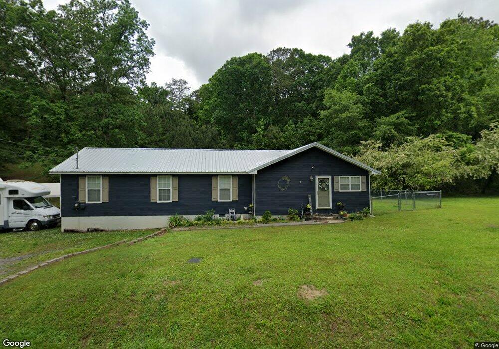
822 Bronco Rd La Fayette, GA 30728
Estimated Value: $158,000 - $193,000
--
Bed
1
Bath
920
Sq Ft
$193/Sq Ft
Est. Value
About This Home
This home is located at 822 Bronco Rd, La Fayette, GA 30728 and is currently estimated at $177,477, approximately $192 per square foot. 822 Bronco Rd is a home located in Walker County with nearby schools including Gilbert Elementary School, Lafayette Middle School, and Lafayette High School.
Ownership History
Date
Name
Owned For
Owner Type
Purchase Details
Closed on
Jul 19, 1994
Sold by
Mitchell Adam Lee and Mitchell Patricia
Bought by
Mitchell Adam Lee
Current Estimated Value
Purchase Details
Closed on
May 5, 1992
Sold by
Gilreath Faye M
Bought by
Mitchell Adam Lee and Mitchell Patricia
Purchase Details
Closed on
Feb 1, 1991
Sold by
Gilreath James M and Gilreath Faye
Bought by
Gilreath Faye M
Purchase Details
Closed on
Jan 23, 1987
Sold by
Jeanette M Mitchell
Bought by
Gilreath James M and Gilreath Faye
Purchase Details
Closed on
Mar 7, 1970
Bought by
Jeanette M Mitchell
Create a Home Valuation Report for This Property
The Home Valuation Report is an in-depth analysis detailing your home's value as well as a comparison with similar homes in the area
Home Values in the Area
Average Home Value in this Area
Purchase History
| Date | Buyer | Sale Price | Title Company |
|---|---|---|---|
| Mitchell Adam Lee | -- | -- | |
| Mitchell Adam Lee | $16,000 | -- | |
| Gilreath Faye M | -- | -- | |
| Gilreath James M | $20,000 | -- | |
| Jeanette M Mitchell | -- | -- |
Source: Public Records
Tax History Compared to Growth
Tax History
| Year | Tax Paid | Tax Assessment Tax Assessment Total Assessment is a certain percentage of the fair market value that is determined by local assessors to be the total taxable value of land and additions on the property. | Land | Improvement |
|---|---|---|---|---|
| 2024 | $1,432 | $66,171 | $12,523 | $53,648 |
| 2023 | $1,352 | $61,031 | $9,939 | $51,092 |
| 2022 | $1,186 | $49,068 | $4,394 | $44,674 |
| 2021 | $928 | $34,498 | $4,394 | $30,104 |
| 2020 | $844 | $30,180 | $4,394 | $25,786 |
| 2019 | $859 | $30,180 | $4,394 | $25,786 |
| 2018 | $799 | $30,180 | $4,394 | $25,786 |
| 2017 | $944 | $30,180 | $4,394 | $25,786 |
| 2016 | $820 | $30,180 | $4,394 | $25,786 |
| 2015 | $753 | $25,903 | $5,688 | $20,215 |
| 2014 | $668 | $25,903 | $5,688 | $20,215 |
| 2013 | -- | $25,902 | $5,688 | $20,214 |
Source: Public Records
Map
Nearby Homes
- 334 S Oakland Dr
- 300 Bronco Rd
- 308 Pledger Pkwy
- 1152 Magnolia St
- 0 Indiana St Unit 28 10583802
- 39 Cook St
- 1125 S Chattanooga St
- 100 Lake Terrace Dr
- Perry Plan at Lake Terrace
- Sullivan Plan at Lake Terrace
- Lewis Plan at Lake Terrace
- Curtis Plan at Lake Terrace
- Edmon Plan at Lake Terrace
- Wyeth Plan at Lake Terrace
- 1103 Sisemore St
- 221 Chota Cir
- 24605 Highway 193
- 908 Gilbert Ln
- 1122 S Chattanooga St
- 1002 Colerain St
- 762 Bronco Rd
- 884 Bronco Rd
- 885 Bronco Rd
- 915 Bronco Rd
- 863 Bronco Rd
- 703 Bronco Rd
- 944 Bronco Rd
- 1285 S Burnt Mill Rd
- 0 Stanfield Dr
- 584 Bronco Rd
- 1391 S Burnt Mill Rd
- 215 Brett Ln
- 1483 S Burnt Mill Rd
- 1 Stanfield Dr
- 1327 S Burnt Mill Rd
- 1327 S Burnt Mill Rd
- 1327 S Burnt Mill Rd
- 1327 S Burnt Mill Rd
- 573 Bronco Rd
- 978 Bronco Rd