Estimated Value: $382,000 - $422,000
3
Beds
2
Baths
2,350
Sq Ft
$171/Sq Ft
Est. Value
About This Home
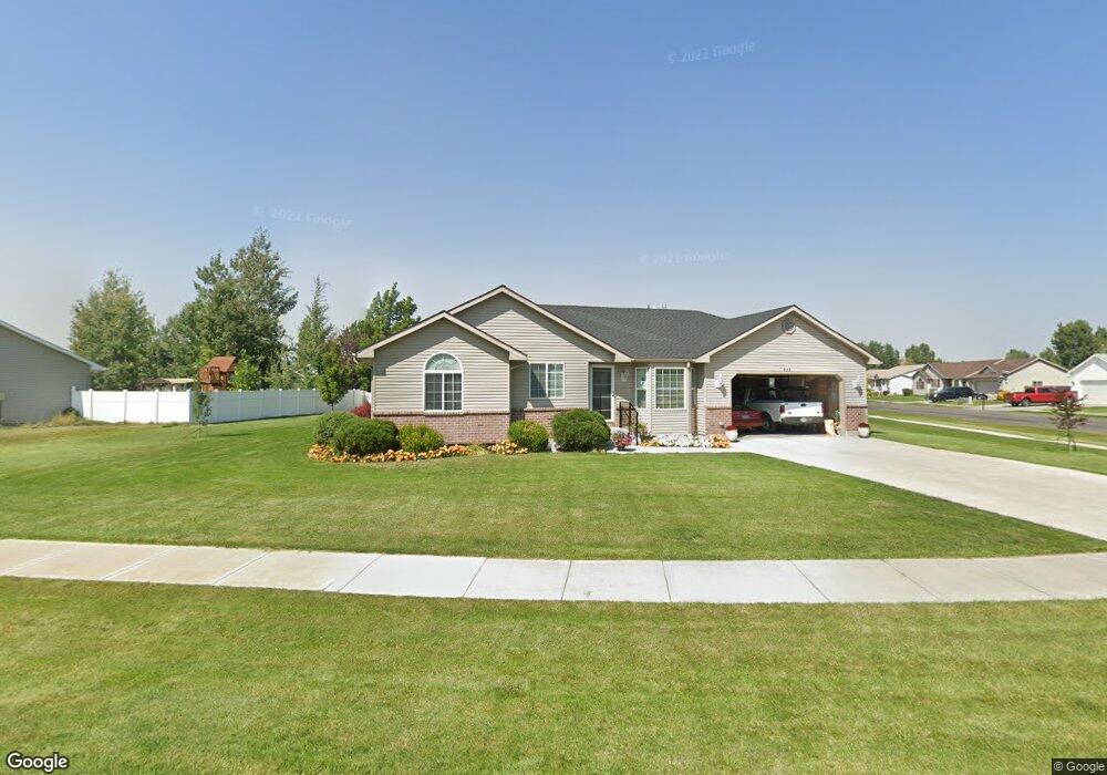
This home is located at 822 Ensign Dr, Ammon, ID 83406 and is currently estimated at $402,988, approximately $171 per square foot. 822 Ensign Dr is a home located in Bonneville County with nearby schools including Hillview Elementary School, Sandcreek Middle School, and Hillcrest High School.
Ownership History
Date
Name
Owned For
Owner Type
Purchase Details
Closed on
May 25, 2005
Sold by
Goldie Audra D and Goldie Riedner Audra D
Bought by
Melander Elliott Wray and Melander Charlotte Kaye
Current Estimated Value
Home Financials for this Owner
Home Financials are based on the most recent Mortgage that was taken out on this home.
Original Mortgage
$74,000
Outstanding Balance
$38,584
Interest Rate
5.84%
Mortgage Type
New Conventional
Estimated Equity
$364,404
Create a Home Valuation Report for This Property
The Home Valuation Report is an in-depth analysis detailing your home's value as well as a comparison with similar homes in the area
Purchase History
| Date | Buyer | Sale Price | Title Company |
|---|---|---|---|
| Melander Elliott Wray | -- | First American Title Co |
Source: Public Records
Mortgage History
| Date | Status | Borrower | Loan Amount |
|---|---|---|---|
| Open | Melander Elliott Wray | $74,000 |
Source: Public Records
Tax History
| Year | Tax Paid | Tax Assessment Tax Assessment Total Assessment is a certain percentage of the fair market value that is determined by local assessors to be the total taxable value of land and additions on the property. | Land | Improvement |
|---|---|---|---|---|
| 2025 | $1,717 | $461,464 | $90,427 | $371,037 |
| 2024 | $1,723 | $472,014 | $90,427 | $381,587 |
| 2023 | $1,486 | $364,891 | $92,491 | $272,400 |
| 2022 | $1,680 | $317,617 | $62,807 | $254,810 |
| 2021 | $1,542 | $242,045 | $57,085 | $184,960 |
| 2019 | $1,514 | $207,903 | $47,973 | $159,930 |
| 2018 | $1,280 | $207,116 | $39,306 | $167,810 |
| 2017 | $1,189 | $174,661 | $25,911 | $148,750 |
| 2016 | $1,164 | $162,119 | $23,509 | $138,610 |
| 2015 | $1,040 | $142,989 | $23,509 | $119,480 |
| 2014 | $19,943 | $142,989 | $23,509 | $119,480 |
| 2013 | $1,019 | $142,748 | $23,508 | $119,240 |
Source: Public Records
Map
Nearby Homes
- 3930 John Adams Pkwy
- 4139 Fairview Dr
- 4315 Stubblefield Ct
- 4353 Stubblefield Ct
- 171 Robison Dr
- 243 S Bridger Dr
- 4113 Birchwood Cir
- 978 Edinburg Cir
- 3823 E Summerridge Cir
- 3828 Briar Creek Cir
- 820 S Adam Ln
- 250 Butterfly Dr
- 596 S Adam Ln
- 169 S Heath Ln
- 3617 E Daleen
- 1406 Bellagio Dr
- 3684 Briar Creek Ln
- 225 Monte Vista Ave
- 1468 Bellagio Dr
- TBD E 17th St
- 827 Ensign Dr
- 790 Ensign Dr
- 833 Barnwood Dr
- 880 Barnwood Dr
- 791 Ensign Dr
- 894 Barnwood Dr
- 760 Ensign Dr
- 860 Barnwood Dr
- 789 Barnwood Dr
- 871 Ensign Dr
- 761 Ensign Dr
- 846 Barnwood Dr
- 761 Barnwood Dr
- 732 Ensign Dr
- 834 Barnwood Dr
- 731 Ensign Dr
- 818 Barnwood Dr
- 733 Barnwood Dr
- 788 Barnwood Dr
- 788 Barnwood Dr
Your Personal Tour Guide
Ask me questions while you tour the home.