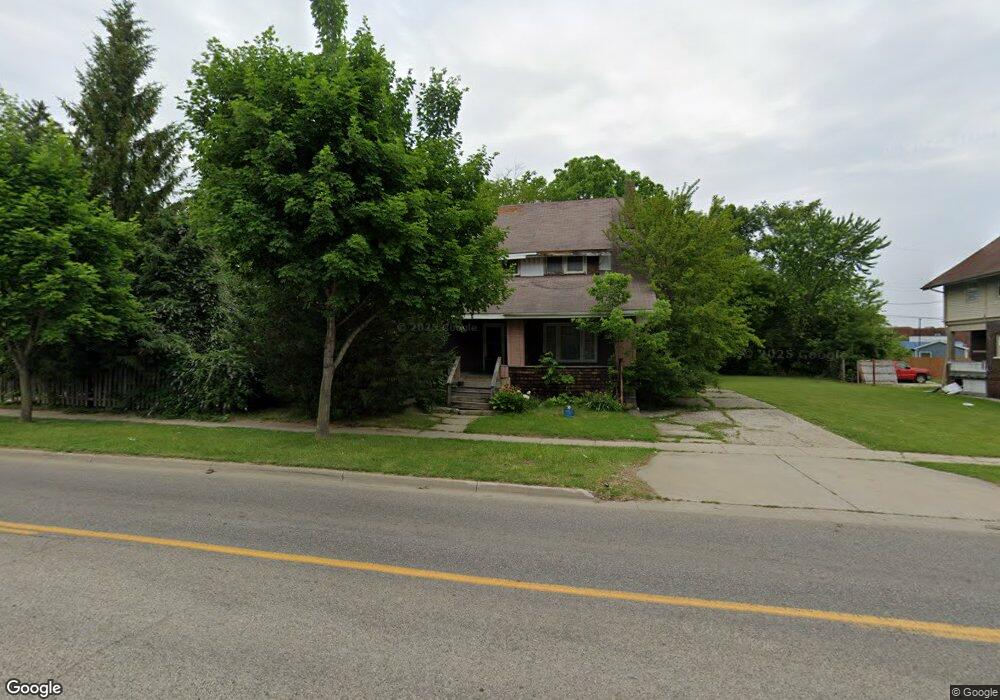
822 M l King Ave Flint, MI 48503
Downtown Flint NeighborhoodEstimated Value: $51,000 - $97,000
3
Beds
1
Bath
1,602
Sq Ft
$47/Sq Ft
Est. Value
About This Home
This home is located at 822 M l King Ave, Flint, MI 48503 and is currently estimated at $74,659, approximately $46 per square foot. 822 M l King Ave is a home located in Genesee County with nearby schools including Doyle/Ryder School, Flint Cultural Center Academy, and WAY Academy of Flint.
Ownership History
Date
Name
Owned For
Owner Type
Purchase Details
Closed on
May 6, 2019
Sold by
Genesee County Land Bank Authority
Bought by
Duncon Casey Frelon
Current Estimated Value
Purchase Details
Closed on
Dec 18, 2018
Sold by
Genesee County Treasurer
Bought by
Genesee County Land Bank Authority
Purchase Details
Closed on
Aug 19, 2011
Sold by
Vanbrocklin Allan J and Brocklin Linda A
Bought by
Coleman Consuelo
Purchase Details
Closed on
Aug 17, 2006
Sold by
Vanbrocklin Allan J and Vanbrocklin Van Brocklin
Bought by
Vanbrocklin Allan J and Vanbrocklin Van Brocklin
Create a Home Valuation Report for This Property
The Home Valuation Report is an in-depth analysis detailing your home's value as well as a comparison with similar homes in the area
Home Values in the Area
Average Home Value in this Area
Purchase History
| Date | Buyer | Sale Price | Title Company |
|---|---|---|---|
| Duncon Casey Frelon | $2,500 | None Available | |
| Genesee County Land Bank Authority | -- | None Available | |
| Coleman Consuelo | $7,500 | First American Title Ins Co | |
| Vanbrocklin Allan J | -- | None Available |
Source: Public Records
Tax History
| Year | Tax Paid | Tax Assessment Tax Assessment Total Assessment is a certain percentage of the fair market value that is determined by local assessors to be the total taxable value of land and additions on the property. | Land | Improvement |
|---|---|---|---|---|
| 2025 | $745 | $15,700 | $0 | $0 |
| 2024 | $683 | $13,200 | $0 | $0 |
| 2023 | $676 | $12,100 | $0 | $0 |
| 2022 | $0 | $11,300 | $0 | $0 |
| 2021 | $697 | $10,400 | $0 | $0 |
| 2020 | $637 | $7,800 | $0 | $0 |
| 2019 | $410 | $0 | $0 | $0 |
| 2018 | $419 | $5,600 | $0 | $0 |
| 2017 | $412 | $0 | $0 | $0 |
| 2016 | $410 | $0 | $0 | $0 |
| 2015 | -- | $0 | $0 | $0 |
| 2014 | -- | $0 | $0 | $0 |
| 2012 | -- | $5,100 | $0 | $0 |
Source: Public Records
Map
Nearby Homes
- 562 Williams St
- 1303 Root St
- 416 W 2nd Ave Unit 4
- 407 W 2nd Ave
- 800 Martin Luther King Ave
- 1606 Garland St
- 1620 Mason St
- 1409 Prospect St
- 1710 Wilberforce Cir
- 1706 Wilberforce Cir
- 626 E 2nd St
- 1801 Clement St
- 712 S Grand Traverse St
- 1717 Wolcott St
- 1645 Seminole St
- 314 E 4th St
- 410 E 4th St
- 1016 Dupont St
- 1008 Dupont St
- 1930 Concord St
- 818 M l King Ave
- 908 M l King Ave
- 819 Root St
- 810 Martin Luther King Ave
- 907 Root St
- 815 Root St
- 912 M l King Ave
- 909 Root St
- 524 Louisa St
- 811 M l King Ave
- 901 M l King Ave
- 5743 Argyl Stocker Ave
- 913 Root St
- 807 M l King Ave
- 909 M l King Ave
- 805 M l King Ave
- 805 M l King Ave
- 801 Martin Luther King Ave
- 112 W 5th Ave
- 812 Garland St
Your Personal Tour Guide
Ask me questions while you tour the home.